Garrawalt, Queensland

Last updated

Garrawalt
Queensland
Australia Queensland location map.svg
Red pog.svg
Garrawalt
Coordinates 18°31′03″S145°50′16″E / 18.5176°S 145.8377°E / -18.5176; 145.8377 (Garrawalt (centre of locality))
Population0 (2021 census) [1]
 • Density0.0000/km2 (0.000/sq mi)
Postcode(s) 4850
Area184.1 km2 (71.1 sq mi)
Time zone AEST (UTC+10:00)
LGA(s) Shire of Hinchinbrook
State electorate(s) Hinchinbrook
Federal division(s) Kennedy
Suburbs around Garrawalt:
Wairuna Abergowrie Abergowrie
Valley Of Lagoons Garrawalt Long Pocket
Valley Of Lagoons Wallaman Lannercost

Garrawalt is a rural locality in the Shire of Hinchinbrook, Queensland, Australia. [2]

Contents

In the 2021 census, Garrawalt had "no people or a very low population". [1]

Geography

The locality is loosely bounded to the north by the Herbert River, which separates the mountainous terrain of the locality from the flat sugarcane farming areas of Abergowrie to the north. [3]

Garrawalt has the following mountains:

Most of the locality is within the Girringun National Park except for some small areas adjacent to the Herbert River which are flatter lower land (30 metres (98 ft) above sea level) using for farming. [3]

History

The locality was named and bounded on 27 April 2001. [2]

Demographics

In the 2016 census, Garrawalt had "no people or a very low population". [7]

In the 2021 census, Garrawalt had "no people or a very low population". [1]

Education

There are no schools in Girrawalt. The nearest government primary school is Abergowrie State School in neighbouring Abergowrie to the north. The nearest government secondary school is Ingham State High School in Ingham to the south-east. [3]

Related Research Articles

<span class="mw-page-title-main">Lakeland, Queensland</span> Town in Queensland, Australia

Lakeland is a rural town and locality in the Shire of Cook, Queensland, Australia. In the 2016 census, the locality of Lakeland had a population of 299 people.

<span class="mw-page-title-main">Lucinda, Queensland</span> Town in Queensland, Australia

Lucinda is a coastal town and locality in the Shire of Hinchinbrook, Queensland, Australia. In the 2021 census, the locality of Lucinda had a population of 435 people.

<span class="mw-page-title-main">Paluma, Queensland</span> Town in Queensland, Australia

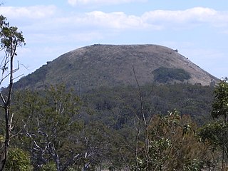
Paluma is a town in the City of Townsville and a locality split between the City of Townsville and the Charters Towers Region in Queensland, Australia. In the 2016 census, the locality of Paluma had a population of 68 people.

<span class="mw-page-title-main">Mount Carbine, Queensland</span> Town in Queensland, Australia

Mount Carbine is a rural town and locality in the Shire of Mareeba, Queensland, Australia. In the 2016 census, the locality of Mount Carbine had a population of 101 people.

Forrest Beach is a coastal locality in the Shire of Hinchinbrook, Queensland, Australia. In the 2016 census, Forrest Beach had a population of 1,254 people.

<span class="mw-page-title-main">Abergowrie, Queensland</span> Suburb of Shire of Hinchinbrook, Queensland, Australia

Abergowrie is a rural town and locality in the Shire of Hinchinbrook, Queensland, Australia. In the 2021 census, the locality of Abergowrie had a population of 305 people.

<span class="mw-page-title-main">Waverley, Queensland</span> Suburb of Shire of Boulia, Queensland, Australia

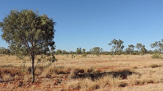
Waverley is an outback locality in the Shire of Boulia, Queensland, Australia. In the 2021 census, Waverley had a population of 6 people.

Bambaroo is a rural locality in the Shire of Hinchinbrook, Queensland, Australia. In the 2021 census, Bambaroo had a population of 146 people.

Helens Hill is a rural locality in the Shire of Hinchinbrook, Queensland, Australia. In the 2021 census, Helens Hill had a population of 118 people.

<span class="mw-page-title-main">Mount Fox, Queensland</span> Suburb of Shire of Hinchinbrook, Queensland, Australia

Mount Fox is a rural locality in the Shire of Hinchinbrook, Queensland, Australia. In the 2021 census, Mount Fox had a population of 84 people.

Cordelia is a rural locality in the Shire of Hinchinbrook, Queensland, Australia. In the 2021 census, Cordelia had a population of 176 people.

Lannercost is a rural locality in the Shire of Hinchinbrook, Queensland, Australia. In the 2021 census, Lannercost had a population of 168 people.

Long Pocket is a rural locality in the Shire of Hinchinbrook, Queensland, Australia. In the 2021 census, Long Pocket had a population of 150 people.

<span class="mw-page-title-main">Bemerside, Queensland</span> Suburb of Shire of Hinchinbrook, Queensland, Australia

Bemerside is a rural locality in the Shire of Hinchinbrook, Queensland, Australia. In the 2021 census, Bemerside had a population of 259 people.

<span class="mw-page-title-main">Whyanbeel</span> Suburb of Shire of Douglas, Queensland, Australia

Whyanbeel is a rural locality in the Shire of Douglas, Queensland, Australia. In the 2021 census, Whyanbeel had a population of 172 people.

Dalrymple Creek is a locality in the Shire of Hinchinbrook, Queensland, Australia. In the 2021 census, Dalrymple Creek had a population of 51 people.

Humeburn is a locality in the Shire of Paroo, Queensland, Australia. In the 2021 census, Humeburn had a population of 9 people.

Rungoo is a coastal locality in the Cassowary Coast Region, Queensland, Australia. In the 2021 census, Rungoo had a population of 11 people.

<span class="mw-page-title-main">Hawkins Creek, Queensland</span> Suburb of Shire of Hinchinbrook, Queensland, Australia

Hawkins Creek is a rural locality in the Shire of Hinchinbrook, Queensland, Australia. In the 2021 census, Hawkins Creek had a population of 236 people.

<span class="mw-page-title-main">Amber, Queensland</span> Suburb of Shire of Mareeba, Queensland, Australia

Amber is a rural locality in the Shire of Mareeba, Queensland, Australia. In the 2021 census, Amber had "no people or a very low population".

References

  1. 1 2 3 Australian Bureau of Statistics (28 June 2022). "Garrawalt (SAL)". 2021 Census QuickStats. Retrieved 28 February 2023. OOjs UI icon edit-ltr-progressive.svg
  2. 1 2 "Garrawalt – locality in Shire of Hinchinbrook (entry 42517)". Queensland Place Names. Queensland Government . Retrieved 28 October 2019.
  3. 1 2 3 4 5 "Queensland Globe". State of Queensland . Retrieved 5 February 2023.
  4. 1 2 "Mountain peaks and capes - Queensland". Queensland Open Data. Queensland Government. 12 November 2020. Archived from the original on 25 November 2020. Retrieved 25 November 2020.
  5. "Mount Facing – mountain in Hinchinbrook Shire (entry 12106)". Queensland Place Names. Queensland Government . Retrieved 25 November 2020.
  6. "The Pinnacles – mountain in Hinchinbrook Shire (entry 34068)". Queensland Place Names. Queensland Government . Retrieved 25 November 2020.
  7. Australian Bureau of Statistics (27 June 2017). "Garrawalt (SSC)". 2016 Census QuickStats. Retrieved 20 October 2018. OOjs UI icon edit-ltr-progressive.svg