Bemerside, Queensland

Last updated

Map all coordinates using: OpenStreetMap  
Download coordinates as: KML
Bemerside
Queensland
Large pan of Hinchinbrook Island with rainbow and storm. A great view from Lookout Number two - don't bother with the first one, walk around (3mins) to the second. Dec 2015 Peter Neaum. - panoramio.jpg
View towards Hinchinbook Island from Hinchbrook Lookout in Bemerside, 2015
Australia Queensland location map.svg
Red pog.svg
Bemerside
Coordinates 18°33′26″S146°11′33″E / 18.5573°S 146.1925°E / -18.5573; 146.1925 (Bemerside (centre of locality)) Coordinates: 18°33′26″S146°11′33″E / 18.5573°S 146.1925°E / -18.5573; 146.1925 (Bemerside (centre of locality))
Population241 (2016 census) [1]
 • Density4.753/km2 (12.31/sq mi)
Postcode(s) 4850
Area50.7 km2 (19.6 sq mi)
Time zone AEST (UTC+10:00)
Location
LGA(s) Shire of Hinchinbrook
State electorate(s) Hinchinbrook
Federal division(s) Kennedy
Suburbs around Bemerside:
Hawkins Creek Rungoo Macknade
Hawkins Creek Bemerside Macknade
Hawkins Creek Gairloch
Foresthome
Cordelia

Bemerside is a rural locality in the Shire of Hinchinbrook, Queensland, Australia. [2] In the 2016 census, Bemerside had a population of 241 people. [1]

Contents

Geography

Bemerside is bounded to the north-east and by the Seymour River, to the south-east by the Anabranch River, to the south by the Herbert River and Ripple Creek. [3] The Anabranch River is a tidal stream that connects the Seymour River to the Herbert River. [4]

Bemerside has the following mountains along its eastern boundary (from north to south): [3]

The Girringun National Park is in the north of the locality, extending into the neighbouring localities of Rungoo and Hawkins Creek. [3]

The Bruce Highway enters the locality from the south (Gairloch) and exits to the north (Rungoo). [3]

The North Coast railway line enters the locality from the south (Foresthome) and exits to the north (Rungoo) with the locality served by two railway stations (from north to south):

Ripple Creek is a neighbourhood ( 18°35′00″S146°12′00″E / 18.5833°S 146.2°E / -18.5833; 146.2 (Ripple Creek (neighbourhood)) ) in the south of the locality. [10] It presumably takes its name from the nearby watercourse Ripple Creek, a tributary of the Herbert River. [11] [3]

The terrain is mountainous in the north-east with Mount Cudmore the highest point, but is otherwise flat and low-lying, approximately 10 metres (33 ft) above sea level. [3] Most of the flat land is used to grow sugarcane. There is a cane tramway network to transport the harvested sugarcane to the Macknade sugar mill in neighbouring Macknade for crushing. [3]

History

The locality takes its name from the Bemerside Sugar Mill, established in 1873 and named after the town of Bermersyde (note the different spelling) in Scotland, which was associated with the Haig family who originally owned the sugar mill in conjunction with the Miles family. [2] [12]

Ripple Creek Provisional school opened on 19 June 1893. On 1 June 1909, it became Ripple Creek State School. In 1931 and 1932 there were temporary closures. It closed permanently on 16 December 1995. [13] [14] It was on Fulton Drive ( 18°34′47″S146°12′19″E / 18.5796°S 146.2053°E / -18.5796; 146.2053 (Ripple Creek State School (former)) ). [15] [16] [3]

In the 2016 census, Bemerside had a population of 241 people. [1]

Education

There are no schools in Bemerside. The nearest government primary schools are Macknade State School in neighbouring Macknade to the east and Ingham State School in Ingham to the south. The nearest government secondary school is Ingham State High School, also in Ingham. [3]

Attractions

Hinchinbrook Lookout is on Mount Cudmore Tower Road, off the Bruce Highway ( 18°31′59″S146°11′20″E / 18.5330°S 146.1889°E / -18.5330; 146.1889 (Hinchinbrook Lookout) ). [17] It offers views across the Hinchinbrook Channel to Hinchinbrook Island. [18]

Related Research Articles

Cardwell, Queensland Town in Queensland, Australia

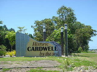
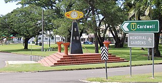
Cardwell is a coastal town and rural locality in the Cassowary Coast Region, Queensland, Australia. In the 2016 census, the locality of Cardwell had a population of 1,309 people.

Ingham, Queensland Town in Queensland, Australia

Ingham is a rural town and locality in the Shire of Hinchinbrook, Queensland, Australia. In the 2016 census, the locality of Ingham had a population of 4,426 people. It is named after William Bairstow Ingham and is the administrative centre for the Shire of Hinchinbrook.

North Queensland Region in Queensland, Australia

North Queensland or the Northern Region is the northern part of the Australian state of Queensland that lies just south of Far North Queensland. Queensland is a massive state, larger than many countries, and its tropical northern part has been historically remote and undeveloped, resulting in a distinctive regional character and identity.

Lucinda, Queensland Town in Queensland, Australia

Lucinda is a coastal town and locality in the Shire of Hinchinbrook, Queensland, Australia. In the 2016 census, the locality of Lucinda had a population of 406 people.

Rollingstone, Queensland Town in Queensland, Australia

Rollingstone is a rural town and coastal locality in the City of Townsville, Queensland, Australia. In the 2016 census, the locality of Rollingstone had a population of 125 people.

Forrest Beach is a small coastal locality in the Shire of Hinchinbrook, Queensland, Australia. In the 2016 census, Forrest Beach had a population of 1,254 people.

Halifax is a town and a coastal locality in the Shire of Hinchinbrook, Queensland, Australia. In the 2016 census, Halifax had a population of 462 people.

Abergowrie, Queensland Suburb of Shire of Hinchinbrook, Queensland, Australia

Abergowrie is a rural town and locality in the Shire of Hinchinbrook, Queensland, Australia. In the 2016 census, Abergowrie had a population of 438 people.

Minnamoolka is a locality in the Tablelands Region, Queensland, Australia. In the 2016 census, Minnamoolka had a population of 38 people.

Taylors Beach is a coastal town and locality in the Shire of Hinchinbrook, Queensland, Australia. It takes its name from its beach. In the 2016 census, the locality of Taylors Beach had a population of 318 people.

Macknade, Queensland Town in Queensland, Australia

Macknade is a rural town and coastal locality in the Shire of Hinchinbrook, Queensland, Australia. In the 2016 census, the locality of Macknade had a population of 229 people.

Toobanna is a rural town and locality in the Shire of Hinchinbrook, Queensland, Australia. In the 2016 census, the locality of Toobanna had a population of 278 people.

Victoria Plantation is a rural locality in the Shire of Hinchinbrook, Queensland, Australia. In the 2016 census Victoria Plantation had a population of 156 people.

Bambaroo is a rural locality in the Shire of Hinchinbrook, Queensland, Australia. In the 2016 census, Bambaroo had a population of 126 people.

Helens Hill is a rural locality in the Shire of Hinchinbrook, Queensland, Australia. In the 2016 census Helens Hill had a population of 123 people.

Mount Fox, Queensland Suburb of Shire of Hinchinbrook, Queensland, Australia

Mount Fox is a rural locality in the Shire of Hinchinbrook, Queensland, Australia. In the 2016 census Mount Fox had a population of 87 people.

Foresthome is a rural locality in the Shire of Hinchinbrook, Queensland, Australia. In the 2016 census Foresthome had a population of 87 people.

Lannercost is a rural locality in the Shire of Hinchinbrook, Queensland, Australia. In the 2016 census, Lannercost had a population of 121 people.

Yuruga is a rural locality in the Shire of Hinchinbrook, Queensland, Australia. In the 2016 census Yuruga had a population of 73 people.

Hawkins Creek, Queensland Suburb of Shire of Hinchinbrook, Queensland, Australia

Hawkins Creek is a rural locality in the Shire of Hinchinbrook, Queensland, Australia. In the 2016 census, Hawkins Creek had a population of 216 people.

References

  1. 1 2 3 Australian Bureau of Statistics (27 June 2017). "Bemerside (SSC)". 2016 Census QuickStats. Retrieved 20 October 2018. OOjs UI icon edit-ltr-progressive.svg
  2. 1 2 "Bemerside – locality in Shire of Hinchinbrook (entry 2251)". Queensland Place Names. Queensland Government . Retrieved 27 December 2020.
  3. 1 2 3 4 5 6 7 8 9 "Queensland Globe". State of Queensland . Retrieved 6 May 2022.
  4. Bates, Cameron (24 September 2019). "Hinchinbrook local believes a mystery white substance lining Anabranch River sand is most likely salt". Herbert River Express . Archived from the original on 6 May 2022. Retrieved 6 May 2022.
  5. 1 2 3 "Mountain peaks and capes - Queensland". Queensland Open Data. Queensland Government. 12 November 2020. Archived from the original on 25 November 2020. Retrieved 25 November 2020.
  6. "Mount Cudmore – mountain in Hinchinbrook Shire (entry 8934)". Queensland Place Names. Queensland Government . Retrieved 25 November 2020.
  7. "Mount Separation – mountain in Hinchinbrook Shire (entry 30409)". Queensland Place Names. Queensland Government . Retrieved 25 November 2020.
  8. "Mount Maragen – mountain in Hinchinbrook Shire (entry 20882)". Queensland Place Names. Queensland Government . Retrieved 25 November 2020.
  9. 1 2 "Railway stations and sidings - Queensland". Queensland Open Data. Queensland Government. 2 October 2020. Archived from the original on 5 October 2020. Retrieved 5 October 2020.
  10. "Ripple Creek – locality unbounded in Shire of Hinchinbrook (entry 28517)". Queensland Place Names. Queensland Government . Retrieved 7 March 2022.
  11. "Ripple Creek – creek in the Shire of Hinchinbrook (entry 28517)". Queensland Place Names. Queensland Government . Retrieved 17 January 2018.
  12. "THE HAIGS". The Sydney Morning Herald . No. 27, 820. New South Wales, Australia. 5 March 1927. p. 11. Archived from the original on 6 May 2022. Retrieved 8 January 2018 via National Library of Australia.
  13. Queensland Family History Society (2010), Queensland schools past and present (Version 1.01 ed.), Queensland Family History Society, ISBN   978-1-921171-26-0
  14. "Queensland state school - centre closures" (PDF). Queensland Government . 20 August 2013. Archived (PDF) from the original on 20 March 2022. Retrieved 7 April 2022.
  15. "Parish of Cordelia" (Map). Queensland Government. 1977. Archived from the original on 29 December 2020. Retrieved 6 May 2022.
  16. "Parish of Marathon, County of Cardwell" (Map). Queensland Government. 1976. Archived from the original on 24 April 2022. Retrieved 6 May 2022.
  17. "Tourist points - Queensland". Queensland Open Data. Queensland Government. 18 November 2020. Archived from the original on 24 November 2020. Retrieved 24 November 2020.
  18. "Hinchinbrook Island Lookout". The Hinchinbrook Way. Archived from the original on 19 March 2022. Retrieved 6 May 2022.

Further reading