Foresthome

Last updated

Foresthome
Queensland
Australia Queensland location map.svg
Red pog.svg
Foresthome
Coordinates 18°36′41″S146°12′19″E / 18.6113°S 146.2052°E / -18.6113; 146.2052 (Foresthome (centre of locality))
Population84 (2021 census) [1]
 • Density4.88/km2 (12.65/sq mi)
Postcode(s) 4850
Area17.2 km2 (6.6 sq mi)
Time zone AEST (UTC+10:00)
Location
LGA(s) Shire of Hinchinbrook
State electorate(s) Hinchinbrook
Federal division(s) Kennedy
Suburbs around Foresthome:
Gairloch Gairloch Bemerside
Gairloch Foresthome Cordelia
Ingham Victoria Plantation Victoria Plantation

Foresthome is a rural locality in the Shire of Hinchinbrook, Queensland, Australia. [2] In the 2021 census, Foresthome had a population of 84 people. [1]

Contents

Geography

The North Coast railway line enters the locality from the south and exits to the north. There are two railway stations on the line in the locality, but both are now abandoned: [3] [4]

History

Foresthome State School opened on 26 November 1935 with over 40 students. [5] [6] [7] [8] It closed on 15 March 1993. [9] [10] It was at 571 Halifax Road ( 18°36′25″S146°12′08″E / 18.60682°S 146.20223°E / -18.60682; 146.20223 (Forestholme State School (former)) ). [11] [12] As at 2022, the school sign remains extant on the site. [13] [14]

Demographics

In the 2016 census, Foresthome had a population of 87 people. [15]

In the 2021 census, Foresthome had a population of 84 people. [1]

Education

There are no schools in Foresthome. The nearest government primary schools are Victoria Plantation State School in neighbouring Victoria Plantation to the south and Halifax State School in Halifax to the north-east. The nearest government secondary school is Ingham State High School in neighbouring Ingham to the south-west. [16]

Related Research Articles

<span class="mw-page-title-main">Cardwell, Queensland</span> Town in Queensland, Australia

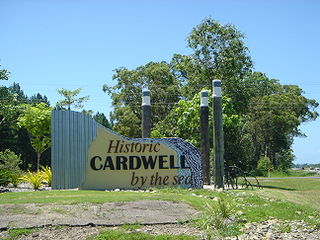
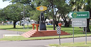
Cardwell is a coastal town and rural locality in the Cassowary Coast Region, Queensland, Australia. In the 2021 census, the locality of Cardwell had a population of 1,320 people.

<span class="mw-page-title-main">Ingham, Queensland</span> Town in Queensland, Australia

Ingham is a rural town and locality in the Shire of Hinchinbrook, Queensland, Australia. It is named after William Bairstow Ingham and is the administrative centre for the Shire of Hinchinbrook.

<span class="mw-page-title-main">Lucinda, Queensland</span> Town in Queensland, Australia

Lucinda is a coastal town and locality in the Shire of Hinchinbrook, Queensland, Australia. In the 2021 census, the locality of Lucinda had a population of 435 people.

<span class="mw-page-title-main">Rollingstone, Queensland</span> Town in Queensland, Australia

Rollingstone is a rural town and coastal locality in the City of Townsville, Queensland, Australia. In the 2021 census, the locality of Rollingstone had a population of 133 people.

<span class="mw-page-title-main">Nome, Queensland</span> Suburb of City of Townsville, Queensland, Australia

Nome is a rural locality in the City of Townsville, Queensland, Australia. In the 2021 census, Nome had a population of 990 people.

<span class="mw-page-title-main">Halifax, Queensland</span> Town in Queensland, Australia

Halifax is a town and a coastal locality in the Shire of Hinchinbrook, Queensland, Australia. In the 2021 census, the locality of Halifax had a population of 477 people.

<span class="mw-page-title-main">Abergowrie, Queensland</span> Town in Queensland, Australia

Abergowrie is a rural town and locality in the Shire of Hinchinbrook, Queensland, Australia. In the 2021 census, the locality of Abergowrie had a population of 305 people.

Taylors Beach is a coastal town and locality in the Shire of Hinchinbrook, Queensland, Australia. It takes its name from its beach. In the 2021 census, the locality of Taylors Beach had a population of 297 people.

<span class="mw-page-title-main">Macknade, Queensland</span> Town in Queensland, Australia

Macknade is a rural town and coastal locality in the Shire of Hinchinbrook, Queensland, Australia. In the 2021 census, the locality of Macknade had a population of 203 people.

Toobanna is a rural town and locality in the Shire of Hinchinbrook, Queensland, Australia. In the 2021 census, the locality of Toobanna had a population of 276 people.

Bambaroo is a rural locality in the Shire of Hinchinbrook, Queensland, Australia. In the 2021 census, Bambaroo had a population of 146 people.

Helens Hill is a rural locality in the Shire of Hinchinbrook, Queensland, Australia. In the 2021 census, Helens Hill had a population of 118 people.

<span class="mw-page-title-main">Boogan, Queensland</span> Suburb of Cassowary Coast Region, Queensland, Australia

Boogan is a rural locality in the Cassowary Coast Region, Queensland, Australia. In the 2021 census, Boogan had a population of 138 people.

Cordelia is a rural locality in the Shire of Hinchinbrook, Queensland, Australia. In the 2021 census, Cordelia had a population of 176 people.

<span class="mw-page-title-main">Bemerside, Queensland</span> Suburb of Shire of Hinchinbrook, Queensland, Australia

Bemerside is a rural locality in the Shire of Hinchinbrook, Queensland, Australia. In the 2021 census, Bemerside had a population of 259 people.

Yuruga is a rural locality in the Shire of Hinchinbrook, Queensland, Australia. In the 2021 census, Yuruga had a population of 64 people.

Dalrymple Creek is a locality in the Shire of Hinchinbrook, Queensland, Australia. In the 2021 census, Dalrymple Creek had a population of 51 people.

Wangan is a town and a locality in the Cassowary Coast Region, Queensland, Australia. In the 2021 census, the locality of Wangan had a population of 612 people.

Rungoo is a coastal locality in the Cassowary Coast Region, Queensland, Australia. In the 2021 census, Rungoo had a population of 11 people.

<span class="mw-page-title-main">Hawkins Creek, Queensland</span> Suburb of Shire of Hinchinbrook, Queensland, Australia

Hawkins Creek is a rural locality in the Shire of Hinchinbrook, Queensland, Australia. In the 2021 census, Hawkins Creek had a population of 236 people.

References

  1. 1 2 3 Australian Bureau of Statistics (28 June 2022). "Foresthome (SAL)". 2021 Census QuickStats. Retrieved 28 February 2023. OOjs UI icon edit-ltr-progressive.svg
  2. "Foresthome – locality in Shire of Hinchinbrook (entry 47382)". Queensland Place Names. Queensland Government . Retrieved 27 December 2020.
  3. "Railway stations and sidings - Queensland". Queensland Open Data. Queensland Government. 2 October 2020. Archived from the original on 5 October 2020. Retrieved 5 October 2020.
  4. "Queensland Globe". State of Queensland . Retrieved 31 December 2020.
  5. "Advertising". Townsville Daily Bulletin . Vol. LIV, no. 257. Queensland, Australia. 26 October 1932. p. 2. Retrieved 26 December 2024 via National Library of Australia.
  6. "STATE PUBLIC WORKS". The Courier-mail . No. 497. Queensland, Australia. 2 April 1935. p. 18. Retrieved 26 December 2024 via National Library of Australia.
  7. "PUBLIC WORKS". Daily Standard . No. 6979. Queensland, Australia. 31 May 1935. p. 2. Retrieved 26 December 2024 via National Library of Australia.
  8. "INGHAM NOTES". Townsville Daily Bulletin . Vol. LVII, no. 331. Queensland, Australia. 14 November 1935. p. 5. Retrieved 26 December 2024 via National Library of Australia.
  9. "Agency ID 11745, Foresthome State School". Queensland State Archives . Retrieved 26 December 2024.
  10. Queensland Family History Society (2010), Queensland schools past and present (Version 1.01 ed.), Queensland Family History Society, ISBN   978-1-921171-26-0
  11. "Ingham" (Map). Queensland Government. 1944. Archived from the original on 23 July 2024. Retrieved 26 December 2024.
  12. "Parish of Cordelia" (Map). Queensland Government. 1977. Archived from the original on 27 June 2024. Retrieved 26 December 2024.
  13. "Foresthome State School sign". Google Street View . September 2022. Retrieved 26 December 2024.
  14. "Foresthome State School sign". Google Street View . December 2007. Retrieved 26 December 2024.
  15. Australian Bureau of Statistics (27 June 2017). "Foresthome (SSC)". 2016 Census QuickStats. Retrieved 20 October 2018. OOjs UI icon edit-ltr-progressive.svg
  16. "Layers: Locality; Schools and school catchments". Queensland Globe. Queensland Government. Archived from the original on 19 December 2017. Retrieved 25 December 2024.