
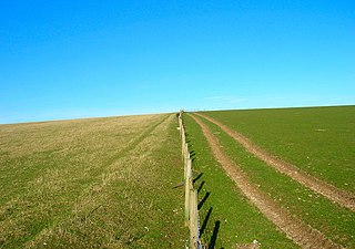
Surrey is a county in South East England which borders Kent to the east, East Sussex to the southeast, West Sussex to the south, Hampshire to the west, Berkshire to the northwest, and Greater London to the northeast. With about 1.2 million people, Surrey is the 12th-most populous English county, the third-most populous home county, after Kent and Essex, and the third-most populous in the Southeast, after Hampshire and Kent.

Crawley is a large town and borough in West Sussex, England. It is 28 miles (45 km) south of London, 18 miles (29 km) north of Brighton and Hove, and 32 miles (51 km) north-east of the county town of Chichester. Crawley covers an area of 17.36 square miles (44.96 km2) and had a population of 106,597 at the time of the 2011 Census.

Reigate and Banstead is a local government district with borough status in east Surrey, England. It includes the towns of Reigate, Redhill, Horley and Banstead. The borough borders the Borough of Crawley to the south, the Borough of Epsom and Ewell and District of Mole Valley to the west, Tandridge District to the east and the London Boroughs of Sutton and Croydon to the north.
Mid Sussex is a local government district in the English non-metropolitan county of West Sussex, within the historic county of Sussex. It contains the towns of East Grinstead, Haywards Heath and Burgess Hill.
Epsom is the principal town of the Borough of Epsom and Ewell in Surrey, England, approximately 13.5 mi (21.7 km) south of Charing Cross and 4.75 mi (7.64 km) northeast of Leatherhead. The town is recorded as Ebbesham in the 13th century and its name probably derives from that of a Saxon landowner. Founded as a spring line settlement where the permeable chalk of the North Downs meets the impermeable London Clay, Epsom developed as a spa town in the Georgian period. The mineral waters were found to be rich in magnesium sulphate, which became known as Epsom salts.

Epsom and Ewell is a local government district with borough status in Surrey, England, covering the towns of Epsom and Ewell. The borough was formed as an urban district in 1894, and was known as Epsom until 1934. It was made a municipal borough in 1937. The district was considered for inclusion in Greater London in 1965 but was left unaltered by the London Government Act 1963 and the Local Government Act 1972 in 1974. However, despite being outside modern Greater London the borough was in the Metropolitan Police District until it was transferred to Surrey Police in 2000. In the May 2019 elections, the borough was held by the Epsom and Ewell Residents Association with 32 seats, Labour with 3 seats, Liberal Democrats with 2 seats, and Conservatives with 1 seat.

The Brighton main line is a major railway line in the United Kingdom that links Brighton, on the south coast of England, with central London. In London the line has two branches, out of London Victoria and London Bridge stations respectively, which join up in Croydon and continue towards Brighton as one line. The line is electrified throughout using the third rail system.

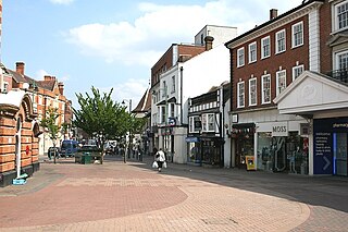
Horley is a town in the borough of Reigate and Banstead in Surrey, England south of the towns of Reigate and Redhill. The county border with West Sussex is to the south with Crawley and Gatwick Airport close to the town. With fast links by train throughout the day to London from Horley railway station, it qualifies as a commuter town and has a significant economy of its own, including business parks and a relatively long high street.

The Sutton and Mole Valley lines were constructed between 1847 and 1868 by the London, Brighton and South Coast Railway, the London and South Western Railway and the LBSCR-sponsored Horsham, Dorking and Leatherhead Railway.

Redhill railway station serves the town of Redhill, Surrey, England. The station is a major interchange point on the Brighton Main Line, 22 miles 40 chains (36.2 km) measured from London Charing Cross. It is managed by Southern, and is also served by Thameslink and GWR.

Tattenham Corner is a neighbourhood in north Surrey, UK, but the name is principally associated with Epsom Racecourse. It is in the Tattenhams ward of Reigate and Banstead Borough.

The A217 is a road in London and Surrey in England. It runs north/south. It runs from Kings Road in Fulham, London, crosses the Thames at Wandsworth Bridge, then passes through Wandsworth, Earlsfield, Summerstown, Tooting, Mitcham, Rosehill and Sutton Common in Sutton, then Cheam. Then, widened as a dual carriageway, comes Belmont, a suburban district built on a slope rising southward. On the North Downs in Surrey the road then skirts past Banstead and through its late 19th century offspring villages particularly Burgh Heath and Kingswood, Surrey. It then crosses the M25 motorway at Junction 8, then, returning to single carriageways, passes through the castle town of Reigate. It then cuts through the green buffer farmland of two rural villages and terminates at the road network at Gatwick Airport's northern perimeter.

Nork is a residential area of the borough of Reigate and Banstead in Surrey and borders Greater London, England. Nork is separated from its post town Banstead only by the A217 dual carriageway, and the built-up area is also contiguous with similar parts of Tattenham Corner and Burgh Heath. A thin belt of more open land separates it from the communities to the north: Epsom, Ewell, Cheam and Belmont. There are two parades of shops, one called the Driftbridge and another at the north-eastern end of Nork Way, the street which runs centrally through the residential area. Nork lies on chalk near the top of the gentle north-facing slope of the North Downs, 175 m (575 ft) above sea level at its highest point.

Dorking railway station is one of three stations that serve the town of Dorking in Surrey, England. It is 22 miles 8 chains (35.6 km) down the line from London Waterloo. It is within walking distance of Dorking Deepdene station and interchange on a through ticket is permitted. Dorking West and Dorking Deepdene are on the North Downs Line.

The Charlwood and Horley Act 1974 was an Act of the Parliament of the United Kingdom that amended the Local Government Act 1972 to move the villages of Charlwood and Horley from West Sussex to Surrey.

The RH postcode area, also known as the Redhill postcode area, is a group of twenty postcode districts in South East England, within seventeen post towns. These cover east Surrey and northeastern West Sussex plus small parts of northwestern East Sussex.
Reigate was a hundred in what is now Surrey, England. It was geographically consonant with the southern two thirds of Borough of Reigate and Banstead together with two parishes in Tandridge and fractions of former parishes in the London Borough of Croydon and Borough of Crawley, West Sussex. Accordingly, it included the medieval-established town of Reigate with its motte castle and land which become the towns of Redhill and Horley.

Lowfield Heath is a former village within the boundaries of the Borough of Crawley, West Sussex, England. Situated on the main London to Brighton road approximately 27 miles (43 km) south of London and 2 miles (3.2 km) north of Crawley, it was gradually rendered uninhabitable by the expansion of London Gatwick Airport immediately to the north.
The Horsham, Dorking and Leatherhead Railway (HDLR) was an early railway company in southern England. It completed earlier plans for a line through the Mole Valley, joining several important towns across the North Downs. It was promoted and later acquired by the London, Brighton and South Coast Railway (LBSCR), and became an essential part of the route later known as the Portsmouth Line.