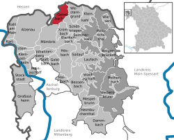
Geiselbach

Last updated
Geiselbach
Geiselbach view from the north.JPG
A view of Geiselbach from the north, with the church St. Maria Magdalena
Wappen von Geiselbach.svg
Location of Geiselbach within Aschaffenburg district
Geiselbach in AB.svgJohannesbergWiesener ForstForst Hain im SpessartHeinrichsthaler ForstHeinrichsthaler ForstWaldaschaffer ForstSchöllkrippener ForstSailaufer ForstRohrbrunner ForstRothenbucher ForstGoldbachWiesenKrombachHaibach
Germany adm location map.svg
Red pog.svg
Geiselbach
Bavaria location map.svg
Red pog.svg
Geiselbach
Coordinates: 50°07′N9°12′E / 50.117°N 9.200°E / 50.117; 9.200
Country Germany
State Bavaria
Admin. region Unterfranken
District Aschaffenburg
Subdivisions2 Ortsteile
Government
   Mayor (202026) Marianne Krohnen [1] (CSU)
Area
  Total9.50 km2 (3.67 sq mi)
Elevation
270 m (890 ft)
Population
 (2022-12-31) [2]
  Total2,142
  Density230/km2 (580/sq mi)
Time zone UTC+01:00 (CET)
  Summer (DST) UTC+02:00 (CEST)
Postal codes
63826
Dialling codes 06024
Vehicle registration AB
Website geiselbach.de

Geiselbach is a community in the Aschaffenburg district in the Regierungsbezirk of Lower Franconia (Unterfranken) in Bavaria, Germany.

Contents

Geography

Location

Constituent communities Gemeinde Geiselbach.svg
Constituent communities

Geiselbach lies on the Hesse-Bavaria boundary, 20 km north of Aschaffenburg and 50 km east of Frankfurt am Main.

Elevations in the community reach from 272 m above sea level at the church up to 381 m at the Ziegelberg.

The municipal area comprises 535 ha in the constituent community of Geiselbach and 415 ha in the constituent community of Omersbach.

History

In 1269, Geiselbach had its first documentary mention in a purchase agreement between the Seligenstadt Monastery and the Archbishopric of Mainz, between Abbot Conrad and Archbishop Werner.

There also exists an earlier document from 1250 in which was about a dispute between the brothers Friedrich and Heinrich von Rannenberg and Reinhard von Hanau about holdings and rights in Geiselbach.

After 1269, the Seligenstadt Monastery relinquished its rights in Geiselbach to the noble families of Büdingen, Hanau and Rannenberg and to the knight Erpho von Orb.

In 1278, the patrician from Gelnhausen Irmgard Ungefüge took over the Geiselbach Vogtei with the villages of Geiselbach, Omersbach and Hofstädten. In three documents from 25 May 1278 it was agreed between the Seligenstadt Abbey and Madam Irmgard that the Abbey could reacquire all rights from her in better times. Even before the turn of the century, in 1290, Sir Erpho von Orb was once again named the Vogt in Geiselbach.

The Seligenstadt Monastery held the lordship over Geiselbach until Secularization in 1802. Most of the villages of the upper Kahlgrund then passed to the Principality of Aschaffenburg. Geiselbach, on the other hand, as a Seligenstadt Monastery holding, passed into ownership of the Landgrave of Hesse, who moved the Vogtei administration from Geiselbach to Seligenstadt.

In 1811, the three villages were united with the Grand Ducal Hessian Amt in Alzenau, which itself became Bavarian in 1816.

In 1972 the formerly self-administering community of Omersbach was amalgamated with Geiselbach, while the community of Hofstädten, which had likewise belonged to the Vogtei of Geiselbach, passed to Schöllkrippen in 1978.

Coat of arms

The community’s arms might be described thus: Gules an uppercase A with crossbar on top in fess and cross stroke in chevron inverted Or among three mullets of six argent.

The community of Geiselbach was acquired in 1296 by the Seligenstadt Monastery from the Archbishopric of Mainz for an undisclosed price. It thereby belonged along with the two neighbouring villages of Hofstädten and Omersbach to the Vogtei of the Dreidörfer (“Three Villages”) over which the monastery managed to get the landlordship and the low jurisdiction through the acquisition. The big A (Abbatio) in the arms is the charge borne by the Seligenstadt Monastery and refers to the monastery’s lordship until Secularization in 1802. The three mullets (stars) symbolize the three-village parish. The tinctures silver and red are Electoral Mainz’s colours and recall Mainz’s lordship until 1803.

The arms have been borne since August 1967.

Notable people

Town partnerships

Related Research Articles

<span class="mw-page-title-main">Schöllkrippen</span> Municipality in Bavaria, Germany

Schöllkrippen is a market community in the Aschaffenburg district in the Regierungsbezirk of Lower Franconia (Unterfranken) in Bavaria, Germany and seat of the Verwaltungsgemeinschaft of Schöllkrippen. It has a total population of around 4,300 (2020).

<span class="mw-page-title-main">Hainburg, Germany</span> Municipality in Hesse, Germany

Hainburg is a municipality of just under 14,400 inhabitants in the Offenbach district in the Regierungsbezirk of Darmstadt in Hesse, Germany.

<span class="mw-page-title-main">Seligenstadt</span> Town in Hesse, Germany

Seligenstadt is a town in the Offenbach district in the Regierungsbezirk of Darmstadt in Hesse, Germany. Seligenstadt is one of Germany's oldest towns and was already of great importance in Carolingian times.

<span class="mw-page-title-main">Alzenau</span> Town in Bavaria, Germany

Alzenau is a town in the north of the Aschaffenburg district in the Regierungsbezirk of Lower Franconia (Unterfranken) in Bavaria, Germany. Until 1 July 1972, Alzenau was the district seat of the now abolished district of the same name and has a population of around 19,000.

<span class="mw-page-title-main">Mömlingen</span> Municipality in Bavaria, Germany

Mömlingen is a municipality in the Miltenberg district in the Regierungsbezirk of Lower Franconia (Unterfranken) in Bavaria, Germany.

<span class="mw-page-title-main">Principality of Aschaffenburg</span> Principality

The Principality of Aschaffenburg was a principality of the Holy Roman Empire created in 1803 and, following the dissolution of the Empire in 1806, of the Confederation of the Rhine, which existed from 1806 to 1810. Its capital was Aschaffenburg.

<span class="mw-page-title-main">Blankenbach</span> Municipality in Bavaria, Germany

Blankenbach is a community in the Aschaffenburg district in the Regierungsbezirk of Lower Franconia (Unterfranken) in Bavaria, Germany, and a member of the Verwaltungsgemeinschaft of Schöllkrippen.

<span class="mw-page-title-main">Heimbuchenthal</span> Municipality in Bavaria, Germany

Heimbuchenthal is a community in the Aschaffenburg district in the Regierungsbezirk of Lower Franconia (Unterfranken) in Bavaria, Germany, and the seat of the Verwaltungsgemeinschaft of Mespelbrunn. It is also a state-recognized recreational resort (Erholungsort).

<span class="mw-page-title-main">Kleinkahl</span> Municipality in Bavaria, Germany

Kleinkahl is a community in the Aschaffenburg district in the Regierungsbezirk of Lower Franconia (Unterfranken) in Bavaria, Germany, and a member of the Verwaltungsgemeinschaft of Schöllkrippen. Kleinkahl has around 1,800 inhabitants.

<span class="mw-page-title-main">Krombach, Bavaria</span> Municipality in Bavaria, Germany

Krombach is a community in the Aschaffenburg district in the Regierungsbezirk of Lower Franconia (Unterfranken) in Bavaria, Germany and a member of the Verwaltungsgemeinschaft of Schöllkrippen.

<span class="mw-page-title-main">Stockstadt am Main</span> Municipality in Bavaria, Germany

Stockstadt am Main is a market community in the Aschaffenburg district in the Regierungsbezirk of Lower Franconia (Unterfranken) in Bavaria, Germany.

<span class="mw-page-title-main">Wiesen, Bavaria</span> Municipality in Bavaria, Germany

Wiesen is a community in the Aschaffenburg district in the Regierungsbezirk of Lower Franconia (Unterfranken) in Bavaria, Germany and a member of the Verwaltungsgemeinschaft of Schöllkrippen. It has around 1,000 inhabitants.

<span class="mw-page-title-main">Partenstein</span> Municipality in Bavaria, Germany

Partenstein is a community in the Main-Spessart district in the Regierungsbezirk of Lower Franconia (Unterfranken) in Bavaria, Germany and the seat of the Verwaltungsgemeinschaft of Partenstein. Partenstein is located on Bundesstraße 276.

<span class="mw-page-title-main">Wiesthal</span> Municipality in Bavaria, Germany

Wiesthal is a community in the Main-Spessart district in the Regierungsbezirk of Lower Franconia (Unterfranken) in Bavaria, Germany and a member of the Verwaltungsgemeinschaft of Partenstein. It has a population of around 1,300.

<span class="mw-page-title-main">Altenbuch</span> Municipality in Bavaria, Germany

Altenbuch is a community in the Miltenberg district in the Regierungsbezirk of Lower Franconia (Unterfranken) in Bavaria, Germany and a member of the Verwaltungsgemeinschaft of Stadtprozelten. Altenbuch has around 1,200 inhabitants.

<span class="mw-page-title-main">Dorfprozelten</span> Municipality in Bavaria, Germany

Dorfprozelten is a municipality in the Miltenberg district in the Regierungsbezirk of Lower Franconia (Unterfranken) in Bavaria, Germany. It is one of the oldest settlements on the Lower Main. Sandstone quarrying was a major industry once. The village has also long been known as the home of people involved in inland (river) navigation. Today, Dorfprozelten has a population of close to 1,800.

<span class="mw-page-title-main">Rüdenau</span> Municipality in Bavaria, Germany

Rüdenau is a municipality in the Miltenberg district in the Regierungsbezirk of Lower Franconia (Unterfranken) in Bavaria, Germany and a member of the Verwaltungsgemeinschaft of Kleinheubach.

<span class="mw-page-title-main">Mainhausen</span> Municipality in Hesse, Germany

Mainhausen is a municipality of over 9,000 in the Offenbach district in the Regierungsbezirk of Darmstadt in Hesse, Germany.

<span class="mw-page-title-main">Jossgrund</span> Municipality in Hesse, Germany

Jossgrund is a municipality in the Main-Kinzig district, in Hesse, Germany. It has around 3,500 inhabitants distributed among several formerly independent villages, now Ortsteile. The administration seat is at Oberndorf.

<span class="mw-page-title-main">Birkenhainer Straße</span> Long-distance hiking trail in Germany

The Birkenhainer Straße is a long-distance hiking trail that follows an ancient trade route through the Mittelgebirge Spessart, in the states of Hesse and Bavaria, Germany. It is 71 km long and leads from Hanau to Gemünden am Main, cutting across the so-called Mainviereck, a large loop of the river Main. The trail follows an ancient trade route which in the Middle Ages was an important road for moving troops and for long-distance trade. The Birkenhainer Straße was a part of the link between Nuremberg and Antwerp. Its origins may lie back as far as the Neolithic period. The name likely derives from a prominent copse of birch trees that used to exist near the road at Geiselbach (Hesse).

References