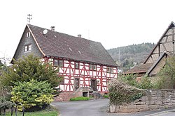
Laufach

Last updated
Laufach
Laufach Hain Auweg 1.jpg
Fachwerkhaus in Laufach
DEU Laufach COA.svg
Location of Laufach within Aschaffenburg district
Laufach in AB.svg
Germany adm location map.svg
Red pog.svg
Laufach
Bavaria location map.svg
Red pog.svg
Laufach
Coordinates: 50°01′N09°18′E / 50.017°N 9.300°E / 50.017; 9.300 Coordinates: 50°01′N09°18′E / 50.017°N 9.300°E / 50.017; 9.300
Country Germany
State Bavaria
Admin. region Unterfranken
District Aschaffenburg
Subdivisions3 Ortsteile
Government
   Mayor (202026) Friedrich Fleckenstein [1] (SPD)
Area
  Total15.60 km2 (6.02 sq mi)
Elevation
180 m (590 ft)
Population
 (2020-12-31) [2]
  Total5,200
  Density330/km2 (860/sq mi)
Time zone UTC+01:00 (CET)
  Summer (DST) UTC+02:00 (CEST)
Postal codes
63846
Dialling codes 06093
Vehicle registration AB
Website www.laufach.de

Laufach is a community in the Aschaffenburg district in the Regierungsbezirk of Lower Franconia (Unterfranken) in Bavaria, Germany.

Contents

Geography

Location

The community lies in northwest Bavaria east of Aschaffenburg. Laufach lies in the heart of the Vorspessart (range) and stretches through its outlying centre of Hain into the High Spessart. The community's elevation ranges from 170 to 500 m above sea level, including the peaks of Steigkoppe to the north and Steinknückl to the south.

Subdivisions

Laufach's Ortsteile are Frohnhofen (898 inhabitants), Hain (1,177 inhabitants) and Laufach (3,204 inhabitants).

History

In 1084, Laufach, which was originally known as Laufahe, had its first documentary mention in an obituary from Saints Peter and Alexander collegiate church in Aschaffenburg. Laufach's name came from the stream on which it was built. Over the years, the community's name has changed many times, from Laufache in 1182, to Loifahe in 1191, to Loupha in 1348, to Lauffach around 1528 and 1624 before settling on Laufach in the early 19th century.

The Laufach valley was settled under the protection of the Counts of Rieneck, who already held the Vogtei (position of Vogt ) from the Archbishopric of Mainz and the collegiate church in Aschaffenburg. On the Rieneck free court in 1380 – where Schöffen (roughly “lay jurists”) from Laufach were specifically mentioned – settlers sat as free citizens.

In the mid-14th century, glassmakers were brought into service in the Spessart with special incentives. Since they had to leave the forest from Martinmas (11 November) until Easter, they sought winter dwellings in Hain and Laufach. Many of these workers settled here owing to family ties. Already by 1469, there was a mine near the "Weyber" palace (Schloss Weyber, Weyberhöfe). In Unserer lieber Frauen Teil, presumably part of the Liebesgrund, copper was mined. After the Thirty Years' War, ores were mined and smelted.

In the mid-18th century, in the area of today's sporting ground, a hammer mill was built. The building of a railway in the years 1850 to 1854 had a very positive effect on the community's industrial development. With the railway station, an important transport link with Aschaffenburg and the whole Lower Main was created. In the course of time, the ironworks became an integrated industry in which both the mining and the processing were done, yielding a finished product.

Even trades and crafts were important to Laufach quite early on. From earlier craft businesses grew highly productive operations.

In 1866, shortly after the Austro-Prussian War broke out, the engagements near Frohnhofen between Prussia and troops of the German Confederation took place during the Campaign of the Main (Mainfeldzug).

In 1984, the community of Laufach celebrated 900 years of existence.

Frohnhofen and the outlying centre of Hain developed into purely residential areas in which most inhabitants earned their income in the industrial and commercial businesses in Laufach, Aschaffenburg and the surrounding area. Laufach's economy underwent a shift from agriculture to industry.

To further foster commercial-industrial growth, the Laufach-Ost commercial area was developed, covering an eight-hectare area between Laufach and Hain. Another such area was developed in 2001 on a four-hectare area between Laufach and Frohnhofen.

Religion

There are a Catholic church and an Evangelical church in the core municipality. Until 1184 the people of the Laufach valley had to go to the Aschaffenburg Mother of God parish for church services, then from 1184 to 1250 to Bessenbach, and then from 1250 to 1810 to Sailauf.

On 28 November 1810, Laufach, together with Hain, was raised to a double parish. In 1812, a bigger church was built, which then stood on the Kirchberg until 1962. In 1964, on the same spot, a new church building was consecrated to Saint Thomas More.

In 1995, Saint Peter's Evangelical Church (Petruskirche) celebrated its 90th birthday.

Demographics

Before the Thirty Years' War began in 1618, Laufach was a village with 76 Unterthanen (a word that usually means “subjects” in German, but in this case it means “men or families”) – all together 300 inhabitants. After the disastrous war, according to a description of properties from 1651, there were 12 men and 33 “hearth places” (houses). Through an energetic promotional effort by the Elector of Mainz, the depopulated Spessart was newly settled with soldiers, craftsmen and foreigners. The old family names had disappeared and new ones made their appearance. In 1668, Laufach had 72 households and 105 inhabitants.

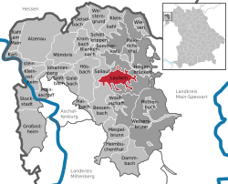
Until Napoleonic times, Laufach belonged to Electoral Mainz. From 1803 to 1810 it belonged to the Principality of Aschaffenburg, then passing until 1813 to the Grand Duchy of Frankfurt. Since 1814, Laufach has been on Bavarian soil. At that time, Laufach and Frohnhofen counted all together 115 houses with 161 households and 1,451 inhabitants. The inflow of those driven from their homelands by the Second World War brought the population up to 2,552 in 1950. In 1967 there were more than 3,000 inhabitants in Laufach, among them 56 foreigners. With municipal reform in 1978 and the attendant amalgamation of the community of Hain im Spessart, the population rose to 4,545 all told, 2,995 from Laufach, 687 from Frohnhofen and 863 from Hain. In mid-2001, 5,267 persons were living in Laufach, among them 580 foreigners from 42 different nations.

Government

Community council

The council is made up of 20 council members, counting the full-time mayor, Valentin Weber (Freie Wähler).

CSU SPD Freie Wähler Total
200896520 seats

(as at municipal election held on 2 March 2008)

Coat of arms

The community's arms might be described thus: Gules a sprig of three oakleaves Or, in base a sledge and a cross-peen hammer in saltire argent.

The oakleaves shown in the arms refer to Laufach's location in the Spessart, which is rich in oaks. The crossed tools in the base are symbolic of the old iron mines and ironworks.

The arms were conferred on 19 September 1969.

The former community of Hain once bore its own arms.

Infrastructure

Transport

Laufach can be reached via the Bundesstraße 26, by rail (Laufach station on the Aschaffenburg-Würzburg line, served by the Regionalbahn) and on the nearby A 3.

Laufach is located at one end of the Spessart Ramp of the Main-Spessart railway.

Public institutions

Education

Related Research Articles

Schöllkrippen Municipality in Bavaria, Germany

Schöllkrippen is a market community in the Aschaffenburg district in the Regierungsbezirk of Lower Franconia (Unterfranken) in Bavaria, Germany and seat of the Verwaltungsgemeinschaft of Schöllkrippen. It has a total population of around 4,300 (2020).

Heigenbrücken Municipality in Bavaria, Germany

Heigenbrücken is a municipality in the Aschaffenburg district in the Regierungsbezirk of Lower Franconia (Unterfranken) in Bavaria, Germany, and seat of the Verwaltungsgemeinschaft of Heigenbrücken. It has a population of around 2,200.

Dammbach Municipality in Bavaria, Germany

Dammbach is a community in the Aschaffenburg district in the Regierungsbezirk of Lower Franconia (Unterfranken) in Bavaria, Germany, and a member of the Verwaltungsgemeinschaft of Mespelbrunn, whose seat is in Heimbuchenthal.

Lohr am Main Place in Bavaria, Germany

Lohr am Main is a town in the Main-Spessart district in the Regierungsbezirk of Lower Franconia (Unterfranken) in Bavaria, Germany and the seat of the Verwaltungsgemeinschaft of Lohr am Main. It has a population of around 15,000.

Rieneck Town in Bavaria, Germany

Rieneck is a town in the Main-Spessart district in the Regierungsbezirk of Lower Franconia (Unterfranken) in Bavaria, Germany.

Haibach, Lower Franconia Municipality in Bavaria, Germany

Haibach is a community in the Aschaffenburg district in the Regierungsbezirk of Lower Franconia (Unterfranken) in Bavaria, Germany. It has a population of around 8,300.

Johannesberg, Bavaria Municipality in Bavaria, Germany

Johannesberg is a community in the Aschaffenburg district in the Regierungsbezirk of Lower Franconia (Unterfranken) in Bavaria, Germany. It has around 3,900 inhabitants.

Mespelbrunn Municipality in Bavaria, Germany

Mespelbrunn is a community in the Aschaffenburg district in the Regierungsbezirk of Lower Franconia (Unterfranken) in Bavaria, Germany and a member of the Verwaltungsgemeinschaft of Mespelbrunn, whose seat is in Heimbuchenthal.

Rothenbuch Municipality in Bavaria, Germany

Rothenbuch is a community in the Aschaffenburg district in the Regierungsbezirk of Lower Franconia (Unterfranken) in Bavaria, Germany. It has a population of around 1,700.

Sailauf Municipality in Bavaria, Germany

Sailauf is a municipality in the Aschaffenburg district in the Regierungsbezirk of Lower Franconia (Unterfranken) in Bavaria, Germany. It has a population of around 3,600.

Sommerkahl Municipality in Bavaria, Germany

Sommerkahl is a community in the Aschaffenburg district in the Regierungsbezirk of Lower Franconia (Unterfranken) in Bavaria, Germany and a member of the Verwaltungsgemeinschaft of Schöllkrippen. It has a population of around 1,300 (2020).

Weibersbrunn Municipality in Bavaria, Germany

Weibersbrunn is a community with a population of close to 2,000 in the Aschaffenburg district in the Regierungsbezirk of Lower Franconia (Unterfranken) in Bavaria, Germany.

Wiesen, Bavaria Municipality in Bavaria, Germany

Wiesen is a community in the Aschaffenburg district in the Regierungsbezirk of Lower Franconia (Unterfranken) in Bavaria, Germany and a member of the Verwaltungsgemeinschaft of Schöllkrippen. It has around 1,000 inhabitants.

Burgsinn Municipality in Bavaria, Germany

Burgsinn is a market community in the Main-Spessart district in the Regierungsbezirk of Lower Franconia (Unterfranken) in Bavaria, Germany and the seat of the Verwaltungsgemeinschaft of Burgsinn. It has a population of around 2,500.

Fellen Municipality in Bavaria, Germany

Fellen is a community in the Main-Spessart district in the Regierungsbezirk of Lower Franconia (Unterfranken) in Bavaria, Germany and a member of the Verwaltungsgemeinschaft of Burgsinn.

Frammersbach Municipality in Bavaria, Germany

Frammersbach is a market community in the Main-Spessart district in the Regierungsbezirk of Lower Franconia (Unterfranken) in Bavaria, Germany. In the early modern period, people from Frammersbach achieved international renown as drivers of wagons on the most important trans-European trade routes. Today, Frammersbach has a population of around 4,500.

Partenstein Municipality in Bavaria, Germany

Partenstein is a community in the Main-Spessart district in the Regierungsbezirk of Lower Franconia (Unterfranken) in Bavaria, Germany and the seat of the Verwaltungsgemeinschaft of Partenstein. Partenstein is located on Bundesstraße 276.

Wiesthal Municipality in Bavaria, Germany

Wiesthal is a community in the Main-Spessart district in the Regierungsbezirk of Lower Franconia (Unterfranken) in Bavaria, Germany and a member of the Verwaltungsgemeinschaft of Partenstein. It has a population of around 1,300.

Mönchberg Municipality in Bavaria, Germany

Mönchberg is a market community in the Miltenberg district in the Regierungsbezirk of Lower Franconia (Unterfranken) in Bavaria, Germany. It is the seat of the Verwaltungsgemeinschaft of Mönchberg and a state-recognized climatic spa (Luftkurort).

Flörsbachtal Municipality in Hesse, Germany

Flörsbachtal is a municipality in the Main-Kinzig district, in Hesse, Germany. It has a population close to 2,400. Flösbachtal contains both the oldest parish and the youngest settlement established in the Spessart hills. Located within the municipal territory is the Hermannskoppe, the highest elevation in the Hessian part of the Spessart and the Wiesbüttmoor, a rare hanging bog.

References

  1. Liste der ersten Bürgermeister/Oberbürgermeister in kreisangehörigen Gemeinden, Bayerisches Landesamt für Statistik, 15 July 2021.
  2. "Tabellenblatt "Daten 2", Statistischer Bericht A1200C 202041 Einwohnerzahlen der Gemeinden, Kreise und Regierungsbezirke". Bayerisches Landesamt für Statistik (in German). June 2021.