This article needs additional citations for verification .(February 2017) |
Mainaschaff | |
|---|---|
 Coat of arms | |
Location of Mainaschaff within Aschaffenburg district 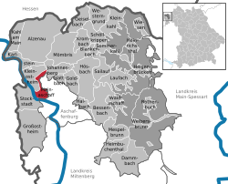 | |
 | |
| Location of Mainaschaff | |
 Mainaschaff  Mainaschaff | |
| Coordinates: 49°59′N9°5′E / 49.983°N 9.083°E | |
| Country | Germany |
| State | Bavaria |
| Admin. region | Unterfranken |
| District | Aschaffenburg |
| Government | |
| • Mayor (2020–26) | Moritz Sammer [1] |
| Area | |
• Total | 7.31 km2 (2.82 sq mi) |
| Elevation | 114 m (374 ft) |
| Population (2023-12-31) [2] | |
• Total | 9,112 |
| • Density | 1,250/km2 (3,230/sq mi) |
| Time zone | UTC+01:00 (CET) |
| • Summer (DST) | UTC+02:00 (CEST) |
| Postal codes | 63814 |
| Dialling codes | 06021 |
| Vehicle registration | AB, ALZ |
| Website | www.mainaschaff.de |
Mainaschaff is a municipality in the Aschaffenburg district in the Regierungsbezirk of Lower Franconia (Unterfranken) in Bavaria, Germany. It has a population of around 9,000 (2020).

