
Singleton is a town on the banks of the Hunter River in New South Wales, Australia. Singleton is 144 km (89 mi) north-north-west of Sydney, and 70 km (43 mi) northwest of Newcastle. At June 2018, Singleton had an urban population of 16,346.

Bingara is a small town on the Gwydir River in Murchison County in the New England region of New South Wales, Australia. Bingara is currently the administrative centre for the Gwydir Shire that was created in 2003. Bingara is one of the few places in Australia where diamonds have been found. The Gwydir River being a main highlight of the town is a main catchment of the Murray-Darling System.

North Sydney is a suburb and major commercial district on the Lower North Shore of Sydney, Australia. North Sydney is located 3 kilometres north of the Sydney central business district and is the administrative centre for the local government area of North Sydney Council.

Glenbrook is a township of the Lower Blue Mountains of New South Wales, Australia. It is located 70 kilometres west of Sydney in the local government area of the City of Blue Mountains. At the 2016 Australian census Glenbrook had a population of 5,051 people.

Muswellbrook is a town in the Upper Hunter Region of New South Wales, Australia, about 243 km (151 mi) north of Sydney and 127 km (79 mi) north-west of Newcastle.

Corowa is a town in the state of New South Wales in Australia. It is on the bank of the Murray River, the border between New South Wales and Victoria, opposite the Victorian town of Wahgunyah. It is the largest town in the Federation Council and was the administrative centre of the former Corowa Shire. The name could have derived from an Aboriginal word referring to the curra pine which yielded gum used by Aboriginal people to fasten the heads of spears to the shafts. Another translation is rocky river.
Towrang is a village in the Southern Tablelands of New South Wales, Australia, in Goulburn Mulwaree Council. It is approximately 13 kilometres (8.1 mi) before Goulburn on the Hume Highway 180 kilometres (110 mi) south from Sydney. At the 2016 census, Towrang had a population of 171.
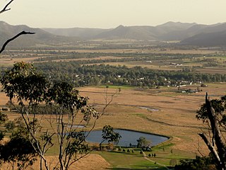
Broke is a village of approximately 292 people in the Hunter Region of New South Wales, Australia in Singleton Shire. It is located 157 kilometres (98 mi) to the north of Sydney on the original early colonial road from Sydney to Singleton.

East Gosford is a suburb of the Central Coast region of New South Wales, Australia, located immediately southeast of Gosford's town centre. It is part of the Central Coast Council local government area, and occupies an area previously inhabited by the Guringai (Wanangine) People. East Gosford is named after the Archibald Acheson, 2nd Earl of Gosford, with whom New South Wales Governor George Gipps served in Canada. Archibald Acheson was appointed Governor of British North America in 1835, and conducted a royal commission into the state of affairs in Lower Canada.
Burrinjuck is a village community in the far eastern part of the Riverina. It is situated by road, about 15 kilometres southwest from Woolgarlo and 28 kilometres south from Bookham. The name of the town is derived from an Aboriginal word meaning 'mountain with a rugged top'. At the 2016 census, the Burrinjuck area had a population of 19.
Hinton is a suburb of the Port Stephens local government area in the Hunter Region of New South Wales, Australia. Primarily rural, the largest population centre is the township of Hinton, which is situated on the Paterson River, near to the confluence of the Hunter and Paterson rivers. In 1835 the post office requested a name for the town and the surveyor general suggested Hinton prior to this it was known as the second arm of the hunter river. The first European settlers were 12 ex convicts in 1818.

Wollombi is a small village in the Hunter Region of New South Wales, Australia. It is within the Cessnock City Council LGA, situated 29 kilometres (18 mi) southwest of Cessnock and 128 km (80 mi) north of Sydney. To the south is the village of Laguna, to the east, the village of Millfield and to the north, the village of Broke.
Liddell is a locality in the Singleton Council of New South Wales, Australia. It had a population of zero as of the 2016 census.
Middle Falbrook is a locality in the Singleton Council region of New South Wales, Australia. It had a population of 92 as of the 2016 census.
Bulga is a locality in the Singleton Council region of New South Wales, Australia. It had a population of 354 as of the 2016 census. The name is derived from an Aboriginal word for "mountain" or "isolated hill or mountain".
Whittingham is a locality in the Singleton Council region of New South Wales, Australia. It had a population of 364 as of the 2016 census.
Warkworth is a locality in the Singleton Council region of New South Wales, Australia. It had a population of 49 as of the 2016 census.

The Beckers Bridge over Webbers Creek is a heritage-listed timber truss road bridge that carries Main Road across Webbers Creek, located in Glendon Brook, Singleton Council, New South Wales, Australia. It was designed by Ernest de Burgh. The property is owned by Roads and Maritime Services, an agency of the Government of New South Wales. It was added to the New South Wales State Heritage Register on 20 June 2000.
Singleton Post Office is a heritage-listed former post office at 25-27 George Street, Singleton, Singleton Council, New South Wales, Australia. It was added to the New South Wales State Heritage Register on 2 April 1999.
The Wollombi Brook bridge is a heritage-listed road bridge that carries Putty Road across the Wollombi Brook at Bulga, in the Singleton Council local government area of New South Wales, Australia. The bridge was designed by Harvey Dare and built in 1912. The bridge is owned by Roads and Maritime Services, an agency of the Government of New South Wales. The bridge was added to the New South Wales State Heritage Register on 20 June 2000.
