Golden Gate, Illinois

Last updated

Golden Gate
Wayne County Illinois Incorporated and Unincorporated areas Golden Gate Highlighted.svg
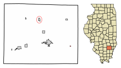
Location of Golden Gate in Wayne County, Illinois.
Illinois in United States (US48).svg
Location of Illinois in the United States
Coordinates: 38°21′32″N88°12′17″W / 38.35889°N 88.20472°W / 38.35889; -88.20472 [1]
CountryUnited States
StateIllinois
County Wayne
Area
[2]
  Total0.08 sq mi (0.21 km2)
  Land0.08 sq mi (0.21 km2)
  Water0.00 sq mi (0.00 km2)
Elevation
[1]
404 ft (123 m)
Population
 (2020)
  Total65
  Density822.78/sq mi (316.45/km2)
Time zone UTC-6 (CST)
  Summer (DST) UTC-5 (CDT)
ZIP Code(s)
62843
Area code 618
FIPS code 17-30250
GNIS feature ID2398173 [1]
Wikimedia CommonsGolden Gate, Illinois

Golden Gate is a village in Wayne County, Illinois, along the Little Wabash River. The population was 65 at the 2020 census.

Contents

Geography

According to the 2010 census, Golden Gate has a total area of 0.08 square miles (0.21 km2), all land. [3] The town was built by the Leach family in the late 19th century. The township that surrounds the Golden Gate area is known as Leech township named after Samuel Leech, an early settler of the area. Golden Gate was built along the railroad tracks and the Little Wabash river for business needs.

Demographics

Historical population
CensusPop.Note
1900 345
1910 311−9.9%
1920 265−14.8%
1930 223−15.8%
1940 24811.2%
1950 199−19.8%
1960 156−21.6%
1970 99−36.5%
1980 12627.3%
1990 71−43.7%
2000 10040.8%
2010 68−32.0%
2020 65−4.4%
U.S. Decennial Census [4]

As of the census [5] of 2000, there were 100 people, 39 households, and 28 families residing in the village. The population density was 1,306.6 inhabitants per square mile (504.5/km2). There were 51 housing units at an average density of 666.4 per square mile (257.3/km2). The racial makeup of the village was 100.00% White. Hispanic or Latino of any race were 4.00% of the population.

There were 39 households, out of which 43.6% had children under the age of 18 living with them, 64.1% were married couples living together, 7.7% had a female householder with no husband present, and 28.2% were non-families. 28.2% of all households were made up of individuals, and 10.3% had someone living alone who was 65 years of age or older. The average household size was 2.56 and the average family size was 3.11.

In the village, the population was spread out, with 30.0% under the age of 18, 6.0% from 18 to 24, 36.0% from 25 to 44, 18.0% from 45 to 64, and 10.0% who were 65 years of age or older. The median age was 34 years. For every 100 females, there were 108.3 males. For every 100 females age 18 and over, there were 94.4 males.

The median income for a household in the village was $21,250, and the median income for a family was $28,750. Males had a median income of $26,250 versus $23,500 for females. The per capita income for the village was $10,214. There were 12.5% of families and 19.2% of the population living below the poverty line, including 15.2% of under eighteens and 14.3% of those over 64.

Related Research Articles

<span class="mw-page-title-main">Allendale, Illinois</span> Village in Illinois, United States

Allendale is a village in Wabash Precinct, Wabash County, Illinois. The population was 475 at the 2010 census.

<span class="mw-page-title-main">Bellmont, Illinois</span> Village in Illinois, United States

Bellmont is a village in Bellmont Precinct, Wabash County, Illinois, United States. The population was 297 at the 2000 census.

<span class="mw-page-title-main">Keensburg, Illinois</span> Village in Illinois, United States

Keensburg is a village in Coffee Precinct, Wabash County, Illinois. The population was 192 at the 2010 census.

<span class="mw-page-title-main">Alamo, Indiana</span> Town in Indiana, United States

Alamo is a town in Ripley Township, Montgomery County, in the U.S. state of Indiana. The population was 66 at the 2020 census, unchanged from 2010.

<span class="mw-page-title-main">Mecca, Indiana</span> Town in Indiana, United States

Mecca is a town in Wabash Township, Parke County, in the U.S. state of Indiana. The population was 335 at the 2010 census.

<span class="mw-page-title-main">Perrysville, Indiana</span> Town in Indiana, United States

Perrysville is a town in Highland Township, Vermillion County, in the U.S. state of Indiana. The population was 456 at the 2010 census.

<span class="mw-page-title-main">Riley, Indiana</span> Town in Indiana, United States

Riley, once known as Lockport, is a town in Riley Township, Vigo County, in the U.S. state of Indiana. The population was 221 at the 2010 census. It is part of the Terre Haute Metropolitan Statistical Area.

<span class="mw-page-title-main">La Fontaine, Indiana</span> Town in Indiana, United States

La Fontaine is a town in Liberty Township, Wabash County, in the U.S. state of Indiana. The population was 875 at the 2010 census. Its name means "The Fountain" in French.

<span class="mw-page-title-main">Lagro, Indiana</span> Town in Indiana, United States

Lagro is a town in Lagro Township, Wabash County, in the U.S. state of Indiana. The population was 415 at the 2010 census.

<span class="mw-page-title-main">Malvern, Iowa</span> City in Iowa, United States

Malvern is a city in Mills County, Iowa, United States. The population was 1,046 at the time of the 2020 census. The Wabash Trace—a railroad converted to a bicycle trail—passes through Malvern. The Mills County Fair is held here, although Glenwood is the county seat. Malvern is the largest town in the eastern half of the county.

<span class="mw-page-title-main">Silver City, Iowa</span> City in Iowa, United States

Silver City is a city in Mills County, Iowa, United States. The population was 245 at the 2020 census. The Wabash Trace—a railroad converted to a bicycle trail—passes through here. At trailside, there is a small park with a gazebo, and across from it, a small cafe.

<span class="mw-page-title-main">South Gate, Maryland</span> Former census-designated place in Maryland, United States

South Gate was a census-designated place (CDP) in Anne Arundel County, Maryland, United States, for the 2000 census, at which time its population was 28,672. It was added primarily to the Glen Burnie CDP for the 2010 census.

<span class="mw-page-title-main">Britton, Michigan</span> Village in Michigan, United States

Britton is a village in Lenawee County in the U.S. state of Michigan. The population was 586 at the 2010 census. The village is located within Ridgeway Township.

Leech Lake Township is a township in Cass County, Minnesota, United States. The population was 384 at the 2000 census. This township took its name from Leech Lake.

<span class="mw-page-title-main">Emerald Beach, Missouri</span> Village in Missouri, United States

Emerald Beach is a village in White River Township, Barry County, Missouri, United States. The community is located on a bend in the White River now Table Rock Lake. Cassville is approximately 13 miles to the northwest and Rogers, Arkansas is 32 miles to the southwest.

<span class="mw-page-title-main">Conception Junction, Missouri</span> City in Missouri, United States

Conception Junction is a city in Nodaway County, Missouri, United States, near the Platte River. The population was 177 at the 2020 census.

<span class="mw-page-title-main">Brinkhaven, Ohio</span> Village in Ohio, United States

Brinkhaven, once known as Mount Holly and Gann, is a village in Knox County, Ohio, United States. The population was 114 at the 2020 census.

<span class="mw-page-title-main">Whitehouse, Ohio</span> Village in Ohio, United States

Whitehouse is a village within the Toledo Metropolitan Area in Lucas County, Ohio, United States. The population was 4,990 at the 2020 census.

Bowstring Lake is an unorganized territory in Itasca County, Minnesota, United States. The population was 1,166 at the 2010 census.

<span class="mw-page-title-main">Verona, Ohio</span> Village in Ohio, United States

Verona is a village in Montgomery and Preble counties in the U.S. state of Ohio. The population was 403 at the 2020 census. It is part of the Dayton Metropolitan Statistical Area.

References

  1. 1 2 3 U.S. Geological Survey Geographic Names Information System: Golden Gate, Illinois
  2. "2020 U.S. Gazetteer Files". United States Census Bureau. Retrieved March 15, 2022.
  3. "G001 - Geographic Identifiers - 2010 Census Summary File 1". United States Census Bureau. Archived from the original on February 13, 2020. Retrieved August 3, 2015.
  4. "Census of Population and Housing". Census.gov. Retrieved June 4, 2015.
  5. "U.S. Census website". United States Census Bureau . Retrieved January 31, 2008.