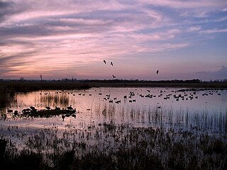
Strumpshaw Fen is a nature reserve managed by the Royal Society for the Protection of Birds (RSPB). It is situated at Strumpshaw on the River Yare in the English county of Norfolk around 6 miles (9.7 km) east of Norwich. The Buckenham Marshes RSPB reserve borders the reserve to the east.
Fleet Pond is a 48.3-hectare (119-acre) biological Site of Special Scientific Interest in Fleet in Hampshire. It is also a Local Nature Reserve.

The Gloucestershire Wildlife Trust is the Gloucestershire local partner in a conservation network of 46 Wildlife Trusts. The Wildlife Trusts are local charities with the specific aim of protecting the United Kingdom's natural heritage. The Gloucestershire Wildlife Trust is managed by a board of trustees elected from its membership who provide overall direction for the development of the trust and there are advisory committees. The work of the trust is carried out through staff and volunteers.

The Cotswold Water Park is the United Kingdom's largest marl lake system, straddling the Wiltshire–Gloucestershire border, northwest of Cricklade and south of Cirencester. There are 180 lakes, spread over 42 square miles (110 km2).

Camley Street Natural Park is an urban nature reserve in St Pancras in central London and within the London Borough of Camden. It is a local nature reserve.
Ashford Green Corridor is a green space that runs through the town of Ashford in Kent, England. The Green Corridor is made up of parks, recreation grounds and other green spaces alongside the rivers that flow through Ashford. It is a Local Nature Reserve.

Burton Mere Wetlands is a nature reserve on the Dee Estuary straddling the border between Cheshire, England and Flintshire, Wales. It is run by the Royal Society for the Protection of Birds (RSPB) and incorporates the older Inner Marsh Farm reserve. It lies near the village of Burton, about 3 kilometres (1.9 mi) south of Neston. It has all been developed by the RSPB and includes a large area of mixed wetland habitats, bluebell woodlands, and arable fields all managed to attract wildlife.

Brandon Marsh is a Site of Special Scientific Interest (SSSI) and nature reserve in Warwickshire, England. It is situated adjacent to the River Avon, near the village of Brandon, a few miles east of Coventry.

Sevenoaks Gravel Pits is a 73.7-hectare (182-acre) biological Site of Special Scientific Interest on the northern outskirts of Sevenoaks in Kent. It is managed by Kent Wildlife Trust as the Sevenoaks Wildlife Reserve and Jeffery Harrison Visitor Centre.

Roswell Pits is an 8 hectare nature reserve on the eastern outskirts of Ely in Cambridgeshire. It is managed by the Environment Agency. It is part of the Ely Pits and Meadows Site of Special Scientific Interest (SSSI)) and Geological Conservation Review site. The SSSI designation for both biological and geological interest. The site was formerly managed by the Wildlife Trust for Bedfordshire, Cambridgeshire and Northamptonshire.

The Yanga National Park is a newly formed national park, located near the township of Balranald in south- western New South Wales. It covers an area of 66,734 hectares which includes 1,932 hectares of Yanga Nature Reserve, and has a frontage of 170 kilometres (110 mi) on the Murrumbidgee River. It is largely located in the Lower Murrumbidgee Floodplain, which is included on A Directory of Important Wetlands in Australia because of its importance as a breeding site for waterbirds when flooded.

North Warren RSPB reserve is a nature reserve run by the Royal Society for the Protection of Birds (RSPB) in Suffolk, England. It lies on the Suffolk coast on the north edge of the town of Aldeburgh and to the south of Thorpeness and includes the Aldringham Walks area of heathland to the north. It is within the Suffolk Coast and Heaths Area of Outstanding Natural Beauty (AONB) and the Suffolk Heritage Coast area. Noted for its populations of Eurasian bittern, European nightjar and other bird species, it covers a range of coastal habitats and is protected with SSSI, SPA conservation status.

The Natural History Society of Northumbria (NHSN) is a voluntary organization to promote the study of natural history and protect the wildlife of North East England.
Lower Wye Gorge is a 65-hectare (160-acre) biological and geological Site of Special Scientific Interest in Gloucestershire, notified in 1954 and renotified 1987. The site includes two Gloucestershire Wildlife Trust nature reserves being Ban-y-gor Wood and Lancaut. The Natural England citation states a revision for Lancaut inclusion.

Hartland Moor is a Site of Special Scientific Interest (SSSI) on the south side of Poole Harbour near the town of Wareham in Dorset, England. It consists of lowland heathland.

Havannah Nature Reserve lies to the west of the village of Hazlerigg, approximately five miles north of the centre of Newcastle upon Tyne in the north of England. It was declared a nature reserve in 1998 and is designated a Site of Local Conservation Interest. A wildlife corridor runs through the site.

Loch Lomond National Nature Reserve (NNR) encompasses 430 hectares of land at the southeastern part of Loch Lomond in the council areas of Stirling and West Dunbartonshire, in Scotland. It covers the islands of Inchcailloch, Clairinsh, Torrinch, Creinch and Aber Isle, alongside areas of woodland and wetlands to either side of the mouth of the Endrick Water. NatureScot owns two parts of the reserve - the island of Inchcailloch and part of Gartfairn Wood - and the rest is privately owned. The reserve is managed by a partnership consisting of NatureScot, the RSPB Scotland and the Loch Lomond and The Trossachs National Park, along with the owners and tenants of the land under agreements. Within this framework NatureScot directly manage the islands of Clairinsh, Inchcailloch, Torrinch and Creinch, and land to the north of the Endrick Water. The RSPB manages the area to the south of the Endrick Water, and the national park manages visitor facilities on Inchcailloch.

Stodmarsh SSSI is a 623.2-hectare (1,540-acre) biological Site of Special Scientific Interest near Stodmarsh, north-east of Canterbury in Kent. Parts of it are a Nature Conservation Review site, Grade I, a National Nature Reserve, a Ramsar internationally important wetland site, a Special Area of Conservation and a Special Protection Area under the European Union Directive on the Conservation of Wild Birds.

Mar Field Fen is a Site of Special Scientific Interest, or SSSI, north of Masham, North Yorkshire, England, in a rural area known as Marfield. It is situated on land containing woodland carr, fen, spring-fed marshy grassland and drier calcareous grassland, between the River Ure to the east and Marfield Wetland nature reserve to the west. As "one of the best examples of fen habitat in the Vale of York," it is a protected habitat for a variety of plants, including the common butterwort, a carnivorous plant. There is no public access to this site.

Ripon Parks is a Site of Special Scientific Interest, or SSSI, situated north of Ripon, to the west of the River Ure and to the east of the village of North Stainley, in North Yorkshire, England. It was once part of the land held since the Middle Ages as a deer park by the archbishops of York and the canons of Ripon. The site was designated as an SSSI in 1983, because its varied habitats are valued for their breeding birds, amphibians and varied flora. The woods here are "of note" for the parasitic flowers of common toothwort and yellow star-of-Bethlehem. A small part of the site is accessible via public footpaths; there are no public facilities or dedicated car parks. The site incorporates the High Batts Nature Reserve, which is privately run for training, recording and educational purposes, and accessible to members only, except for its annual open day. Ripon Parks is now owned by the Ministry of Defence, and parts of the site are used as military training areas.


