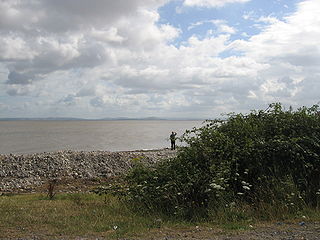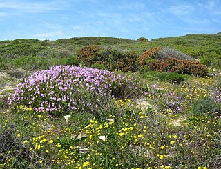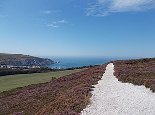
Holkham National Nature Reserve is England's largest national nature reserve (NNR). It is on the Norfolk coast between Burnham Overy Staithe and Blakeney, and is managed by Natural England with the cooperation of the Holkham Estate. Its 3,900 hectares comprise a wide range of habitats, including grazing marsh, woodland, salt marsh, sand dunes and foreshore. The reserve is part of the North Norfolk Coast Site of Special Scientific Interest, and the larger area is additionally protected through Natura 2000, Special Protection Area (SPA) and Ramsar listings, and is part of both an Area of Outstanding Natural Beauty (AONB) and a World Biosphere Reserve. Holkham NNR is important for its wintering wildfowl, especially pink-footed geese, Eurasian wigeon and brant geese, but it also has breeding waders, and attracts many migrating birds in autumn. A number of scarce invertebrates and plants can be found in the dunes, and the reserve is one of the only two sites in the UK to have an antlion colony.

Bridgwater Bay is on the Bristol Channel, 5 kilometres (3.1 mi) north of Bridgwater in Somerset, England at the mouth of the River Parrett and the end of the River Parrett Trail. It stretches from Minehead at the southwestern end of the bay to Brean Down in the north. The area consists of large areas of mudflats, saltmarsh, sandflats and shingle ridges, some of which are vegetated. It has been designated as a Site of Special Scientific Interest (SSSI) covering an area of 3,574.1 hectares since 1989, and is designated as a wetland of international importance under the Ramsar Convention. The risks to wildlife are highlighted in the local Oil Spill Contingency Plan.

Presqu'ile Provincial Park is a park in southeastern Northumberland County on the north shore of Lake Ontario near the town of Brighton in Ontario, Canada. The park occupies an area of 9.37 km2 (3.62 sq mi). The name of the park is the French word for peninsula, or literally "almost island", and was believed to be named by Samuel De Champlain on his second expedition. The peninsula was formed when a limestone island was connected to the mainland by a sand spit; this kind of formation is referred to as a tombolo.

The Duddon Estuary is the sandy, gritty estuary of the River Duddon that lies between Morecambe Bay and the North Lonsdale coast.

Aire Point to Carrick Du SSSI is a Site of Special Scientific Interest on the Penwith Peninsula, Cornwall, England. It is 5.98 square kilometres in extent, stretching from grid reference SW360279 to grid reference SW513410. The site is designated both for its biological and its geological interest.
Shoalwater Bay Military Training Area is a heritage-listed military installation at Byfield Road, Byfield, Shire of Livingstone, Queensland, Australia. It is a large, relatively undisturbed and intact natural system with a wide variety of coastal landforms and a high level of biodiversity. It contains a diverse range of marine and coastal wetland landscapes, vegetation types and ecosystems. It was added to the Australian Commonwealth Heritage List on 22 June 2004.

Arrábida Natural Park is a protected area in Portugal. Founded in 1976, the park occupies an area of 176.41 km2 (68.11 sq mi), covering the southernmost margin of the Setúbal Peninsula.

Cassop Vale is a Site of Special Scientific Interest in the Durham City district of County Durham, England. It lies between the villages of Bowburn and Cassop, 7 km south-east of the centre of Durham..

Ireland is in the Atlantic European Province of the Circumboreal Region, a floristic region within the Holarctic.

Cape Flats Dune Strandveld is an endangered vegetation type. This is a unique type of Cape Strandveld that is endemic to the coastal areas around Cape Town, including the Cape Flats.

Godrevy Head to St Agnes is a coastal Site of Special Scientific Interest (SSSI) in north Cornwall, England], noted for both its biological and geological characteristics. A number of rare and scarce plant species can be found on the site, along with many breeding seabirds.

Polruan to Polperro is a coastal Site of Special Scientific Interest (SSSI) and Special Area of Conservation (SAC) in south-east Cornwall, England, UK, noted for its biological interest. It contains a wide variety of plant species and is a site for populations of breeding birds.

Porth Hellick is a tidal inlet on the south coast of St Mary’s, the largest island in the Isles of Scilly.

The North Norfolk Coast Site of Special Scientific Interest (SSSI) is an area of European importance for wildlife in Norfolk, England. It comprises 7,700 ha (19,027 acres) of the county's north coast from just west of Holme-next-the-Sea to Kelling, and is additionally protected through Natura 2000, Special Protection Area (SPA) listings; it is also part of the Norfolk Coast Area of Outstanding Natural Beauty (AONB). The North Norfolk Coast is also designated as a wetland of international importance on the Ramsar list and most of it is a Biosphere Reserve.

Leckhampton Hill and Charlton Kings Common is a 63.8-hectare (158-acre) biological and geological Site of Special Scientific Interest in Gloucestershire, notified in 1954. There are five units of assessment.

Minchinhampton Common is a 182.7-hectare (451-acre) biological and geological Site of Special Scientific Interest in Gloucestershire, notified in 1972.

Beddmanarch–Cymyran is a site of special scientific interest (SSSI) on the Welsh island of Anglesey extending to just over 900 hectares, and centred on the Cymyran Strait. It was first notified in 1961 for its coastal botanical and ornithological interest. The site is also a marine protected area as it includes intertidal areas and contains marine components.

North Devon's Biosphere Reserve is a UNESCO biosphere reserve in North Devon. It covers 55 square miles (140 km2) and is centred on Braunton Burrows, the largest sand dune system (psammosere) in England. The boundaries of the reserve follow the edges of the conjoined catchment basin of the Rivers Taw and the Torridge and stretch out to sea to include the island of Lundy. The biosphere reserve is primarily lowland farmland, and includes many protected sites including 63 Sites of Special Scientific Interest which protect habitats such as culm grassland and broadleaved woodlands. The most populous settlements in its buffer area are Barnstaple, Bideford, Northam, Ilfracombe, and Okehampton.

Ripon Parks is a Site of Special Scientific Interest, or SSSI, situated north of Ripon, to the west of the River Ure and to the east of the village of North Stainley, in North Yorkshire, England. It was once part of the land held since the Middle Ages as a deer park by the archbishops of York and the canons of Ripon. The site was designated as an SSSI in 1983, because its varied habitats are valued for their breeding birds, amphibians and varied flora. The woods here are "of note" for the parasitic flowers of common toothwort and yellow star-of-Bethlehem. A small part of the site is accessible via public footpaths; there are no public facilities or dedicated car parks. The site incorporates the High Batts Nature Reserve, which is privately run for training, recording and educational purposes, and accessible to members only, except for its annual open day. Ripon Parks is now owned by the Ministry of Defence, and parts of the site are used as military training areas.


