
A grassland is an area where the vegetation is dominated by grasses (Poaceae). However, sedge (Cyperaceae) and rush (Juncaceae) can also be found along with variable proportions of legumes, like clover, and other herbs. Grasslands occur naturally on all continents except Antarctica and are found in most ecoregions of the Earth. Furthermore, grasslands are one of the largest biomes on Earth and dominate the landscape worldwide. There are different types of grasslands: natural grasslands, semi-natural grasslands, and agricultural grasslands. They cover 31–69% of the Earth's land area.

A savanna or savannah is a mixed woodland-grassland ecosystem characterised by the trees being sufficiently widely spaced so that the canopy does not close. The open canopy allows sufficient light to reach the ground to support an unbroken herbaceous layer consisting primarily of grasses. According to Britannica, there exists four savanna forms; savanna woodland where trees and shrubs form a light canopy, tree savanna with scattered trees and shrubs, shrub savanna with distributed shrubs, and grass savanna where trees and shrubs are mostly nonexistent.

Moorland or moor is a type of habitat found in upland areas in temperate grasslands, savannas, and shrublands and montane grasslands and shrublands biomes, characterised by low-growing vegetation on acidic soils. Moorland, nowadays, generally means uncultivated hill land, but also includes low-lying wetlands. It is closely related to heath, although experts disagree on what precisely distinguishes these types of vegetation. Generally, moor refers to highland and high rainfall zones, whereas heath refers to lowland zones which are more likely to be the result of human activity. Moorland habitats mostly occur in tropical Africa, northern and western Europe, and neotropical South America. Most of the world's moorlands are diverse ecosystems. In the extensive moorlands of the tropics, biodiversity can be extremely high. Moorland also bears a relationship to tundra, appearing as the tundra and the natural tree zone. The boundary between tundra and moorland constantly shifts with climatic change.

Pawnee National Grassland is a United States National Grassland located in northeastern Colorado on the Colorado Eastern Plains. The grassland is located in the South Platte River basin in remote northern and extreme northeastern Weld County between Greeley and Sterling. It comprises two parcels totaling 193,060 acres (78,130 ha) largely between State Highway 14 and the Wyoming border. The larger eastern parcel lies adjacent to the borders of both Nebraska and Wyoming. It is administered in conjunction with the Arapaho-Roosevelt National Forest from the U.S. Forest Service office in Fort Collins, with a local ranger district office in Greeley.

Aspen parkland refers to a very large area of transitional biome between prairie and boreal forest in two sections, namely the Peace River Country of northwestern Alberta crossing the border into British Columbia, and a much larger area stretching from central Alberta, all across central Saskatchewan to south central Manitoba and continuing into small parts of the US states of Minnesota and North Dakota. Aspen parkland consists of groves of aspen, poplar and spruce, interspersed with areas of prairie grasslands, also intersected by large stream and river valleys lined with aspen-spruce forests and dense shrubbery. This is the largest boreal-grassland transition zone in the world and is a zone of constant competition and tension as prairie and woodlands struggle to overtake each other within the parkland.

Bishop Middleham Quarry is a disused quarry, about 4 kilometres (2.5 mi) north-west of Sedgefield, County Durham, England. Quarry-working here ceased in 1934, and the site has since been colonised by vegetation. The underlying rock is Magnesian Limestone and this has had a strong influence in determining the range of plant and animal communities now found there.
Witton-le-Wear (SSSI) is a Site of Special Scientific Interest located in the valley of the River Wear, immediately east of the village of Witton-le-Wear in County Durham, England.

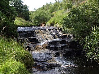
Cotherstone Moor is a Site of Special Scientific Interest in the Teesdale district in south-west County Durham, England. It is an extensive area of moorland which extends almost the entire length of Baldersdale, from the confluence of the River Balder with the Tees at Cotherstone. It runs parallel to Bowes Moor SSSI, which lies a short distance to the south.
Frog Wood Bog is a Site of Special Scientific Interest in the Teesdale district of County Durham, England. It lies alongside Bedburn Beck, approximately 3.5 km west of the village of Bedburn.
Hunder Beck Juniper is a Site of Special Scientific Interest in the Teesdale district of south-west County Durham, England. It lies between the Balderhead and Blackton Reservoirs and adjoins the Cotherstone Moor SSSI to the south.
Lune Forest is a Site of Special Scientific Interest covering an extensive area of moorland in the Teesdale district of west Durham, England. In the north, where it adjoins the Upper Teesdale and Appleby Fells SSSIs, it extends from Mickle Fell eastward almost as far as Harter Fell, above the hamlet of Thringarth. Its southern limit is marked by the River Balder, upstream from Balderhead Reservoir, where it shares a boundary with Cotherstone Moor SSSI to the south. Grains o' th' Beck Meadows and Close House Mine SSSIs are entirely surrounded by Lune Forest, but do not form part of it.
Middle Crossthwaite is a Site of Special Scientific Interest in the Teesdale district of County Durham, England. It is situated on the south bank of the River Tees, about 1.5 km upstream from the village of Middleton-in-Teesdale. The Park End Wood and Middle Side and Stonygill Meadows SSSIs lie on the same stretch of floodplain, while the higher ground to the south is part of the Upper Teesdale SSSI.
Middle Side and Stonygill Meadows is a Site of Special Scientific Interest in the Teesdale district of County Durham, England. It consists of two separate areas, one to the north of the River Tees, the other on the south bank, about 2 km upstream from the village of Middleton-in-Teesdale. The Park End Wood and Middle Crossthwaite SSSIs lie on the same stretch of floodplain, the Teesdale Allotments SSSI is a short distance to the north, while the higher ground to the south of the river is part of the Upper Teesdale SSSI.
Park End Wood is a Site of Special Scientific Interest in the Teesdale district of west County Durham, England. The site occupies a low hill of Whin Sill on the southern edge of the River Tees floodplain just over 2 km upstream from the village of Middleton-in-Teesdale. It adjoins the Upper Teesdale SSSI to the south, and the Middle Crossthwaite and Stonygill Meadows SSSIs are nearby.
Raisby Hill Grassland is a Site of Special Scientific Interest in east County Durham, England. It lies just over 1 km east of the village of Coxhoe.
The Bottoms is a Site of Special Scientific Interest in County Durham, England. It lies just south of the A181 road, roughly midway between the villages of Cassop and Wheatley Hill, some 10 km south-east of Durham city.
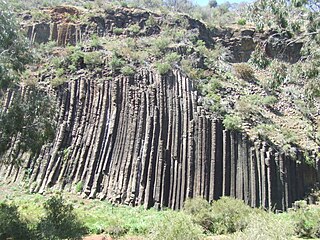
The Organ Pipes National Park, abbreviated as OPNP, is a national park located in the Central region of Victoria, Australia. The 121-hectare (300-acre) protected area was established with the focus on conservation of the native flora and fauna, and preservation of the geological features in the Jacksons Creek, a part of the Maribyrnong valley, north-west of Melbourne. It is situated in a deep gorge in the grassy, basalt Keilor Plains.

Croft Hill is a 128m high natural hill rising up the Soar flood-plain north of Croft&quarry in Leicestershire, England. It stands out as an isolated landmark, and has been used as a meeting place for centuries.

Ripon Parks is a Site of Special Scientific Interest, or SSSI, situated north of Ripon, to the west of the River Ure and to the east of the village of North Stainley, in North Yorkshire, England. It was once part of the land held since the Middle Ages as a deer park by the archbishops of York and the canons of Ripon. The site was designated as an SSSI in 1983, because its varied habitats are valued for their breeding birds, amphibians and varied flora. The woods here are "of note" for the parasitic flowers of common toothwort and yellow star-of-Bethlehem. A small part of the site is accessible via public footpaths; there are no public facilities or dedicated car parks. The site incorporates the High Batts Nature Reserve, which is privately run for training, recording and educational purposes, and accessible to members only, except for its annual open day. Ripon Parks is now owned by the Ministry of Defence, and parts of the site are used as military training areas.
