
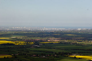
Consett is a town in north-west County Durham, England, about 14 miles (23 km) south-west of Newcastle upon Tyne. It had a population of 27,394 in 2001 and an estimate of 25,774 in 2018.
Teesdale is a dale, or valley, in Northern England. The dale is in the River Tees’s drainage basin, most water flows stem from or converge into said river, including the Skerne and Leven.

Kirkby Stephen is a market town in Cumbria, in North West England. Historically it was part of Westmorland. It lies on the A685, surrounded by sparsely populated hill country and about 25 miles (40 km) from the nearest larger towns: Kendal and Penrith. The River Eden rises 6 miles (9.7 km) away in the peat bogs below Hugh Seat and passes the eastern edge of the town.

Bowburn is a village in County Durham, England. It is situated about 3 miles (4.8 km) to the south-east of Durham, on the A177, between Coxhoe to the south-east, and High Shincliffe to the north-west.

Waldridge is a village in County Durham, in England. The population at the 2001 Census was 215. Prior to the 2011 Census the parish boundaries changed and the population shown at this census was 4,215. It is situated to the south west of Chester-le-Street. It is known as either Waldridge Fell or Waldridge Village, the 'Fell' referring to the surrounding area of moorland. The village used to be known as Waldridge Colliery. The current village dates back to the 1890s, the original village having been located on the fell which overlooks the present location. Rainwater runs into the Cong Burn to the north and the South Burn to the south, both of which flow into the River Wear which is a few miles to the east.

The Coconino National Forest is a 1.856-million acre United States National Forest located in northern Arizona in the vicinity of Flagstaff. Originally established in 1898 as the "San Francisco Mountains National Forest Reserve", the area was designated a U.S. National Forest in 1908 when the San Francisco Mountains National Forest Reserve was merged with lands from other surrounding forest reserves to create the Coconino National Forest. Today, the Coconino National Forest contains diverse landscapes, including deserts, ponderosa pine forests, flatlands, mesas, alpine tundra, and ancient volcanic peaks. The forest surrounds the towns of Sedona and Flagstaff and borders four other national forests; the Kaibab National Forest to the west and northwest, the Prescott National Forest to the southwest, the Tonto National Forest to the south, and the Apache-Sitgreaves National Forest to the southeast. The forest contains all or parts of ten designated wilderness areas, including the Kachina Peaks Wilderness, which includes the summit of the San Francisco Peaks. The headquarters are in Flagstaff. There are local ranger district offices in Flagstaff, Happy Jack, and Sedona.

The Arizona Strip is the part of Arizona lying north of the Colorado River. The difficulty of crossing the Grand Canyon causes this region to have more physical and cultural connections with southern Utah and Nevada than with the rest of Arizona. The largest settlements in the Strip are Colorado City and Fredonia.
Turian-Chay State Reserve or Turyanchay State Reserve was established on the area of 126.3 square kilometres in 1958.

The River Wear in North East England rises in the Pennines and flows eastwards, mostly through County Durham to the North Sea in the City of Sunderland. At 60 mi (97 km) long, it is one of the region's longest rivers, wends in a steep valley through the cathedral city of Durham and gives its name to Weardale in its upper reach and Wearside by its mouth.

The Lost Forest Research Natural Area is a designated forest created by the Bureau of Land Management to protect an ancient stand of ponderosa pine in the remote high desert county of northern Lake County, in the south central area of the U.S. state of Oregon. Lost Forest is an isolated area of pine trees separated from the nearest contiguous forest land by forty miles of arid desert. There are no springs or surface water in Lost Forest, and much of the southwest portion of the natural area is covered by large shifting sand dunes that are slowly encroaching on the forest.

Waldridge Fell is a Site of Special Scientific Interest located immediately south-west of Chester-le-Street in the northern part of County Durham, England. It is one of the largest areas of lowland heath in County Durham and contains the only lowland valley-mire in the county. The fell is home to a number of plants and insects that are scarce to rare elsewhere in the county.

Backstone Bank and Baal Hill Woods is a Site of Special Scientific Interest in the County Durham district of Durham, England. It occupies the steep eastern slopes of the valley of Waskerley Beck, alongside and downstream of Tunstall Reservoir, some 3 km north of Wolsingham and is one of the largest expanses of semi-natural woodland in west Durham.

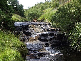
Burnhope Burn is a Site of Special Scientific Interest in the Wear Valley district of north County Durham, England. It consists of a 12.6-acre (5.1 ha) area of woodland, carr, fen and mire in the valley of Burnhope Burn, just below the dam of the Derwent Reservoir, a mile (1.6 km) north-east of the village of Edmundbyers.

Frog Wood Bog is a Site of Special Scientific Interest in the Teesdale district of County Durham, England. It lies alongside Bedburn Beck, approximately 3.5 km west of the village of Bedburn.
Hunder Beck Juniper is a Site of Special Scientific Interest in the Teesdale district of south-west County Durham, England. It lies between the Balderhead and Blackton Reservoirs and adjoins the Cotherstone Moor SSSI to the south.
Muggleswick, Stanhope and Edmundbyers Commons and Blanchland Moor is a Site of Special Scientific Interest in County Durham and Northumberland, England. It consists of two separate areas, the larger—encompassing the upland areas of Muggleswick, Stanhope and Edmundbyers Commons—in the Derwentside and Wear Valley districts of north Durham, the smaller—Blanchland Moor—in the Tynedale district of south-west Northumberland.

Pow Hill Bog is a Site of Special Scientific Interest in the Wear Valley district of County Durham, England. It lies alongside Derwent Reservoir, approximately 2 km north-west of the village of Edmundbyers and adjacent to the Edmundbyers Common portion of the Muggleswick, Stanhope and Edmundbyers Commons and Blanchland Moor SSSI.
Heathery Burn Cave is a cave near Stanhope, County Durham, England, in which a large collection of Late Bronze Age weapons and tools was discovered and excavated between 1859 and 1872.

