The A19 is a major road in England running approximately parallel to and east of the A1 road. Although the two roads meet at the northern end of the A19, the two roads originally met at the southern end of the A19 in Doncaster, but the old route of the A1 was changed to the A638. From Sunderland northwards, the route was formerly the A108. In the past the route was known as the East of Snaith-York-Thirsk-Stockton-on-Tees-Sunderland Trunk Road. Most traffic joins the A19, heading for Teesside, from the A168 at Dishforth Interchange.

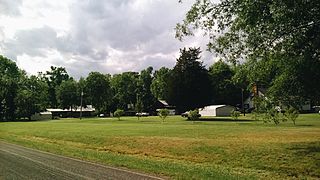
Rougemont is an unincorporated community and census-designated place (CDP) in Durham and Person counties, North Carolina, United States. The population of the CDP was 978 at the 2010 census. An act to incorporate Rougemont as a town was introduced to the North Carolina General Assembly in 2011.

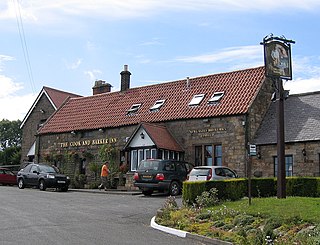
Newton on the Moor is a village in Northumberland, England. It is located 5 miles (8 km) south of Alnwick, on the old route of the A1 road although the village has now been bypassed just to the east. The village in the civil parish of Newton on the Moor and Swarland, which also includes the village of Swarland, south-west of Newton on the Moor. The population of the parish is 822, increasing to 905 at the 2011 Census. The village is a conservation area.

Fairy Holes Cave is a Site of Special Scientific Interest in the Wear Valley district of west County Durham, England. It is located on the western flanks of Snowhope Moor, on the right bank of Westernhope Burn, some 3 km south-west of the village of Eastgate.

Frog Wood Bog is a Site of Special Scientific Interest in the Teesdale district of County Durham, England. It lies alongside Bedburn Beck, approximately 3.5 km west of the village of Bedburn.

Green Croft and Langley Moor is a Site of Special Scientific Interest in the Derwentside district in north County Durham, England. It consists of three separate areas, two to the south of Annfield Plain and one just west of Quaking Houses, between the towns of Consett, to the west, and Stanley, to the east.

Hesledon Moor East is a Site of Special Scientific Interest in the County Durham district in east County Durham, England. It is located on the southern edge of the village of Murton, 10 km south of Sunderland and a little under 2 km north-east of Hesledon Moor West SSSI.

Hexhamshire Moors is a Site of Special Scientific Interest covering an extensive area of moorland in the Wear Valley district of north-west County Durham and the Tynedale district of south-west Northumberland, England.

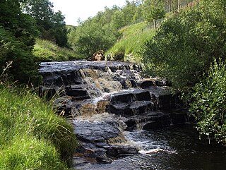
Hisehope Burn Valley is a Site of Special Scientific Interest in the Derwentside district of Durham, England. It consists of two separate parcels of land, one on the west bank of Hisehope Burn, the other a few hundred yards to the east, straddling the headwaters of another small burn. The site is some 3 km west of the village of Castleside and 1 km north of the Smiddy Shaw Reservoir. The larger area adjoins the Muggleswick, Stanhope and Edmundbyers Commons and Blanchland Moor SSSI.

Hunder Beck Juniper is a Site of Special Scientific Interest in the Teesdale district of south-west County Durham, England. It lies between the Balderhead and Blackton Reservoirs and adjoins the Cotherstone Moor SSSI to the south.

Pig Hill is a Site of Special Scientific Interest in the County Durham district of north-east County Durham, England, situated 1 km south of the village of Easington Lane.

Pittington Hill is a Site of Special Scientific Interest in County Durham, England. It lies adjacent to the village of Pittington, some 6 km north-east of Durham city. A disused quarry occupies part of the site.

Quarrington Hill Grasslands is a Site of Special Scientific Interest in County Durham, England. The site consists of three separate areas, two closely adjacent to the east of the village of Quarrington Hill, the third immediately west of the village, which lies 8 km south-east of Durham City.

Tuthill Quarry is a Site of Special Scientific Interest in the County Durham district of north-east County Durham, England. It lies just over 1 km east of the village of Haswell.

Raisby Hill Grassland is a Site of Special Scientific Interest in east County Durham, England. It lies just over 1 km east of the village of Coxhoe.

Stony Cut, Cold Hesledon is a Site of Special Scientific Interest in the Easington district of north-east County Durham, England. It consists of a shallow cutting alongside Seaham Golf Course close to the village of Cold Hesledon.

Sherburn Hill is a Site of Special Scientific Interest in County Durham, England. It lies just south of the road between the villages of Sherburn and Sherburn Hill, some 5.5 km east of Durham city. A disused quarry occupies part of the site.

The Bottoms is a Site of Special Scientific Interest in County Durham, England. It lies just south of the A181 road, roughly midway between the villages of Cassop and Wheatley Hill, some 10 km south-east of Durham city.


