Crag Gill

Last updated
Crag Gill
Site of Special Scientific Interest
Country England
Region North East
District Teesdale
Location NZ026235
 - coordinates 54°36′26″N1°57′38″W / 54.60722°N 1.96056°W / 54.60722; -1.96056 Coordinates: 54°36′26″N1°57′38″W / 54.60722°N 1.96056°W / 54.60722; -1.96056
Area 2.3 ha (5.7 acres)
Notification 1984
Management Natural England
Area of Search County Durham
Interest Geological
Durham UK relief location map.jpg
Red pog.svg
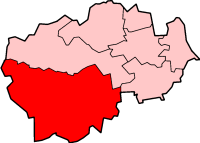
Location of Crag Gill SSSI, Co Durham
Website: Map of site

Crag Gill is a Site of Special Scientific Interest in the Teesdale district in south-west County Durham, England. It lies about 3 km east of the village of Eggleston, just off the B6282 road, which separates it from the Bollihope, Pikestone, Eggleston and Woodland Fells SSSI to the north.

Site of Special Scientific Interest Conservation designation denoting a protected area in the United Kingdom

A Site of Special Scientific Interest (SSSI) in Great Britain or an Area of Special Scientific Interest (ASSI) in the Isle of Man and Northern Ireland is a conservation designation denoting a protected area in the United Kingdom and Isle of Man. SSSI/ASSIs are the basic building block of site-based nature conservation legislation and most other legal nature/geological conservation designations in the United Kingdom are based upon them, including national nature reserves, Ramsar sites, Special Protection Areas, and Special Areas of Conservation. The acronym "SSSI" is often pronounced "triple-S I".

Teesdale (district) former local government district in County Durham, England

Teesdale was, from 1974 to 2009, a local government district in County Durham, England. Its council was based in Barnard Castle and it was named after the valley of the River Tees.

County Durham County of England

County Durham is a county in North East England. The county town is Durham, a cathedral city. The largest settlement is Darlington, closely followed by Hartlepool and Stockton-on-Tees. It borders Tyne and Wear to the north east, Northumberland to the north, Cumbria to the west and North Yorkshire to the south. The county's historic boundaries stretch between the rivers Tyne and Tees, thus including places such as Gateshead, Jarrow, South Shields and Sunderland.

Crag Gill consists of an exposure of late Namurian limestones, sandstones and shales that form a Yoredale-type sequence. The exposure is the type locality of the Whitestone limestone, a marker horizon for Namurian stratigraphy. [1]

The Namurian is a stage in the regional stratigraphy of northwest Europe with an age between roughly 326 and 313 Ma. It is a subdivision of the Carboniferous system or period and the regional Silesian series. The Namurian is named for the Belgian city and province of Namur where strata of this age occur. The Millstone Grit Group in the lithostratigraphy of northern England and parts of Wales is also of Namurian age.

Limestone Sedimentary rocks made of calcium carbonate

Limestone is a carbonate sedimentary rock that is often composed of the skeletal fragments of marine organisms such as coral, foraminifera, and molluscs. Its major materials are the minerals calcite and aragonite, which are different crystal forms of calcium carbonate (CaCO3). A closely related rock is dolostone, which contains a high percentage of the mineral dolomite, CaMg(CO3)2. In fact, in old USGS publications, dolostone was referred to as magnesian limestone, a term now reserved for magnesium-deficient dolostones or magnesium-rich limestones.

Sandstone A clastic sedimentary rock composed mostly of sand-sized particles

Sandstone is a clastic sedimentary rock composed mainly of sand-sized mineral particles or rock fragments.

Related Research Articles

Scafell Pike highest mountain in England

Scafell Pike or is the highest mountain in England, at an elevation of 978 metres (3,209 ft) above sea level. It is located in the Lake District National Park, in Cumbria, and is part of the Southern Fells.

Oolite Sedimentary rock formed from ooids

Oolite or oölite is a sedimentary rock formed from ooids, spherical grains composed of concentric layers. The name derives from the Ancient Greek word ᾠόν for egg. Strictly, oolites consist of ooids of 0.25–2 millimetres' diameter; rocks composed of ooids larger than 2 mm are called pisolites. The term oolith can refer to oolite or individual ooids.

Hutton Roof Crags mountain in United Kingdom

Hutton Roof Crags is a hill in south-eastern Cumbria in north-west England, located near to the village of Hutton Roof. It has extensive areas of limestone pavement as well as grassland and woodland. The hill forms the Hutton Roof Crags Site of Special Scientific Interest and is part of the Morecambe Bay Pavements Special Area of Conservation. A significant proportion of the UK's 20 km² of limestone pavement is to be found on Hutton Roof Crags and the neighbouring Farleton Knott.

Hoplocarida subclass of crustaceans

Hoplocarida is a subclass of crustaceans. The only extant members are the mantis shrimp (Stomatopoda), but two other orders existed in the Palaeozoic: Aeschronectida and Palaeostomatopoda.

Castle Crag mountain in United Kingdom

Castle Crag is a hill in the North Western Fells of the English Lake District. It is the smallest hill included in Alfred Wainwright's influential Pictorial Guide to the Lakeland Fells, the only Wainwright below 1,000 feet (300 m).

Seven Star Crags lake

The Seven Star Crags are located across from the center of Zhaoqing City, Guangdong, People's Republic of China. The crags are all situated in or around Star Lake directly across from Paifang square in downtown Zhaoqing.

Millstone Grit

Millstone Grit is the name given to any of a number of coarse-grained sandstones of Carboniferous age which occur in the British Isles. The name derives from its use in earlier times as a source of millstones for use principally in watermills. Geologists refer to the whole suite of rocks that encompass the individual limestone beds and the intervening mudstones as the Millstone Grit Group. The term Millstone Grit Series was formerly used to refer to the rocks now included within the Millstone Grit Group together with the underlying Edale Shale Group.

Rosthwaite Fell mountain in United Kingdom

Rosthwaite Fell is a fell in the English Lake District. It is situated some 12 kilometres (7.5 mi) due south of Keswick and 2 kilometres (1.2 mi) south of the village of Rosthwaite in Borrowdale.

Clints Crags mountain in United Kingdom

Clints Crags is a small fell in the north of the English Lake District near Blindcrake, Cumbria. It has its own chapter in Alfred Wainwright's The Outlying Fells of Lakeland. He describes a circular walk from Blindcrake, and laments that at the time of writing (1974): "This is a walk on public footpaths, but until somebody removes the barbed wire and other obstacles to legitimate progress it can be recommended only to gymnasts." It reaches 804 feet (245 m). Since the time of writing the barbed wire has been removed and the path to the summit is clear of obstructions.

Cribarth mountain in United Kingdom

Cribarth or Sleeping Giant is a hill in the Brecon Beacons National Park in Brecknockshire, southern Wales. The summit lies on the broken ridge at an elevation of 428m at OS grid reference SN 831143. To its west is a 426m high rounded top at SN 829144 which lies just to the northwest of a mile long ridge which forms the main bulk of the hill. The ridge attains a height of 423m high at its southwest end and this spot is marked by a trig point. Both of these latter high points are adorned by Bronze Age burial cairns.

Warton Crag hill

Warton Crag is a limestone hill in north west Lancashire, England. It lies to the north west of Warton village, in City of Lancaster district. At 163 metres (535 ft) it is the highest point in the Arnside and Silverdale Area of Outstanding Natural Beauty, and is listed as a "HuMP" or "Hundred Metre Prominence", its parent being Hutton Roof Crags. Two areas are Local Nature Reserves, called Warton Crag and Warton Crag Quarry. Different sections are owned by Lancashire County Council, the Wildlife Trust for Lancashire, Manchester and North Merseyside, Lancaster City Council and the Royal Society for the Protection of Birds.

Botany Hill

Botany Hill, formerly known as Botany Quarry, is a Site of Special Scientific Interest in the Teesdale district of south-west County Durham, England. It occupies a position on both sides of How Gill, just under 1 km north of the village of Hury, in Baldersdale.

West Rigg Open Cutting

West Rigg Open Cutting is a Site of Special Scientific Interest in the Wear Valley district of west County Durham, England. It is a disused ironstone quarry, located just over 1 km north of the village of Westgate, in Weardale.

Sleightholme Beck Gorge – The Troughs

Sleightholme Beck Gorge – The Troughs is a Site of Special Scientific Interest in the Teesdale district of south-west County Durham, England. The site covers a gorge in the valley of Sleightholme Beck between the hamlet of Sleightholme and the confluence with the River Greta, some 3 km upriver from the village of Bowes.

Sinomeganeura is an extinct genus of griffenfly in the family Meganeuridae and containing a single species Sinomeganeura huangheensis. The species is known only from Late Carboniferous, Namurian stage, Tupo Formation near the village of Xiaheyan in Ningxia Hui Autonomous Region, China.

The geology of Lancashire in northwest England consists in the main of Carboniferous age rocks but with Triassic sandstones and mudstones at or near the surface of the lowlands bordering the Irish Sea though these are largely obscured by Quaternary deposits.

Brunton Bank Quarry

Brunton Bank Quarry is a disused quarry now designated as a Site of Special Scientific Interest (SSSI) in north Northumberland, North East England. The quarry exposes a base layer of the Namurian Great Limestone stratigraphic unit, including the Chaetetes Band, the fossilised fauna within which is of current geological interest.

References

  1. "Crag Gill" (PDF). English Nature. 1984. Retrieved 19 July 2010.