| Teesdale District | |
|---|---|
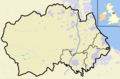
 Shown within ceremonial County Durham | |
| History | |
| • Origin | Barnard Castle Urban District Barnard Castle Rural District Startforth Rural District |
| • Created | 1974 |
| • Abolished | 2009 |
| • Succeeded by | County Durham |
| Status | District |
| ONS code | 20UH |
| Government | Teesdale District Council |
| • HQ | Barnard Castle |
Teesdale was, from 1974 to 2009, a local government district in County Durham, England. Its council was based in Barnard Castle and it was named after the valley of the River Tees.
Contents
That part of the district south of the River Tees is historically part of the North Riding of Yorkshire, and made up Startforth Rural District before the Local Government Act 1972 came into effect in 1974. The other predecessors to the district were Barnard Castle Urban District and Barnard Castle Rural District.
Much of the area had before 1894 constituted a single Teesdale rural sanitary district.
The district was the least-populous ordinary district in England (with a population of 24,457 in 2001), with only the City of London and the Isles of Scilly being smaller. It also had the third-lowest population density in England, after the former districts of Eden in Cumbria and Tynedale in Northumberland.
The district was abolished as part of the 2009 structural changes to local government in England.