Congleton (borough)

Last updated

Borough of Congleton
CheshireCongleton.png
Shown within Cheshire
History
  Origin Congleton Municipal Borough
Alsager Urban District
Middlewich Urban District
Sandbach Urban District
Congleton Rural District.
  Created1 April 1974
  Abolished31 March 2009
  Succeeded by Cheshire East
Status Non-metropolitan district
ONS code 13UC
   HQ Westfields, Sandbach

Congleton was, from 1974 to 2009, a local government district with borough status in Cheshire, England. It included the towns of Congleton, Alsager, Middlewich and Sandbach. The headquarters of the borough council were located in Sandbach.

Contents

History

Chairmen of Congleton Rural District Council (1894-1974) Chairmen of Congleton Rural District Council (1894-1974).jpg
Chairmen of Congleton Rural District Council (1894-1974)

The borough was formed on 1 April 1974 under the Local Government Act 1972 by the merger of the former borough of Congleton, the urban districts of Alsager, Middlewich and Sandbach, and the Congleton Rural District. The new district was awarded borough status from its creation, allowing the chairman of the council to take the title of mayor. [1]

In 2006 the Department for Communities and Local Government considered reorganising Cheshire's administrative structure as part of the 2009 structural changes to local government in England. The decision to merge the boroughs of Congleton, Macclesfield, and Crewe and Nantwich to create a single unitary authority was announced on 25 July 2007, following a consultation period in which a proposal to create a single Cheshire unitary authority was rejected. [2]

The Borough of Congleton was abolished on 31 March 2009, with the area becoming part of the unitary authority of Cheshire East on 1 April 2009. [3] [4]

Civil parishes

Congleton was divided into 23 civil parishes and included no unparished areas. Of the 23 civil parishes, four were administered at this level of local government by town councils: Alsager, Middlewich, Sandbach, and Congleton; with the remainder having parish councils. [5] There are two pairs of civil parishes that are grouped together so that they share a parish council. These are Hulme Walfield and Somerford Booths, whose single parish council is called "Hulme Walfield and Somerford Booths Parish Council", and Newbold Astbury and Moreton cum Alcumlow, whose single parish council is called "Newbold Astbury-cum-Moreton Parish Council". [5]

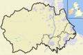
The following civil parishes were included in the borough:

Demographics

The resident population of the borough, as measured in the 2001 Census, was 90,655, of which 49 per cent were male and 51 per cent were female.

Religion

The percentage of people of each religion in the borough (trom the Census 2001): [6]

Stated religionPercentage
Christian81.46%
Buddhist0.12%
Hindu0.11%
Jewish0.06%
Muslim0.17%
Sikh0.04%
Other religions0.16%
No religion11.46%
Religion not stated6.43%

Political control

The town of Congleton had been a municipal borough from 1836 to 1974 with a borough council. [7] The first elections to the new Congleton Borough created under the Local Government Act 1972 were held in 1973, initially operating as a shadow authority until the new arrangements came into effect on 1 April 1974. Political control of the council from 1974 until its abolition in 2009 was held by the following parties: [8]

Party in controlYears
No overall control 1974–1976
Conservative 1976–1982
No overall control 1982–1983
Conservative 1983–1986
No overall control 1986–1991
Liberal Democrats 1991–1992
No overall control 1992–1994
Liberal Democrats 1994–2002
No overall control 2002–2003
Conservative 2003–2009

Leadership

The leaders of the council from 1987 were:

CouncillorPartyFromTo
Dennis Round [9] Liberal 198714 July 1987
Linda Short [10] [11] Liberal Democrats 198714 December 2000
Rod Fletcher Liberal Democrats 20012002
Roland Domleo [12] [13] Conservative 200231 March 2009

Composition

The political composition of the council at its abolition in 2009 was: [14]

PartyCouncillors
Conservative25
Liberal Democrat13
Middlewich First6
Independent4

Premises

The council was based at Westfields on Middlewich Road in Sandbach. This was a large nineteenth century house which had been bought in 1960 by the Congleton Rural District Council, one of the council's predecessors. [15] In 2005–2007 a replacement headquarters building, also called Westfields, was built in front of the old house, which was then demolished. [16] The new building was formally opened on 25 January 2008. [17] After Congleton Borough Council's abolition, Westfields became the headquarters for the new Cheshire East Council. [18]

Alderman and Freeman of the Borough

Borough of Congleton roll of honorary Alderman plaque Borough of Congleton Roll of Honorary Alderman.jpg
Borough of Congleton roll of honorary Alderman plaque

The following people and military units received the Freedom of the Borough of Congleton or were an Alderman of the Borough of Congleton.

Individuals

Military Units

Council elections

By-election results

Congleton North By-Election 10 August 2000
PartyCandidateVotes%±%
Labour David Atkin30350.9+9.6
Liberal Democrats 15626.2-24.9
Conservative 13622.9+15.3
Majority14724.7
Turnout 59521.6
Labour gain from Liberal Democrats Swing
Congleton North West By-Election 10 August 2000
PartyCandidateVotes%±%
Conservative Sue Appleton27537.2+11.3
Liberal Democrats 25134.0-8.3
Labour 21328.8-3.0
Majority243.2
Turnout 73924.6
Conservative gain from Liberal Democrats Swing
Congleton North By-Election 26 August 2004 (2)
PartyCandidateVotes%±%
Conservative 191
Conservative 174
Labour 142
Labour 133
Liberal Democrats Simon Davey111
Liberal Democrats Paul Jones108
Turnout 85915.6
Conservative gain from Labour Swing
Congleton West By-Election 28 October 2004
PartyCandidateVotes%±%
Conservative 49153.7-1.5
Liberal Democrats Simon Davey27530.1+6.2
Labour 14816.2-4.8
Majority26123.6
Turnout 91420.5
Conservative hold Swing
Alsager Central By-Election 17 February 2005
PartyCandidateVotes%±%
Liberal Democrats Julian Burgess53256.1-14.2
Conservative Warwick Till36538.5+8.8
Labour William Howell525.5+5.5
Majority16717.6
Turnout 94934.5
Liberal Democrats hold Swing
Congleton North West By-Election 24 November 2005
PartyCandidateVotes%±%
Liberal Democrats Simon Davey34154.8+54.8
Conservative Matthew Carey19130.7-13.3
Labour Lisa Bossons9014.5-9.2
Majority15024.1
Turnout 62221.0
Liberal Democrats gain from Conservative Swing
Sandbach West By-Election 18 October 2007
PartyCandidateVotes%±%
Conservative Stella Furlong44545.1+3.6
Liberal Democrats Patrick Darnes38238.7-3.1
Labour Keith Haines16016.2-0.5
Majority636.4
Turnout 98719.2
Conservative hold Swing

See also

Notes

  1. 1 2 3 4 5 6 7 8 9 10 11 12 Source Borough of Congleton roll of honorary Alderman plaque photo

Related Research Articles

<span class="mw-page-title-main">Congleton</span> Town in Cheshire, England

Congleton is a market town and civil parish in the unitary authority of Cheshire East in Cheshire, England. The town is by the River Dane, 21 miles (34 km) south of Manchester and 13 miles (21 km) north of Stoke on Trent. At the 2021 Census, it had a population of 30,015.

<span class="mw-page-title-main">Civil parishes in Cheshire</span>

A civil parish is a country subdivision, forming the lowest unit of local government in England. There are 333 civil parishes in the ceremonial county of Cheshire, most of the county being parished. Cheshire East unitary authority is entirely parished. At the 2001 census, there were 565,259 people living in 332 parishes, accounting for 57.5 per cent of the county's population.

<span class="mw-page-title-main">Congleton (UK Parliament constituency)</span> Parliamentary constituency in the United Kingdom, 1983 onwards

Congleton is a parliamentary constituency in Cheshire, represented in the House of Commons of the UK Parliament since 2010 by Fiona Bruce of the Conservative Party.

<span class="mw-page-title-main">Crewe (UK Parliament constituency)</span> Parliamentary constituency in the United Kingdom, 1885–1983

Crewe was a constituency of the House of Commons of the Parliament of the United Kingdom from 1885 to 1983. It elected one Member of Parliament (MP) by the first past the post system of election.

<span class="mw-page-title-main">Newbold Astbury</span> Human settlement in England

Newbold Astbury is a village and civil parish in the unitary authority of Cheshire East and the ceremonial county of Cheshire, in the north-west of England.

Astbury was one of the eight ancient parishes of the Macclesfield Hundred of Cheshire, England. It included two chapelries and ten townships. The chapelry of Congleton was an ancient borough and became a municipal borough in 1835. Under the Poor Law Amendment Act 1886 the townships and chapelries became civil parishes in their own right. Nine of the townships became part of Congleton Rural District in 1894. whereas Eaton became part of Macclesfield Rural District. At the same time, the Chapelry of Buglawton was made an Urban Sanitary District before being abolished in 1936. On its abolition 2,865 acres (11.59 km2) were transferred to Congleton, 32 acres (130,000 m2) to Eaton and 14 acres (57,000 m2) to North Rode.

Wheelock is a large village in the civil parish of Sandbach which is in the unitary authority of Cheshire East and the ceremonial county of Cheshire, England. It is south of Sandbach on the road to Crewe. It was named after the River Wheelock.

<span class="mw-page-title-main">Knutsford (UK Parliament constituency)</span> Parliamentary constituency in the United Kingdom, 1885–1983

Knutsford was a county constituency in Cheshire which returned one Member of Parliament (MP) to the House of Commons of the Parliament of the United Kingdom from 1885 until it was abolished for the 1983 general election.

<span class="mw-page-title-main">Church Lawton</span> Human settlement in England

Church Lawton is a village and located in the unitary authority of Cheshire East and the ceremonial county of Cheshire in England. Its location is such that its eastern boundary forms part of the county boundary between Cheshire and Staffordshire and, because of its close proximity to Stoke-on-Trent, the parish has a Stoke postcode. In addition to ribbon development connecting Kidsgrove with Scholar Green, the parish also contains the hamlets of Lawton Gate, Lawton Heath and Lawton Heath End, and the Lawton Hall estate. According to the 2001 census, the population of the entire parish was 2,201.

<span class="mw-page-title-main">Hulme Walfield</span> Human settlement in England

Hulme Walfield is a small village and civil parish, just north of Congleton, in the unitary authority of Cheshire East and the ceremonial county of Cheshire. It is home to most of Westlow Mere. According to the 2001 census, the population of the civil parish was 140, increasing slightly to 148 at the 2011 Census

<span class="mw-page-title-main">Cheshire East</span> Borough in England

Cheshire East is a unitary authority area with borough status in Cheshire, England. The local authority is Cheshire East Council. Towns within the area include Crewe, Macclesfield, Congleton, Sandbach, Wilmslow, Handforth, Knutsford, Poynton, Bollington, Alsager and Nantwich. The council is based in the town of Sandbach.

<span class="mw-page-title-main">Moreton cum Alcumlow</span> Human settlement in England

Moreton cum Alcumlow is a small civil parish in the unitary authority of Cheshire East and the ceremonial county of Cheshire, England. In the census of 2001 it was recorded as having a population of 150. The civil parish holds a parish council meeting under a grouping scheme with the adjacent civil parish of Newbold Astbury, and so it is consequently called Newbold Astbury-cum-Moreton Parish Council. Within the civil parish is the small village of Ackers Crossing, and Alcumlow Hall and Great Moreton Hall.

<span class="mw-page-title-main">Somerford Booths</span> Human settlement in England

Somerford Booths is a small civil parish in the unitary authority of Cheshire East and the ceremonial county of Cheshire, England. In the census of 2001 it was recorded as having a population of 175. increasing to 181 at the 2011 Census. The civil parish holds a parish council meeting under a grouping scheme with the civil parish of Hulme Walfield, and so it is consequently called Hulme Walfield & Somerford Booths Parish Council. The parish is small and now consists of scattered farms and small groupings of houses, including the hamlet of Newsbank. It contains Somerford Booths Hall as well as Grove House Farm and Broomfield Farm which are shown as ancient buildings on the Ordnance Survey map of the area.

In Congleton Borough, there were many different provisions for children and young people ranging from pre-schooling to Colleges of Further education. The nearest Area Education Office County Offices were in the neighbouring Borough of Macclesfield. As of 1 April 2009, responsibility for education in the former borough of Congleton passed to the new unitary authority of Cheshire East.

<span class="mw-page-title-main">Cheshire East Council</span>

Cheshire East Council is the local authority of the Borough of Cheshire East, Cheshire, England. It is a unitary authority, having the powers of a non-metropolitan county and district council combined. It provides a full range of local government services including Council Tax billing, libraries, social services, processing planning applications, waste collection and disposal, and it is a local education authority. The council was first elected on 1 May 2008, a year before coming into its powers on 1 April 2009. After an election in May 2019, no party holds overall control. The civil parish of Sandbach hosts the administrative headquarters for the council.

The county of Cheshire, England, has many buildings that have been listed.

The ceremonial county of Cheshire, which comprises the unitary authorities of Cheshire East, Cheshire West and Chester, Halton and Warrington, has returned 11 MPs to the UK Parliament since 1997.

References

  1. "District Councils and Boroughs". Parliamentary Debates (Hansard) . 28 March 1974. Retrieved 3 September 2022.
  2. BBC News, 25 July 2007 – County split into two authorities. Retrieval Date: 25 July 2007.
  3. Cheshire (Structural Changes) Order 2008 Archived 17 May 2009 at the Wayback Machine
  4. "Home". Congleton.gov.uk. Archived from the original on 6 January 2010. Retrieved 25 March 2022.
  5. 1 2 "Parish Councils". Congleton Borough Council. Archived from the original on 9 November 2007. Retrieved 1 December 2008.
  6. "Key Figures for 2001 Census: Census Area Statistics". neighbourhood.statistics.gov.uk. Retrieved 28 June 2008.
  7. "Congleton Municipal Borough". A Vision of Britain through Time. GB Historical GIS / University of Portsmouth. Retrieved 5 September 2022.
  8. "Compositions calculator". The Elections Centre. Retrieved 10 August 2022.
  9. "Sad council mourns chief, 42" . Crewe Chronicle . 22 July 1987. p. 2. Retrieved 8 August 2023 via Newspapers.com.
  10. "The end of an era in local politics". Warrington Guardian. 10 April 2003. Retrieved 5 September 2022.
  11. "Leader steps aside". Congleton Borough Council. 15 December 2000. Archived from the original on 24 April 2001. Retrieved 5 September 2022.
  12. "List of council membership". Congleton Borough Council. Archived from the original on 12 August 2002. Retrieved 5 September 2022.
  13. Jackson, Matt (19 September 2019). "'He was the best friend I had...' – Tributes paid to 'dedicated' Roland, 73, who served as council leader for years". Stoke on Trent Live. Retrieved 5 September 2022.
  14. "Your Councillors". Congleton Borough Council. Archived from the original on 20 October 2007. Retrieved 27 November 2008.
  15. "£12,000 conversion of Westfields". Crewe Chronicle . 16 July 1960. p. 18. Retrieved 8 August 2023 via Newspapers.com.
  16. "Fight to save historic home". Cheshire Live. 10 November 2004. Retrieved 5 September 2022.
  17. "New council HQ formally opened". North Wales Live. 25 January 2008. Retrieved 5 September 2022.
  18. "Westfields Council HQ". Cheshire East Council. Retrieved 5 September 2022.
  19. 1 2 3 4 5 6 7 8 9 10 11 12 13 "CIVIC SUB COMMITTEE ITEM 6 HONORARY ALDERMEN AND FREEMAN" (PDF). cheshireeast.gov. p. 3. Archived (PDF) from the original on 14 December 2021. Retrieved 30 May 2023.
  20. 1 2 Alcock, Joan P (15 March 2014). Congleton Though Time. Stroud: Amberley Publishing. p. 32. ISBN   1445609762.
  21. legislation.gov.uk – The Borough of Congleton (Electoral Arrangements) Order 1975. Retrieved on 19 November 2015.
  22. legislation.gov.uk – The Cheshire, Derbyshire, Hereford and Worcester and Staffordshire (County Boundaries) Order 1991. Retrieved on 5 November 2015.
  23. legislation.gov.uk – The Cheshire, Derbyshire, Hereford and Worcester and Staffordshire (County Boundaries) (Variation) Order 1992. Retrieved on 5 November 2015.
  24. legislation.gov.uk – The Borough of Congleton (Electoral Changes) Order 1998. Retrieved on 4 October 2015.

53°9′N2°18′W / 53.150°N 2.300°W / 53.150; -2.300