
Wiltshire is a ceremonial county in South West England. It borders Gloucestershire to the north, Oxfordshire to the north-east, Berkshire to the east, Hampshire to the south-east, Dorset to the south, and Somerset to the west. The largest settlement is Swindon, and Trowbridge is the county town.

Melksham Without is a civil parish in the county of Wiltshire, England. It surrounds, but does not include, the town of Melksham and is the largest rural parish in Wiltshire, with a population of 7,230 and an area of 29 square kilometres. The parish includes the villages of Beanacre, Berryfield, Shaw and Whitley, and the hamlets of Outmarsh and Redstocks. It also includes the outer Melksham suburbs of Bowerhill and The Spa, and the dispersed settlement of Sandridge which includes Sandridge Common.

The A350 is a north–south primary route in southern England, that runs from the M4 motorway in Wiltshire to Poole in Dorset.

Westbury is a market town and civil parish in west Wiltshire, England. The town lies below the northwestern edge of Salisbury Plain, about 4 miles (6 km) south of Trowbridge and a similar distance north of Warminster.
Westbury was a parliamentary constituency in Wiltshire from 1449 to 2010. It was represented in the House of Commons of England until 1707, and then in the House of Commons of Great Britain from 1707 to 1800, and finally in the House of Commons of the Parliament of the United Kingdom from 1801 until 2010.

The Wessex Main Line is the railway line from Bristol Temple Meads to Southampton Central. Diverging from this route is the Heart of Wessex Line from Westbury to Weymouth. The Wessex Main Line intersects the Reading to Taunton Line at Westbury and the West of England Main Line at Salisbury.

Chippenham is a constituency represented in the House of Commons of the Parliament of the United Kingdom since 2024 by Sarah Gibson, a Liberal Democrat. The 2024 constituency includes the Wiltshire towns of Calne, Chippenham, Corsham and Royal Wootton Bassett.

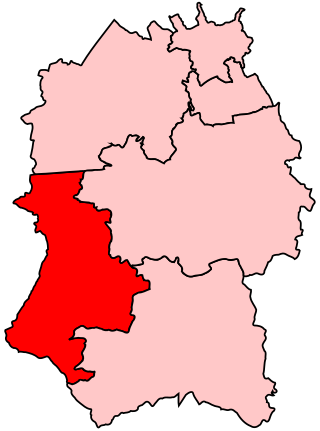
South West Wiltshire is a constituency in Wiltshire, England. The constituency has been represented in the House of Commons of the UK Parliament by Andrew Murrison, a Conservative, since its inauguration in 2010.

Wiltshire Council, known between 1889 and 2009 as Wiltshire County Council, is the local authority for the non-metropolitan county of Wiltshire in South West England. Since 2009 it has been a unitary authority, being a county council which also performs the functions of a district council. The non-metropolitan county is smaller than the ceremonial county, the latter additionally including Swindon. Wiltshire Council has been controlled by the Conservative Party since 2000, and has its headquarters at County Hall in Trowbridge.
Elections to Wiltshire County Council were held on 7 June 2001. The whole council was up for election and the Conservatives held onto control.
Elections to Wiltshire County Council were held on 1 May 1997. The whole council was up for election and the result was no overall control, with the Conservatives as the largest party.
Dorset & Wilts 3 North was an English Rugby Union league, forming part of the South West Division, for clubs primarily based in Wiltshire, sitting at tier 10 of the English rugby union system. Promoted teams tended to move up to Dorset & Wilts 2 North and there was no relegation. The league was created in 2005 and was disbanded after the 2019–20 season.
The Warminster and Westbury Rural District was a rural district in Wiltshire, England from 1935 to 1974.

The 2021 Wiltshire Council election took place on 6 May 2021 as part of the 2021 local elections in the United Kingdom. All 98 councillors were elected from electoral divisions which returned one councillor each by first-past-the-post voting for a four-year term of office.

Wiltshire is a unitary authority area in the ceremonial county of Wiltshire, South West England. It was formed in April 2009 following the abolition of Wiltshire County Council and the districts of Kennet, North Wiltshire, Salisbury, and West Wiltshire. They were all replaced by Wiltshire Council, which is based at County Hall in Trowbridge. The remaining part of the ceremonial county is the Borough of Swindon, administered by a separate unitary authority. In 2022 it had a population of 515,885.

Melksham and Devizes is a constituency of the House of Commons in the UK Parliament. Further to the completion of the 2023 Periodic Review of Westminster constituencies, it was first contested at the 2024 general election, when it was won by Brian Mathew of the Liberal Democrats. He defeated former Conservative cabinet minister Michelle Donelan, who had been MP for Chippenham from 2015 to 2024.


