
Ouse Washes is a linear 2,513.6-hectare (6,211-acre) biological Site of Special Scientific Interest stretching from near St Ives in Cambridgeshire to Downham Market in Norfolk, England. It is also a Ramsar internationally important wetland site, a Special Protection Area for birds, a Special Area of Conservation and a Nature Conservation Review site, Grade I. An area of 186 hectares between March and Ely is managed by the Wildlife Trust for Bedfordshire, Cambridgeshire and Northamptonshire and another area near Chatteris is managed by the Royal Society for the Protection of Birds. The Wildfowl & Wetlands Trust manages another area near Welney.

Ferryhill is a town and civil parish in County Durham, England, with an estimated population in 2018 of 9,362. The town grew in the 1900s around the coal mining industry. The last mine officially closed in 1968. It is located between the towns of Bishop Auckland, Newton Aycliffe, Sedgefield, Shildon, Spennymoor and the cathedral city of Durham.
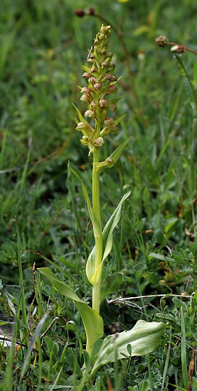
Witton-le-Wear (SSSI) is a Site of Special Scientific Interest located in the valley of the River Wear, immediately east of the village of Witton-le-Wear in County Durham, England.
Brasside Pond is a Site of Special Scientific Interest just north of the city of Durham, England. The site occupies an area of former clay pits sandwiched between the River Wear to the south and Frankland Prison to the north and is split into two parts by a disused railway line.
Frog Wood Bog is a Site of Special Scientific Interest in the Teesdale district of County Durham, England. It lies alongside Bedburn Beck, approximately 3.5 km west of the village of Bedburn.
Wingate Quarry is a biological Site of Special Scientific Interest in the County Durham district of east County Durham, England. Part of the site is also a Local Nature Reserve It is a disused quarry located just south of the village of Wheatley Hill.
Hawthorn Dene is a Site of Special Scientific Interest in the County Durham district of County Durham, England. The site occupies the incised valley of Hawthorn Burn and extends from just south of the village of Hawthorn eastward as far as the Durham Coast railway line: the area between the railway line and the sea forms part of the Durham Coast SSSI.

Hell Kettles is a Site of Special Scientific Interest in the Darlington district of County Durham, England. It was designated for its biological interest as the only site in County Durham where there is a body of water fed by springs.
Middleton Quarry is a Site of Special Scientific Interest in the Teesdale district of west County Durham, England. It is a disused quarry, from which Whin Sill stone was formerly excavated. It lies just south of the River Tees, opposite the village of Middleton-in-Teesdale on the river's northern bank.
Pike Whin Bog is a Site of Special Scientific Interest in the Easington district of east County Durham, England. It is situated just east of Hurworth Burn Reservoir, about 8 km west of Hartlepool.
Quarrington Hill Grasslands is a Site of Special Scientific Interest in County Durham, England. The site consists of three separate areas, two closely adjacent to the east of the village of Quarrington Hill, the third immediately west of the village, which lies 8 km south-east of Durham City.
Railway Stell West is a Site of Special Scientific Interest in County Durham, England. The site consists of a length of ditch alongside the East Coast Main Line railway, 3 km east of the town of Newton Aycliffe.
Tuthill Quarry is a Site of Special Scientific Interest in the County Durham district of north-east County Durham, England. It lies just over 1 km east of the village of Haswell.
Redcar Field is a Site of Special Scientific Interest in the Darlington district of County Durham, England. It is situated just north of Darlington, about 1 km south of the village of Coatham Mundeville.
The Bottoms is a Site of Special Scientific Interest in County Durham, England. It lies just south of the A181 road, roughly midway between the villages of Cassop and Wheatley Hill, some 10 km south-east of Durham city.
Thrislington Plantation is a Site of Special Scientific Interest and a national nature reserve in County Durham, England. It is situated about 1 km east of Ferryhill, between the East Coast Main Line railway and the A1(M) road.

Ferryhill railway station was located in Ferryhill, County Durham, Northeast England. It was located on what became the East Coast Main Line between Darlington and Durham, close to the junctions with several former branches, including the extant freight-only Stillington Line to Norton-on-Tees and Stockton.

Mar Field Fen is a Site of Special Scientific Interest, or SSSI, north of Masham, North Yorkshire, England, in a rural area known as Marfield. It is situated on land containing woodland carr, fen, spring-fed marshy grassland and drier calcareous grassland, between the River Ure to the east and Marfield Wetland nature reserve to the west. As "one of the best examples of fen habitat in the Vale of York," it is a protected habitat for a variety of plants, including the common butterwort, a carnivorous plant. There is no public access to this site.
Mainsforth Colliery was situated between Ferryhill and the small hamlet of Mainsforth in County Durham, England, United Kingdom. It was adjacent to the former Ferryhill railway station in the Ferryhill Station area of the town.
