Pike Whin Bog

Last updated
Pike Whin Bog
Site of Special Scientific Interest
Country England
Region North East
District Easington
Location NZ415334
 - coordinates 54°41′40″N1°21′25″W / 54.69444°N 1.35694°W / 54.69444; -1.35694 Coordinates: 54°41′40″N1°21′25″W / 54.69444°N 1.35694°W / 54.69444; -1.35694
Area 1.25 ha (3.09 acres)
Notification 1984
Management Natural England
Area of Search County Durham
Interest Biological
Durham UK relief location map.jpg
Red pog.svg
Location of Pike Whin Bog SSSI, Co Durham
Website: Map of site

Pike Whin Bog is a Site of Special Scientific Interest in the Easington district of east County Durham, England. It is situated just east of Hurworth Burn Reservoir, about 8 km west of Hartlepool.

Site of Special Scientific Interest Conservation designation denoting a protected area in the United Kingdom

A Site of Special Scientific Interest (SSSI) in Great Britain or an Area of Special Scientific Interest (ASSI) in the Isle of Man and Northern Ireland is a conservation designation denoting a protected area in the United Kingdom and Isle of Man. SSSI/ASSIs are the basic building block of site-based nature conservation legislation and most other legal nature/geological conservation designations in the United Kingdom are based upon them, including national nature reserves, Ramsar sites, Special Protection Areas, and Special Areas of Conservation. The acronym "SSSI" is often pronounced "triple-S I".

County Durham County of England

County Durham is a county in North East England. The county town is Durham, a cathedral city. The largest settlement is Darlington, closely followed by Hartlepool and Stockton-on-Tees. It borders Tyne and Wear to the north east, Northumberland to the north, Cumbria to the west and North Yorkshire to the south. The county's historic boundaries stretch between the rivers Tyne and Tees, thus including places such as Gateshead, Jarrow, South Shields and Sunderland.

England Country in north-west Europe, part of the United Kingdom

England is a country that is part of the United Kingdom. It shares land borders with Wales to the west and Scotland to the north-northwest. The Irish Sea lies west of England and the Celtic Sea lies to the southwest. England is separated from continental Europe by the North Sea to the east and the English Channel to the south. The country covers five-eighths of the island of Great Britain, which lies in the North Atlantic, and includes over 100 smaller islands, such as the Isles of Scilly and the Isle of Wight.

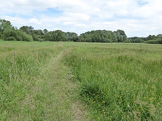
The bog lies in a natural depression, in which the water table is at or above ground level for most of the year, and is one of the few remaining wetlands in lowland Durham.

Water table top of a saturated aquifer, or where the water pressure head is equal to the atmospheric pressure

The water table is the upper surface of the zone of saturation. The zone of saturation is where the pores and fractures of the ground are saturated with water.

The majority of the site is sedge fen, in which common cotton-grass, Eriophorum angustifolium , is the dominant species. A variety of grassland types occur around the edges of the fen. [1]

Cyperaceae family of plants

The Cyperaceae are a family of graminoid (grass-like), monocotyledonous flowering plants known as sedges, which superficially resemble the closely related rushes and the more distantly related grasses. The family is large, with some 5,500 known species described in about 90 genera, the largest being the "true sedges" genus Carex with over 2,000 species. These species are widely distributed, with the centers of diversity for the group occurring in tropical Asia and tropical South America. While sedges may be found growing in almost all environments, many are associated with wetlands, or with poor soils. Ecological communities dominated by sedges are known as sedgelands.

Fen type of wetland

A fen is one of the main types of wetland, the others being grassy marshes, forested swamps, and peaty bogs. Along with bogs, fens are a kind of mire. Fens are minerotrophic peatlands, usually fed by mineral-rich surface water or groundwater. They are characterised by their distinct water chemistry, which is pH neutral or alkaline, with relatively high dissolved mineral levels but few other plant nutrients. They are usually dominated by grasses and sedges, and typically have brown mosses in general including Scorpidium or Drepanocladus. Fens frequently have a high diversity of other plant species including carnivorous plants such as Pinguicula. They may also occur along large lakes and rivers where seasonal changes in water level maintain wet soils with few woody plants. The distribution of individual species of fen plants is often closely connected to water regimes and nutrient concentrations.

<i>Eriophorum angustifolium</i> species of plant

Eriophorum angustifolium, commonly known as common cottongrass or common cottonsedge, is a species of flowering plant in the sedge family Cyperaceae. Native to North America, North Asia, and Northern Europe, it grows on peat or acidic soils, in open wetland, heath or moorland. It begins to flower in April or May and, after fertilisation in early summer, the small, unremarkable brown and green flowers develop distinctive white bristle-like seed-heads that resemble tufts of cotton; combined with its ecological suitability to bog, these characteristics give rise to the plant's alternative name, bog cotton.

Because of the scarcity of wetlands in lowland Durham, species associated with this habitat also have a very localised distribution. Particularly noteworthy at Pike Whin Bog are greater spearwort, Ranunculus lingua , slender tufted sedge, Carex acuta , marsh stitchwort, Stellaria palustris , and bog bean, Menyanthes trifoliata . [1]

<i>Carex acuta</i> species of plant

Carex acuta, the acute sedge, slender tufted-sedge, or slim sedge, can be found growing on the margins of rivers and lakes in the Palaearctic terrestrial ecoregions in beds of wet, alkaline or slightly acid depressions with mineral soil.

Related Research Articles

Bog wetland that accumulates peat due to incomplete decomposition of plant leftovers

A bog or bogland is a wetland that accumulates peat, a deposit of dead plant material—often mosses, and in a majority of cases, sphagnum moss. It is one of the four main types of wetlands. Other names for bogs include mire, quagmire, and muskeg; alkaline mires are called fens. They are frequently covered in ericaceous shrubs rooted in the sphagnum moss and peat. The gradual accumulation of decayed plant material in a bog functions as a carbon sink.

Ballynahone Bog is a raised bog, situated in County Londonderry, Northern Ireland, about 3 km south of Maghera, on low-lying ground immediately north of the Moyola River about 14 km from its mouth at Lough Neagh. It is one of the largest lowland raised bogs in Northern Ireland.

Great Fen nature reserve in the United Kingdom

The Great Fen is a habitat restoration project being undertaken on The Fens in the county of Cambridgeshire in the United Kingdom. It is one of the largest restoration projects in the country, and aims to create a 3,700 hectare wetland and aims to connect Woodwalton Fen National Nature Reserve (NNR), Holme Fen NNR and other nature reserves to create a larger site with conservation benefits for wildlife and socio-economic benefits for people.

Crymlyn Bog nature reserve and a designated Site of Special Scientific Interest of international significance, near Swansea, Wales.

Crymlyn Bog is a nature reserve and a designated Site of Special Scientific Interest of international significance, near Swansea, south Wales.

Yanal Bog

Yanal Bog is a 1.6 hectare biological Site of Special Scientific Interest on the southern edge of the North Somerset Levels, just north of the village of Sandford, North Somerset. It was notified as an SSSI in 1988.

Cors Caron

Cors Caron is a raised bog in Ceredigion, Wales. Cors is the Welsh word for "bog": the site is also known as Tregaron Bog, being near the small town of Tregaron. Cors Caron covers an area of approximately 862 acres (349 ha). Cors Caron represents the most intact surviving example of a raised bog landscape in the United Kingdom. About 44 different species groups inhabit the area including various land and aquatic plants, fish, insects, crustaceans, lichen, fungi, terrestrial mammals and birds.

<i>Carex lasiocarpa</i> species of plant

Carex lasiocarpa is a species of sedge known by the common names slender sedge and woollyfruit sedge.

Poor fen

A poor fen is a natural wetland habitat, supporting a dense carpet of mosses and sedges. It develops where the water is fairly acidic and has very few plant nutrients. Poor fen is intermediate between the taller vegetation of fen, which occurs where the water is much less acidic, and the short, mossy vegetation of bog, which is even more acidic.

Holme Fen

Holme Fen is a 269.4 hectare biological Site of Special Scientific Interest EAST of Holme in Cambridgeshire. It is also a National Nature Reserve and a Nature Conservation Review site, Grade I. It is part of the Great Fen project, which aims to create a 3,700 wetland wildlife area including Holme Fen, Woodwalton Fen and other areas. It is home to a variety of birds, including the Eurasian siskin, Nightingale and Lesser redpoll, and around 450 species of fungi.

Folly Mills Creek Fen Natural Area Preserve

Folly Mills Creek Fen Natural Area Preserve is a Natural Area Preserve located in Augusta County, Virginia. The preserve was dedicated in 1998, and was the first privately owned Natural Area Preserve to be dedicated in the state.

Black Bog is a raised bog in County Tyrone, Northern Ireland, situated about 17km west of Cookstown. It is one of the two largest intact active bogs in Northern Ireland with hummock and hollow pool complexes and represents one of the best examples of this habitat type in the United Kingdom.

Freshwater marsh type of marsh

A freshwater marsh is a marsh that contains fresh water. Freshwater marshes are usually found near the mouths of rivers and are present in areas with low drainage. It is the counterpart to the salt marsh, an upper coastal intertidal zone of bio-habitat which is regularly flushed with sea water.

Waldridge Fell

Waldridge Fell is a Site of Special Scientific Interest located immediately south-west of Chester-le-Street in the northern part of County Durham, England. It is one of the largest areas of lowland heath in County Durham and contains the only lowland valley-mire in the county. The fell is home to a number of plants and insects that are scarce to rare elsewhere in the county.

Railway Stell West Site of Special Scientific Interest in the Sedgefield district of County Durham, England

Railway Stell West is a Site of Special Scientific Interest in the Sedgefield district of County Durham, England. The site consists of a length of ditch alongside the East Coast Main Line railway, 3 km east of the town of Newton Aycliffe.

The Carrs

The Carrs is a Site of Special Scientific Interest in the Sedgefield district of County Durham, England. It is situated on the eastern outskirts of Ferryhill, between the town and the East Coast Main Line railway.

Blo Norton and Thelnetham Fens Suffolk Wildlife Trust nature reserve

Blo' Norton and Thelnetham Fens are a 21.3 hectare biological Site of Special Scientific Interest (SSSI) on the Norfolk/Suffolk border. Blo' Norton Fen is in the parish of Blo' Norton in Norfolk and Thelnetham Fen is in Thelnetham parish in Suffolk. It is a Nature Conservation Review site, Grade 2, and part of the Waveney and Little Ouse Valley Fens Special Area of Conservation, Thelnetham Fen is managed by the Suffolk Wildlife Trust and Blo' Norton Fen by the Little Ouse Headwaters Project (LOHP).

Meshchyora National Park

Meshchyora National Park covers extensive wetlands and pine/birch woodlands in the Meshchera Lowlands on the East European Plain in Vladimir Oblast, about 120 km east of Moscow. The wetland habitat provides for extremely rich biodiversity among the plants and animals. The area is associated with the medieval Meshchera tribe, from which the area takes its name. "Meshchyora" National Park (Мещёра) is not to be confused with "Meshchersky" (Мещёрский) National Park, which is just to the south, over the border in Ryazan Oblast. The Meshchyora NP is located entirely within the Oka River watershed. A small corner of the park touches on the border of the Moscow region. About 39% of the park territory is used and managed for agricultural purposes by local communities.

Bewick and Beanley Moors

Bewick and Beanley Moors is the name given to a Site of Special Scientific Interest (SSSI) in north Northumberland, in the north-east of England. The moors are asserted to be of national importance by Natural England for the extent, quality and diversity of upland types including heaths, fens, wet grassland, flushes, mires and blanket bogs, together creating an extensive mosaic habitat supporting an exceptional community of amphibians. The moors are important, too, for their relict juniper woodland and scrub.

References

  1. 1 2 "Pike Whin Bog" (PDF). English Nature. 1984. Retrieved 31 July 2010.