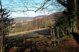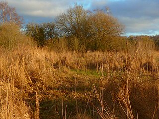
A site of special scientific interest (SSSI) in Great Britain, or an area of special scientific interest (ASSI) in the Isle of Man and Northern Ireland, is a conservation designation denoting a protected area in the United Kingdom and Isle of Man. SSSI/ASSIs are the basic building block of site-based nature conservation legislation and most other legal nature/geological conservation designations in the United Kingdom are based upon them, including national nature reserves, Ramsar sites, Special Protection Areas, and Special Areas of Conservation. The acronym "SSSI" is often pronounced "triple-S I".

The Severn Estuary is the estuary of the River Severn, flowing into the Bristol Channel between South West England and South Wales. Its very high tidal range, approximately 50 feet (15 m), creates valuable intertidal habitats and has led to the area being at the centre of discussions in the UK regarding renewable tidal energy.

A development plan sets out a local authority's policies and proposals for land use in their area. The term is usually used in the United Kingdom. A local plan is one type of development plan. The development plan guides and shapes day-to-day decisions as to whether or not planning permission should be granted, under the system known as development control. In order to ensure that these decisions are rational and consistent, they must be considered against the development plan adopted by the authority, after public consultation and having proper regard for other material factors.

Chilmark Quarries is a 9.65 hectare biological and geological Site of Special Scientific Interest (SSSI), in the ravine south of the village of Chilmark in Wiltshire, England.
The English Stone Forum (ESF) is an organisation which supports the use of building stone, or dimension stone, produced in England. It works to:

Cassop Vale is a Site of Special Scientific Interest in the Durham City district of County Durham, England. It lies between the villages of Bowburn and Cassop, 7 km south-east of the centre of Durham..
Hawthorn Dene is a Site of Special Scientific Interest in the County Durham district of County Durham, England. The site occupies the incised valley of Hawthorn Burn and extends from just south of the village of Hawthorn eastward as far as the Durham Coast railway line: the area between the railway line and the sea forms part of the Durham Coast SSSI.

Stenders Quarry is a 2.8-hectare (6.9-acre) biological and geological Site of Special Scientific Interest in the Forest of Dean, Gloucestershire, England, notified in 1966 and renotified in 1990. The site is designated as an SSSI for its important geological features, although there is also a diversity of plants and animals recorded.

Wotton Hill is a hill on the edge of the Cotswold Hills in Gloucestershire, England, 0.5 miles (0.80 km) north of Wotton-under-Edge. The Cotswold Way passes over the hill.
Lower Wye Gorge is a 65-hectare (160-acre) biological and geological Site of Special Scientific Interest in Gloucestershire, notified in 1954 and renotified 1987. The site includes two Gloucestershire Wildlife Trust nature reserves being Ban-y-gor Wood and Lancaut. The Natural England citation states a revision for Lancaut inclusion.

Hobbs Quarry, Longhope is a 1-hectare (2.5-acre) geological and biological Site of Special Scientific Interest in Gloucestershire, England, notified in 1966. It is situated midway between Longhope and Dursley Cross in the Forest of Dean. Adjacent woods are Kiln Wood and Coleman's Wood. The site was managed by the Gloucestershire Wildlife Trust. Ownership changed to an independent Charitable Trust - Hobbs Nature Reserve Trust - on 1 August 2023. The Management Plan is similar to the one GWT had agreed with Natural England, combining conservation and research work on the geological exposures and preservation of the valuable natural environment. An explanatory website is under development to aid any groups planning educational visits. Local specialists are available to assist with these if required.

Bull Cross, The Frith and Juniper Hill is a 42.33-hectare (104.6-acre) biological and geological Site of Special Scientific Interest in Gloucestershire, notified in 1954. The site is listed in the ‘Stroud District’ Local Plan, adopted November 2005, Appendix 6 as an SSSI and Regionally Important Geological Site (RIGS).

Leckhampton Hill and Charlton Kings Common is a 63.8-hectare (158-acre) biological and geological Site of Special Scientific Interest in Gloucestershire, notified in 1954. There are five units of assessment.
Puddlebrook Quarry is a 0.7-hectare (1.7-acre) geological Site of Special Scientific Interest in Gloucestershire, near Drybrook notified in 1986. The site is listed in the 'Forest of Dean Local Plan Review' as a Key Wildlife Site (KWS).

Rodborough Common is a 116.0-hectare (287-acre) biological and geological Site of Special Scientific Interest in Gloucestershire, notified in 1954. The site is listed in the ‘Stroud District’ Local Plan, adopted November 2005, Appendix 6 as an SSSI and a Regionally Important Geological Site (RIGS). The Common is also a Special Area of Conservation (SAC) under the EU Habitats Directive

Farnham Mires is a Site of Special Scientific Interest, or SSSI, to the east of the village of Farnham, North Yorkshire, England. It consists of a spring-fed marshy fen or mire with reeds and sedge, and drier calcareous grassland containing a diverse range of flora. It has a history of poaching and fox hunting, but since the late 19th century, the attention of botanists has been drawn to its large variety of flowering plants. It has received some consideration on this account since 1944, and from 1954 it was designated SSSI status. This site has no facilities, and is not open to the public.

Cow Myers is a Site of Special Scientific Interest (SSSI) located in the Nidderdale Area of Outstanding Natural Beauty (AONB), near Ripon, North Yorkshire, England. The site was designated in 1984 for its fen and alder carr habitat, which supports a diversity of wetland plant life. Of particular interest are the bird's eye primrose which is scarce in Yorkshire, and early marsh orchid. There is no public access to this site, no vehicular access, and no public facilities.

Bishop Monkton Ings is a Site of Special Scientific Interest, or SSSI, situated east of Bishop Monkton village in North Yorkshire, England. It consists mostly of marshy, calcareous grassland, with some broadleaved woodland, and some fen alongside the two watercourses which run through the site. This varied wetland forms a habitat for a variety of plants, including the semi-parasitic marsh lousewort (Pedicularis palustris).

Mar Field Fen is a Site of Special Scientific Interest, or SSSI, north of Masham, North Yorkshire, England, in a rural area known as Marfield. It is situated on land containing woodland carr, fen, spring-fed marshy grassland and drier calcareous grassland, between the River Ure to the east and Marfield Wetland nature reserve to the west. As "one of the best examples of fen habitat in the Vale of York," it is a protected habitat for a variety of plants, including the common butterwort, a carnivorous plant. There is no public access to this site.


