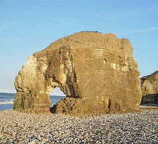
Bishop Middleham Quarry is a disused quarry, about 4 kilometres (2.5 mi) north-west of Sedgefield, County Durham, England. Quarry-working here ceased in 1934, and the site has since been colonised by vegetation. The underlying rock is Magnesian Limestone and this has had a strong influence in determining the range of plant and animal communities now found there.

The Durham Coast is a Site of Special Scientific Interest in County Durham, England. Starting just south of Crimdon Dene, north of Hartlepool, it extends, with a few interruptions, northward to the mouth of the River Tyne at South Shields. Notable locations on the Durham Coast include; Seaham, Sunderland Docks and Whitburn Beach.

Cassop Vale is a Site of Special Scientific Interest in the Durham City district of County Durham, England. It lies between the villages of Bowburn and Cassop, 7 km south-east of the centre of Durham..
Charity Land is a Site of Special Scientific Interest in the Sedgefield district of County Durham, England. It covers an area on both banks of the River Skerne, just to the north-east of the village of Trimdon.
Dabble Bank is a Site of Special Scientific Interest in the County Durham district of County Durham, England. It lies about 1 km west of the village of Haswell and about 9 km east of the city of Durham.
Fishburn Grassland is a Site of Special Scientific Interest in the Sedgefield district of County Durham, England. It lies between the villages of Fishburn and Trimdon, just north of the former.
Hawthorn Dene is a Site of Special Scientific Interest in the Easington district of County Durham, England. The site occupies the incised valley of Hawthorn Burn and extends from just south of the village of Hawthorn eastward as far as the Durham Coast railway line: the area between the railway line and the sea forms part of the Durham Coast SSSI.
Hesledon Moor East is a Site of Special Scientific Interest in the County Durham district in east County Durham, England. It is located on the southern edge of the village of Murton, 10 km south of Sunderland and a little under 2 km north-east of Hesledon Moor West SSSI.

Hisehope Burn Valley is a Site of Special Scientific Interest in the Derwentside district of Durham, England. It consists of two separate parcels of land, one on the west bank of Hisehope Burn, the other a few hundred yards to the east, straddling the headwaters of another small burn. The site is some 3 km west of the village of Castleside and 1 km north of the Smiddy Shaw Reservoir. The larger area adjoins the Muggleswick, Stanhope and Edmundbyers Commons and Blanchland Moor SSSI.
Middleton Quarry is a Site of Special Scientific Interest in the Teesdale district of west County Durham, England. It is a disused quarry, from which Whin Sill stone was formerly excavated. It lies just south of the River Tees, opposite the village of Middleton-in-Teesdale on the river's northern bank.
Pig Hill is a Site of Special Scientific Interest in the County Durham district of north-east County Durham, England, situated 1 km south of the village of Easington Lane.

Pittington Hill is a Site of Special Scientific Interest in County Durham, England. It lies adjacent to the village of Pittington, some 6 km north-east of Durham city. A disused quarry occupies part of the site.
Quarrington Hill Grasslands is a Site of Special Scientific Interest in County Durham, England. The site consists of three separate areas, two closely adjacent to the east of the village of Quarrington Hill, the third immediately west of the village, which lies 8 km south-east of Durham City.
Raisby Hill Grassland is a Site of Special Scientific Interest in east County Durham, England. It lies just over 1 km east of the village of Coxhoe.
Sleightholme Beck Gorge – The Troughs is a Site of Special Scientific Interest in the County Durham district of south-west County Durham, England. The site covers a gorge in the valley of Sleightholme Beck between the hamlet of Sleightholme and the confluence with the River Greta, some 3 km upriver from the village of Bowes.
Sherburn Hill is a Site of Special Scientific Interest in County Durham, England. It lies just south of the road between the villages of Sherburn and Sherburn Hill, some 5.5 km east of Durham city. A disused quarry occupies part of the site.
The Bottoms is a Site of Special Scientific Interest in County Durham, England. It lies just south of the A181 road, roughly midway between the villages of Cassop and Wheatley Hill, some 10 km south-east of Durham city.
The Carrs is a Site of Special Scientific Interest in the Sedgefield district of County Durham, England. It is situated on the eastern outskirts of Ferryhill, between the town and the East Coast Main Line railway.
Thrislington Plantation is a Site of Special Scientific Interest and a national nature reserve in the Sedgefield district of County Durham, England. It is situated about 1 km east of Ferryhill, between the East Coast Main Line railway and the A1(M) road.


