Grant, Portage County, Wisconsin

Last updated

Grant, Wisconsin
WIMap-doton-Grant d.png
Location of Grant, Portage County, Wisconsin
Coordinates: 44°20′54″N89°40′39″W / 44.34833°N 89.67750°W / 44.34833; -89.67750
Country Flag of the United States.svg  United States
State Flag of Wisconsin.svg  Wisconsin
County Portage
Area
  Total71.2 sq mi (184.5 km2)
  Land71.2 sq mi (184.5 km2)
  Water0.0 sq mi (0.1 km2)
Elevation
[1]
1,050 ft (320 m)
Population
 (2000)
  Total2,020
  Density28.4/sq mi (11.0/km2)
Time zone UTC-6 (Central (CST))
  Summer (DST) UTC-5 (CDT)
Area code(s) 715 & 534
FIPS code 55-30350 [2]
GNIS feature ID1583301 [1]

Grant is a town in Portage County, Wisconsin, United States. The population was 2,020 at the 2000 census. The unincorporated community of Kellner is located partially in the town.

Contents

Geography

According to the United States Census Bureau, the town has a total area of 71.2 square miles (184.5 km2), of which, 71.2 square miles (184.5 km2) of it is land and 0.04 square miles (0.1 km2) of it (0.03%) is water.

Demographics

As of the census [2] of 2000, there were 2,020 people, 726 households, and 580 families residing in the town. The population density was 28.4 people per square mile (11.0/km2). There were 748 housing units at an average density of 10.5 per square mile (4.1/km2). The racial makeup of the town was 97.38% White, 0.05% African American, 0.89% Native American, 0.99% Asian, 0.15% from other races, and 0.54% from two or more races. Hispanic or Latino of any race were 0.74% of the population.

There were 726 households, out of which 39.7% had children under the age of 18 living with them, 70.7% were married couples living together, 5.0% had a female householder with no husband present, and 20.0% were non-families. 15.3% of all households were made up of individuals, and 4.4% had someone living alone who was 65 years of age or older. The average household size was 2.78 and the average family size was 3.10.

In the town, the population was spread out, with 28.7% under the age of 18, 5.0% from 18 to 24, 32.5% from 25 to 44, 25.1% from 45 to 64, and 8.6% who were 65 years of age or older. The median age was 37 years. For every 100 females, there were 111.7 males. For every 100 females age 18 and over, there were 110.8 males.

The median income for a household in the town was $52,459, and the median income for a family was $56,417. Males had a median income of $43,654 versus $24,881 for females. The per capita income for the town was $21,793. About 1.9% of families and 2.9% of the population were below the poverty line, including 1.9% of those under age 18 and 4.7% of those age 65 or over.

Related Research Articles

<span class="mw-page-title-main">Worthington, Indiana</span> Town in Indiana, United States

Worthington is a town in Jefferson Township, Greene County, Indiana, United States. The population was 1,463 at the 2010 United States Census. It is part of the Bloomington, Indiana, Metropolitan Statistical Area.

<span class="mw-page-title-main">Straughn, Indiana</span> Town in Indiana, United States

Straughn is a town in Dudley Township, Henry County, Indiana, United States. The population was 222 at the 2010 census.

<span class="mw-page-title-main">Blaine, Maine</span> Town in the state of Maine, United States

Blaine is a town in Aroostook County, Maine, United States. The population was 667 at the 2020 census. It was known as Alva prior to incorporation in 1874, when it was renamed in honor of James G. Blaine, then Speaker of the U.S. House of Representatives. According to local history, Blaine offered to donate a large bell for the tower of the town's new meeting hall, if the citizens would rename the town after him. The town's name was changed, but Blaine never donated a bell. The building still stands on the north end of town, on Route 1.

<span class="mw-page-title-main">Smyrna, Maine</span> Town in the state of Maine, United States

Smyrna is a town in Aroostook County, Maine, United States. The population was 439 at the 2020 census.

<span class="mw-page-title-main">Gretna, Nebraska</span> City in Sarpy County, Nebraska, United States

Gretna is a city in Sarpy County, Nebraska, United States. The population was 5,083 at the 2020 census.

<span class="mw-page-title-main">Village of the Branch, New York</span> Village in New York, United States

Village of the Branch is a village in the Town of Smithtown in Suffolk County, on Long Island, in New York, United States. It is considered part of the Greater Smithtown area, which is anchored by Smithtown. The population was 1,735 at the time of the 2020 census.

<span class="mw-page-title-main">LaGrange, Ohio</span> Village in Ohio, United States

LaGrange is a village in Lorain County, Ohio, United States. The population was 2,595 at the 2020 census.

<span class="mw-page-title-main">Pulaski Township, Beaver County, Pennsylvania</span> Township in Pennsylvania, United States

Pulaski Township is a township in Beaver County, Pennsylvania, United States. The population was 1,296 at the 2020 census. It is part of the Pittsburgh metropolitan area.

<span class="mw-page-title-main">South Franklin Township, Pennsylvania</span> Township in Pennsylvania, United States

South Franklin Township is a township in Washington County, Pennsylvania, United States. The population was 2,864 at the 2020 census.

<span class="mw-page-title-main">Mill Creek, West Virginia</span> Town in West Virginia, United States

Mill Creek is a town in Randolph County, West Virginia, United States, along the Tygart Valley River. The population was 563 at the 2020 census.

<span class="mw-page-title-main">Ellenboro, West Virginia</span> Town in West Virginia, United States

Ellenboro is a town in Ritchie County, West Virginia, United States. The population was 222 at the 2020 census. The town is located at the junction of U.S. Route 50 and West Virginia Route 16; the North Bend Rail Trail also passes through the town. The town was named for Ellen Mariah Williamson, the eldest daughter of the family that granted a right of way for the Baltimore and Ohio Railroad to build their line through the town; an earlier name for the community was Shumley. Ellenboro was incorporated in 1903.

<span class="mw-page-title-main">Dunn, Dane County, Wisconsin</span> Town in Wisconsin, United States

Dunn is a town in Dane County, Wisconsin, United States. The population was 4,880 at the 2020 census.

<span class="mw-page-title-main">Otter Creek, Dunn County, Wisconsin</span> Town in Wisconsin, United States

Otter Creek is a town in Dunn County, Wisconsin, United States. The population was 474 at the 2000 census.

<span class="mw-page-title-main">Marion, Juneau County, Wisconsin</span> Town in Wisconsin, United States

Marion is a town in Juneau County, Wisconsin, United States. The population was 433 at the 2000 census.

<span class="mw-page-title-main">Mecan, Wisconsin</span> Town in Wisconsin, United States

Mecan is a town in Marquette County, Wisconsin, United States. The population was 726 at the 2000 census. The unincorporated community of Mecan is located in the town.

<span class="mw-page-title-main">Big Bend, Rusk County, Wisconsin</span> Town in Wisconsin, United States

Big Bend is a town in Rusk County, Wisconsin, United States. The population was 402 at the 2000 census. The unincorporated community of Island Lake is located in the town.

<span class="mw-page-title-main">Spring Prairie, Wisconsin</span> Town in Wisconsin, United States

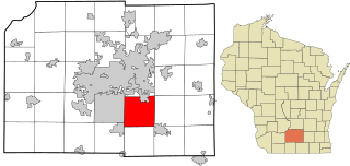
Spring Prairie is a town in Walworth County, Wisconsin, United States. The population was 2,123 at the 2020 census. The unincorporated communities of Spring Prairie and Voree are located in the town. The unincorporated communities of Honey Creek and Honey Lake are also located partially in the town.

<span class="mw-page-title-main">Crystal, Wisconsin</span> Town in Wisconsin, United States

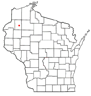
Crystal is a town in Washburn County, Wisconsin, United States. The population was 323 at the 2000 census.

<span class="mw-page-title-main">Rocky Ripple, Indiana</span> Town in Indiana, United States

Rocky Ripple is a town in Marion County, Indiana, United States. The population was 655 at the 2020 census. It was founded in 1927, and the town was incorporated as an "included town" as part of Unigov in 1970. It is part of Indianapolis, but retains a separate functioning town government under IC 36-3-1-11. Although not far from the city center, Rocky Ripple is a somewhat isolated area, located between the Central Canal and the White River; only two traffic-supporting bridges over the canal provide access to the town.

<span class="mw-page-title-main">Deerfield, Wisconsin</span> City in Wisconsin, United States

Deerfield is a city in Dane County, Wisconsin. The population was 2,319 at the time of the 2010 census. The city is located within the Town of Deerfield. It is part of the Madison Metropolitan Statistical Area. Towns and villages near Deerfield include Marshall, Medina, London, Cambridge, and Cottage Grove, Wisconsin.

References

  1. 1 2 "US Board on Geographic Names". United States Geological Survey. October 25, 2007. Retrieved January 31, 2008.
  2. 1 2 "U.S. Census website". United States Census Bureau . Retrieved January 31, 2008.