Greenlee County is a county in the southeastern part of the U.S. state of Arizona. As of the 2020 census, the population was 9,563, making it Arizona's least populous county. The county seat is Clifton.

Clifton is a town in and is the county seat of Greenlee County, Arizona, United States, along the San Francisco River. The population of the town was 3,311 at the 2010 census, with a 2018 population estimate of 3,700. It was a place of the Arizona copper mine strike of 1983.

The Apache–Sitgreaves National Forest is a 2.76-million-acre (11,169 km2) United States National Forest which runs along the Mogollon Rim and the White Mountains in east-central Arizona and into the U.S. state of New Mexico. Formerly two forest, it is currently managed as one unit by USDA Forest Service from the Forest Supervisors Office in Springerville, Arizona. Apache–Sitgreaves has over 400 species of wildlife. With its high elevation and cool summer breezes it is a popular weekend destination from the hot desert for Phoenix, Arizona, residents. The forest is divided into 5 Ranger Districts that span almost 300 miles (480 km) from Clifton, Arizona in the east-central portion of Arizona to the eastern boundary of the Coconino National Forest in north-central Arizona. The Apache–Sitgreaves National Forest borders the western and northern borders of the Fort Apache Indian Reservation. It is located in parts of Greenlee, Apache, Navajo, and Coconino counties in eastern and east-central Arizona, and Catron County in western New Mexico. The more northwesterly Sitgreaves National Forest portion lies adjacent to the north side of the Fort Apache Indian Reservation and is located entirely in Arizona, within Navajo, Apache, and Coconino counties. It has a total area of 818,651 acres (3,313 km2). The more southeasterly and much larger Apache National Forest portion lies adjacent to the east side of the Fort Apache and the San Carlos Indian Reservations. It lies on both sides of the border with New Mexico, in Greenlee, Catron, and Apache counties. It has a total area of 1,813,601 acres (7,339 km2).

The Santa Catalina Mountains, commonly referred to as the Catalina Mountains or the Catalinas, are north and northeast of Tucson in Arizona, United States, on Tucson's north perimeter. The mountain range is the most prominent in the Tucson area, with the highest average elevation. The highest point in the Catalinas is Mount Lemmon at an elevation of 9,157 feet (2,791 m) above sea level and receives 18 inches (46 cm) of precipitation annually.

Mormon Lake is a shallow, intermittent lake located in northern Arizona in Pleasant Valley. With an average depth of only 10 ft (3.0 m), the surface area of the lake is extremely volatile and fluctuates seasonally. When full, the lake has a surface area of about 12 square miles (31 km2), making it the largest natural lake in Arizona. In particularly dry times, the lake has been known to dry up, leaving behind a remnant marsh.

Mount Baldy is a mountain in eastern Arizona in the United States. With a summit elevation of 11,409 feet (3,477 m), the peak of Mount Baldy rises above the tree line and is left largely bare of vegetation, lending the mountain its current name. The Mount Baldy Wilderness occupies the eastern slope of the mountain and is managed by the Apache-Sitgreaves National Forest.

The Black River is a 114-mile-long (183 km) river in the White Mountains of the U.S. state of Arizona. It forms south of the town of Greer and west of the towns of Nutrioso and Alpine. The river flows southwest then northwest to meet the White River west of Fort Apache. The merged streams form the Salt River, a major tributary of the Gila River. Both the Salt and Gila rivers supply water to the Phoenix metro area as well as provides water for farmland and crops around the valley.
Plaskett is a thinly populated oceanside hamlet alongside the Big Sur Coast Highway in the southern Big Sur region of Monterey County, California. It lies at an elevation of 203 feet. It consists of a USFS campground and station, two small resorts, a small school, and a few dozen families spread over the general region.

Maricopa Wells is a former place (locale) situated in Pinal County, Arizona. It has an estimated elevation of 1,093 feet (333 m) above sea level. Historically, it was an oasis around a series of watering holes in the Sierra Estrella, eight miles north of present-day Maricopa, Arizona, and about a mile west of Pima Butte. It developed as a trading center and stopping place for travelers in the mid to late 19th century.

Apache Grove is a populated place situated in Greenlee County, Arizona, United States. It has an estimated elevation of 3,550 feet (1,080 m) above sea level. The Apache Creek runs through the town and there is a small bar and convenience store north of the creek.
The Sevenmile Mountains are a mountain range in central Gila County in the U.S. state of Arizona. The range has a maximum elevation of 6,629 ft (2,021 m) and a prominence of 989 ft (301 m). The highest peak is labelled Seven on the USGS topo sheet and has a topographic isolation of 13.35 miles. The majority of the southern end of the range is located on the San Carlos Apache Indian Reservation. The high point and the northwestern tip of the range is in the Tonto National Forest and is open to free range hiking. The mountains' high point is located just 3 miles east from a section of the U.S. Route 60 in Arizona in between Globe, Arizona and Show Low, Arizona. The southern end of the range that is inside the San Carlos Apache Indian Reservation should only be hiked with permission from the Reservation. The range is one of many that occur in the Arizona transition zone.
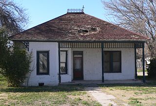
Guthrie is a ghost town in Greenlee County, Arizona, United States. It has an estimated elevation of 3,435 feet (1,047 m) above sea level.
Hidden Springs is a populated place situated in Coconino County, Arizona, United States, located on U.S. 89 approximately 75 miles north of Flagstaff. It has an estimated elevation of 4,819 feet (1,469 m) above sea level. The San Juan Southern Paiute Tribe of Arizona is located there.
Lewis Springs, also called San Pedro Springs after the nearby San Pedro River, is a populated place situated in Cochise County, Arizona, United States. It has an estimated elevation of 4,049 feet (1,234 m) above sea level.
Madera Canyon is a populated place situated in the Santa Rita Mountains of Santa Cruz County, Arizona, United States. It has an estimated elevation of 4,911 feet (1,497 m) above sea level. It is located within a canyon of the same name, Madera Canyon, in the Coronado National Forest.

Sacate is a populated place in the Middle Gila River Valley area, within Pinal County, Arizona, United States. Located 8 mi (13 km) north of Maricopa on the south side of the Gila River near Pima Butte, Sacate was an Pima village, a railroad station of the Southern Pacific Railroad, and a Catholic mission. It had originally been called Sacaton Station but the name was shortened to its current version in 1904.
San Pedro, also known as San Pedro Well and Viopoli or Viopuli is a populated place situated in Pima County, Arizona, United States.
Sheldon is a populated place situated in Greenlee County, Arizona, United States, near the border with New Mexico. It is named after Lionel Sheldon, who served as governor of the New Mexico Territory from 1881 to 1885. A post office was opened at this location in 1908, and remained in operation until its closure in 1919. It has an estimated elevation of 3,586 feet (1,093 m) above sea level.
Vanar was a station on the Southern Pacific railroad and populated place situated in Cochise County, Arizona, United States, adjacent to the border with New Mexico. It has an estimated elevation of 3,917 feet (1,194 m) above sea level. The community was originally named Vanarman after Hiram M. Van Arman, and the name was shortened for telegraph purposes in 1905 to Vanar.
Walker is a populated place situated in Yavapai County, Arizona, United States. It has an estimated elevation of 6,289 feet (1,917 m) above sea level.


