Greers Ferry, Arkansas

Last updated

Greers Ferry, Arkansas
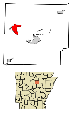
Cleburne County Arkansas Incorporated and Unincorporated areas Greers Ferry Highlighted 0528810.svg
Location of Greers Ferry in Cleburne County, Arkansas.
Coordinates: 35°34′03″N92°10′08″W / 35.56750°N 92.16889°W / 35.56750; -92.16889
Country United States
State Arkansas
County Cleburne
Area
[1]
  Total7.23 sq mi (18.72 km2)
  Land7.22 sq mi (18.69 km2)
  Water0.01 sq mi (0.03 km2)
Elevation
[2]
545 ft (166 m)
Population
 (2020)
  Total821
  Density113.74/sq mi (43.92/km2)
Time zone UTC-6 (Central (CST))
  Summer (DST) UTC-5 (CDT)
ZIP code
72067
Area code 501
FIPS code 05-28810
GNIS feature ID2403759 [2]

Greers Ferry is a city in Cleburne County, Arkansas, United States. The population was 891 at the 2010 census. [3] It was founded in 1968. [4]

Contents

Geography

Greers Ferry is located in western Cleburne County at 35°34′32″N92°9′51″W / 35.57556°N 92.16417°W / 35.57556; -92.16417 (35.575588, -92.164042). [5] It is situated on the east side of Greers Ferry Lake, overlooking The Narrows portion of the lake. Arkansas Highways 16 and 92 cross The Narrows, connecting the city of Greers Ferry with Higden on the west side of the lake. Highway 16, heading north, crosses the northern arm of the lake via the Edgemont Bridge, leading to Fairfield Bay.

According to the United States Census Bureau, Greers Ferry has a total area of 7.2 square miles (18.7 km2), of which 0.012 square miles (0.03 km2), or 0.14%, is water. [3]

Demographics

Historical population
CensusPop.Note
1970 389
1980 55843.4%
1990 72429.7%
2000 93028.5%
2010 891−4.2%
2020 821−7.9%
U.S. Decennial Census [6]

2020 census

Greers Ferry racial composition [7]
RaceNumberPercentage
White (non-Hispanic)76192.69%
Black or African American (non-Hispanic)50.61%
Native American 60.73%
Asian 10.12%
Other/Mixed 303.65%
Hispanic or Latino 182.19%

As of the 2020 United States census, there were 821 people, 451 households, and 330 families residing in the city.

2000 census

As of the census [8] of 2000, there were 930 people, 398 households, and 300 families residing in the city. The population density was 130.5 inhabitants per square mile (50.4/km2). There were 664 housing units at an average density of 93.1 per square mile (35.9/km2). The racial makeup of the city was 97.31% White, 0.11% Black or African American, 0.11% Native American, 0.22% Asian, 0.22% from other races, and 2.04% from two or more races. 1.18% of the population were Hispanic or Latino of any race.

There were 398 households, out of which 24.6% had children under the age of 18 living with them, 65.3% were married couples living together, 7.0% had a female householder with no husband present, and 24.4% were non-families. 21.1% of all households were made up of individuals, and 11.6% had someone living alone who was 65 years of age or older. The average household size was 2.34 and the average family size was 2.65.

In the city, the population was spread out, with 20.3% under the age of 18, 5.1% from 18 to 24, 21.3% from 25 to 44, 26.6% from 45 to 64, and 26.8% who were 65 years of age or older. The median age was 48 years. For every 100 females, there were 99.6 males. For every 100 females age 18 and over, there were 96.0 males.

The median income for a household in the city was $30,238, and the median income for a family was $32,344. Males had a median income of $24,200 versus $16,250 for females. The per capita income for the city was $16,496. About 12.0% of families and 16.0% of the population were below the poverty line, including 26.4% of those under age 18 and 8.2% of those age 65 or over.
Education

Greers Ferry is home to the West Side School District, West Side Elementary School and West Side High School. The district encompasses more than 147.81 square miles (382.8 km2) of land that includes all or portions of the following communities in Cleburne and Van Buren counties: Edgemont, Greers Ferry, Higden and Prim. [9]

Related Research Articles

<span class="mw-page-title-main">Cleburne County, Alabama</span> County in Alabama, United States

Cleburne County is a county located in the east central portion of the U.S. state of Alabama. As of the 2020 census, the population was 15,056. Its county seat is Heflin. Its name is in honor of Patrick R. Cleburne of Arkansas who rose to the rank of major general in the Confederate States Army. The eastern side of the county borders the state of Georgia.

<span class="mw-page-title-main">Van Buren County, Arkansas</span> County in Arkansas, United States

Van Buren County is a county located in the U.S. state of Arkansas. As of the 2020 census, the population was 15,796. The county seat is Clinton. The county was formed on November 11, 1833, and named for Martin Van Buren, President of the United States, who was Vice President at the time of the county's formation. Van Buren County was a dry county until November 3, 2020, as the county residents voted to make it a wet county.

<span class="mw-page-title-main">Stone County, Arkansas</span> County in Arkansas, United States

Stone County is located in the Ozark Mountains in the U.S. state of Arkansas. The county is named for rugged, rocky area terrain of the Ozarks. Created as Arkansas's 74th county on April 21, 1873, Stone County has two incorporated cities: Mountain View, the county seat and most populous city, and Fifty-Six. The county is also the site of numerous unincorporated communities and ghost towns.

<span class="mw-page-title-main">Independence County, Arkansas</span> County in Arkansas, United States

Independence County is a county located in the U.S. state of Arkansas. As of the 2020 census, the population was 37,938. The county seat is Batesville. Independence County is Arkansas's ninth county, formed on October 20, 1820, from a portion of Lawrence County and named in commemoration of the Declaration of Independence. It is an alcohol prohibition or dry county.

<span class="mw-page-title-main">Grant County, Arkansas</span> County in Arkansas, United States

Grant County is a county in the U.S. state of Arkansas. Its population was 17,958 at the 2020 United States Census. The county seat is Sheridan.

<span class="mw-page-title-main">Faulkner County, Arkansas</span> County in Arkansas, United States

Faulkner County is located in the Central Arkansas region of the U.S. state of Arkansas. As of the 2020 census, the population was 123,498, making it the fifth most populous of Arkansas's 75 counties. The county seat and largest city is Conway. Faulkner County was created on April 12, 1873, one of nine counties formed during Reconstruction, and is named for Sandford C. Faulkner, better known as Sandy Faulkner, a popular figure in the state at the time.

<span class="mw-page-title-main">Cleburne County, Arkansas</span> County in Arkansas, United States

Cleburne County is a county located in the U.S. state of Arkansas. As of the 2020 census, the population was 24,711. The county seat and most populous city is Heber Springs. The county was formed on February 20, 1883, as the last of Arkansas's 75 counties to be formed. It is named for Confederate Major-General Patrick Cleburne. Cleburne is an alcohol prohibition or dry county.

<span class="mw-page-title-main">Concord, Arkansas</span> Town in Arkansas, United States

Concord is a town in Cleburne County, Arkansas, United States. The population was 244 at the 2010 census.

<span class="mw-page-title-main">Fairfield Bay, Arkansas</span> City in Arkansas, United States

Fairfield Bay is a city in Cleburne and Van Buren counties in the northern part of the U.S. state of Arkansas. The population was 2,108 at the 2020 census. The population in its portion in Van Buren County, which accounts for the bulk of the city limits, made the city the most populous in Van Buren County as of the 2000 census, but with a slight decline in population, lost the distinction to Clinton as of 2010.

<span class="mw-page-title-main">Heber Springs, Arkansas</span> City in Arkansas, United States

Heber Springs is a city in and the county seat of Cleburne County, Arkansas, United States. The population was 7,165 at the 2010 census.

<span class="mw-page-title-main">Higden, Arkansas</span> Town in Arkansas, United States

Higden is a town in Cleburne County, Arkansas, United States. The population was 120 at the 2010 census. Scott Barker is the current Mayor of Higden

<span class="mw-page-title-main">Quitman, Arkansas</span> City in Arkansas, United States

Quitman is a city in Cleburne and Faulkner counties in the U.S. state of Arkansas. Its population was 762 at the 2010 census. The portion of the city in Faulkner County is part of the Central Arkansas region.

<span class="mw-page-title-main">Oppelo, Arkansas</span> City in Arkansas, United States

OppeloAH-pə-loh is a city in Conway County, Arkansas, United States. The population was 781 at the 2010 census.

<span class="mw-page-title-main">Shirley, Arkansas</span> Town in Arkansas, United States

Shirley is a town in northeast Van Buren County, Arkansas, United States, along the Middle Fork of the Little Red River. A one-time railroad outpost, the community today is oriented toward agriculture and recreational activities due to the river and Greers Ferry Lake. The population was 223 at the 2010 census.

<span class="mw-page-title-main">Kahaluʻu-Keauhou, Hawaii</span> Census-designated place in Hawaii, U.S.

Kahaluʻu-Keauhou is a census-designated place (CDP) in Hawaiʻi County, Hawaii, United States. The population was 3,549 at the 2010 census, up from 2,414 at the 2000 census.

<span class="mw-page-title-main">Edgemont Park, Michigan</span> Census-designated place & unincorporated community in Michigan, United States

Edgemont Park is a census-designated place (CDP) in Ingham County in the U.S. state of Michigan. It is located within Lansing Charter Township. The population was 2,358 at the 2010 census.

<span class="mw-page-title-main">Edgemont, South Dakota</span> City in South Dakota, United States

Edgemont is a city in Fall River County, South Dakota, United States. The population was 725 at the 2020 census. The city lies on the far southern edge of the Black Hills in southwestern South Dakota.

Edgemont is an unincorporated community and census-designated place (CDP) in Cleburne County, Arkansas, United States. Edgemont is located on the north side of Greers Ferry Lake along Arkansas Highway 16, 2 miles (3.2 km) northwest of Greers Ferry. Edgemont has a post office with ZIP code 72044.

Prim is an unincorporated community in Cleburne County, Arkansas, United States. Prim is located at the junction of Arkansas Highway 225 and Arkansas Highway 263, 9 miles (14 km) north-northeast of Greers Ferry. Prim has a post office with ZIP code 72130.

<span class="mw-page-title-main">West Side School District</span> School district in Arkansas, United States

West Side School District is a public school district based in Greers Ferry, Arkansas, United States. It provides early childhood, elementary and secondary education for more than 500 prekindergarten through grade 12 students at its two facilities in Cleburne County. The district is accredited by the Arkansas Department of Education (ADE).

References

  1. "2020 U.S. Gazetteer Files". United States Census Bureau. Retrieved October 29, 2021.
  2. 1 2 U.S. Geological Survey Geographic Names Information System: Greers Ferry, Arkansas
  3. 1 2 "Geographic Identifiers: 2010 Demographic Profile Data (G001): Greers Ferry city, Arkansas". U.S. Census Bureau, American Factfinder. Archived from the original on February 12, 2020. Retrieved June 17, 2014.
  4. "Encyclopedia of Arkansas".
  5. "US Gazetteer files: 2010, 2000, and 1990". United States Census Bureau. February 12, 2011. Retrieved April 23, 2011.
  6. "Census of Population and Housing". Census.gov. Retrieved June 4, 2015.
  7. "Explore Census Data". data.census.gov. Retrieved December 31, 2021.
  8. "U.S. Census website". United States Census Bureau . Retrieved January 31, 2008.
  9. "West Side School District".