The Oldman River is a river in southern Alberta, Canada. It flows roughly west to east from the Rocky Mountains, through the communities of Fort Macleod, Lethbridge, and on to Grassy Lake, where it joins with the Bow River to form the South Saskatchewan River, which eventually drains into the Hudson Bay.

The Elbow River is a river in southern Alberta, Canada. It flows from the Canadian Rockies to the city of Calgary, where it merges into the Bow River.

The Red Deer River is a river in Alberta and a small portion of Saskatchewan, Canada. It is a major tributary of the South Saskatchewan River and is part of the larger Saskatchewan-Nelson system that empties into Hudson Bay.

The Smoky River is a river in western Alberta, Canada. It is a major tributary of the Peace River. The descriptive name refers to the presence of "smouldering beds of coal in the riverbank" noted by the Cree Indians.

The Brazeau River is a river in western Alberta, Canada. It is a major tributary of the North Saskatchewan River.
Cardinal River is a short river in western Alberta, Canada. It flows from the Canadian Rockies, and empties into the Brazeau River, itself a major tributary of the North Saskatchewan River.

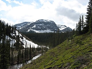
Nigel Creek is a short stream located in the Canadian Rockies of Alberta, Canada. It forms in the glacial meltwaters north of Sunwapta Pass and takes on streams flowing from Nigel Pass.

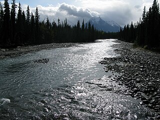
The Fiddle River is a medium-sized tributary of the Athabasca River, flowing into the river near the east gate of Jasper National Park in Alberta, Canada. The Fiddle River forms at the base of Fiddle Pass, with meltwater from Mount Bryant, Mount Gregg, Mount Sir Harold Mitchel, and Mount Barry. The river flows in a general northeast direction before its confluence with the Athabasca. The Fiddle River parallels the road to the popular Miette Hotsprings for a portion of its course.
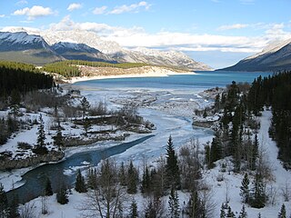
The Cline River is a short river in western Alberta, Canada. It flows from Pinto Lake and joins the North Saskatchewan River at Lake Abraham in west-central Alberta.

The Miette River is a short river in Jasper National Park, Alberta, Canada. It flows south-southwest through the Rocky Mountains before draining into the Athabasca River.

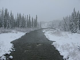
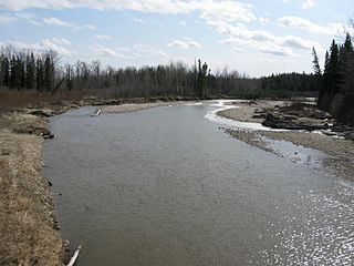
The Embarras River is a short river in west-central Alberta, Canada. The river likely derived its name from the French word for obstruction, because it is often obstructed by driftwood.
The Paddle River is a short river in northern Alberta, Canada. The river is named because of its slow speed. During the fur trade era, a canoe could be easily paddled up the river, in contrast to the more arduous task of ascending a swifter river like the Pembina River that required poling or tracking.
The Freeman River is a short river in west-central Alberta. The Freeman takes its name from the fur traders, who, after leaving the employ of the Hudson's Bay Company or the North West Company, decided to remain in the interior and work as free trappers or free hunters.
The Ram River is a river rising in the Alberta Rocky Mountains. It flows eastward, taking on the North Ram River, before joining the North Saskatchewan River near the Town of Rocky Mountain House. The name Ram Rivulet appears on a David Thompson map of 1814. A ram is a male Rocky Mountain Sheep.
The Whirlpool River is a short river in Jasper National Park, Alberta, Canada. It is an early tributary of the Athabasca River.
The James River is a medium-sized river in central Alberta. It is a tributary of the Red Deer River.

The Blindman River is a river in south-central Alberta. It forms south of Winfield, Alberta and flows southeastward before joining the Red Deer River near Red Deer. The Blindman is bridged by Alberta Highway 20 a number of times in its upper reaches, before passing near the town of Rimbey. The river then takes on the outflow of Gull Lake. It is bridged by Alberta Highway 2 at Red Deer before flowing into the Red Deer River.

The Medicine River is a medium-sized river in central Alberta. It begins at the outlet of Medicine Lake, north of Rocky Mountain House. The Medicine River initially travels through the Rocky Mountain House Grazing Reserve, a protected area with over 15,000 acres (61 km2) of land set aside for cattle grazing and recreation. The river flows southwest, taking on a number of creeks before passing Eckville. The Medicine River joins the Red Deer River north of Innisfail, downstream of the Dickson Dam, at the Medicine Flats. The Medicine is bridged by Alberta highways 53, 12, 11, and 54.

The Edson River is a minor river in west-central Alberta, Canada. The river, like the nearby town of Edson, is named for Edson Joseph Chamberlin (1852–1924), a Vice-President and General Manager of the Grand Trunk Pacific Railway. Chamberlain also acted as the President of the Grand Trunk Railway.