Guayabo, Aguada, Puerto Rico

Last updated
Guayabo
Barrio
Carretera PR-414, Aguada, Puerto Rico.jpg
Puerto Rico Highway 414 in Guayabo
Guayabo, Aguada, Puerto Rico locator map.png
Location of Guayabo within the municipality of Aguada shown in red
Caribbean location map.svg
Red pog.svg
Guayabo
Location of Puerto Rico
Coordinates: 18°22′28″N67°12′32″W / 18.374506°N 67.208867°W / 18.374506; -67.208867 [1]
Commonwealth Flag of Puerto Rico.svg  Puerto Rico
Municipality Aguada flag.png Aguada
Area
[1]
  Total2.42 sq mi (6.3 km2)
  Land2.20 sq mi (5.7 km2)
  Water0.22 sq mi (0.6 km2)
Elevation
[2]
10 ft (3 m)
Population
 (2010)
  Total3,273
  Density1,494.5/sq mi (577.0/km2)
 Source: 2010 Census
Time zone UTC−4 (AST)
ZIP Code
00602
Area code(s) 787, 939

Guayabo is a barrio in the municipality of Aguada, Puerto Rico. Its population in 2010 was 3,273. [3] [4] [5]

Contents

History

Guayabo was in Spain's gazetteers [6] until Puerto Rico was ceded by Spain in the aftermath of the Spanish–American War under the terms of the Treaty of Paris of 1898 and became an unincorporated territory of the United States. In 1899, the United States Department of War conducted a census of Puerto Rico finding that the combined population of Guayabo, Cruces and Río Grande barrios was 1,533. [7]

Historical population
CensusPop.Note
1910 788
1920 88812.7%
1930 823−7.3%
1940 1,00722.4%
1950 970−3.7%
1960 825−14.9%
1970 0−100.0%
1980 2,108
1990 2,68027.1%
2000 2,96110.5%
2010 3,27310.5%
U.S. Decennial Census
1900 (N/A) [8] 1910-1930 [9]
1930-1950 [10] 1960 [11] 1980-2000 [12] 2010 [13]

Sectors

Barrios (which are, in contemporary times, roughly comparable to minor civil divisions) [14] in turn are further subdivided into smaller local populated place areas/units called sectores (sectors in English). The types of sectores may vary, from normally sector to urbanización to reparto to barriada to residencial, among others. [15] [16] [17] [18]

The following sectors are in Guayabo barrio: [19]

Avenida Nativo Alers, Condominio Mar Azul, Condominio Ocean View Castle, Extensión Casualidad, Sector El Palmar, Sector El Túnel, Sector Hacienda El Palmar, Sector Juan Cardona, Sector La Mora, Sector Las Cruces, Sector Miguel A. Ruíz, Sector Pancho Agudo, Sector Pascual Muñoz, Sector Silva, Tramo Carretera 115, Urbanización El Palmar, and Urbanización Villas del Palmar.

In Guayabo barrio is part of the Aguada urban zone. [5]

See also

Related Research Articles

<span class="mw-page-title-main">Frailes, Guaynabo, Puerto Rico</span> Barrio of Puerto Rico

Frailes is a barrio in the municipality of Guaynabo, Puerto Rico. Its population in 2010 was 32,050.

<span class="mw-page-title-main">Guaynabo barrio-pueblo</span> Historical and administrative center (seat) of Guaynabo, Puerto Rico

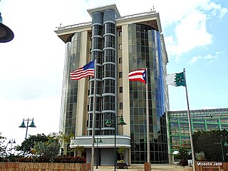
Guaynabo barrio-pueblo is a barrio and the administrative center (seat) of Guaynabo, a municipality of Puerto Rico. Its population in 2010 was 4,008.

<span class="mw-page-title-main">Pueblo Viejo, Guaynabo, Puerto Rico</span> Barrio of Puerto Rico

Pueblo Viejo is a barrio in the municipality of Guaynabo, Puerto Rico. Its population in 2010 was 23,816.

<span class="mw-page-title-main">Santa Rosa, Guaynabo, Puerto Rico</span> Barrio of Puerto Rico

Santa Rosa is a barrio in the municipality of Guaynabo, Puerto Rico. Its population in 2010 was 16,904.

<span class="mw-page-title-main">Palmas, Cataño, Puerto Rico</span> Barrio of Puerto Rico

Palmas is a barrio in the municipality of Cataño, Puerto Rico. Its population in 2010 was 23,857.

<span class="mw-page-title-main">Candelaria, Toa Baja, Puerto Rico</span> Barrio of Puerto Rico

Candelaria is a barrio in the municipality of Toa Baja, Puerto Rico. Its population in 2010 was 23,343.

<span class="mw-page-title-main">Sabana Seca</span> Barrio of Toa Baja, Puerto Rico

Sabana Seca is a barrio in the municipality of Toa Baja, Puerto Rico. Its population in 2010 was 53,192.

<span class="mw-page-title-main">Mucarabones</span> Barrio of Toa Alta, Puerto Rico

Mucarabones is a barrio in the municipality of Toa Alta, Puerto Rico. Its population in 2010 was 23,221.

<span class="mw-page-title-main">Ortíz, Toa Alta, Puerto Rico</span> Barrio of Puerto Rico

Ortíz is a large barrio in the municipality of Toa Alta, Puerto Rico. Its population in 2010 was 26,580.

<span class="mw-page-title-main">Machos, Ceiba, Puerto Rico</span> Barrio of Puerto Rico

Machos is a barrio in the municipality of Ceiba, Puerto Rico. Its population in 2010 was 3,567.

<span class="mw-page-title-main">Camaceyes, Aguadilla, Puerto Rico</span> Barrio of Puerto Rico

Camaceyes is a barrio in the municipality of Aguadilla, Puerto Rico. Its population in 2010 was 12,547. In Camaceyes barrio is part of the Aguadilla urban zone.

<span class="mw-page-title-main">Asomante, Aguada, Puerto Rico</span> Barrio of Puerto Rico

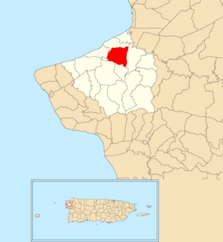
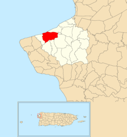
Asomante is a barrio in the municipality of Aguada, Puerto Rico. Its population in 2010 was 3,177.

<span class="mw-page-title-main">Río Grande, Aguada, Puerto Rico</span> Barrio of Puerto Rico

Río Grande is a barrio in the municipality of Aguada, Puerto Rico. Its population in 2010 was 1,152.

<span class="mw-page-title-main">Navarro, Gurabo, Puerto Rico</span> Barrio of Puerto Rico

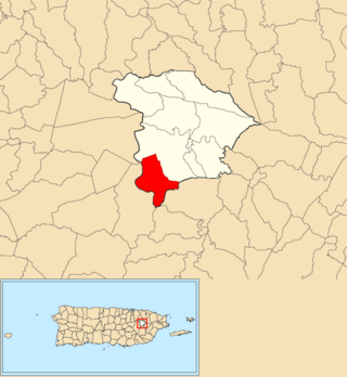
Navarro is a barrio in the municipality of Gurabo, Puerto Rico. Its population in 2010 was 10,561.

<span class="mw-page-title-main">Piedras Blancas, Aguada, Puerto Rico</span> Barrio of Puerto Rico

Piedras Blancas is a barrio in the municipality of Aguada, Puerto Rico. Its population in 2010 was 4,635.

<span class="mw-page-title-main">Santana, Arecibo, Puerto Rico</span> Barrio of Puerto Rico

Santana is a barrio in the municipality of Arecibo, Puerto Rico. Its population in 2010 was 5,253.

<span class="mw-page-title-main">Carrizal, Aguada, Puerto Rico</span> Barrio of Puerto Rico

Carrizal is a barrio in the municipality of Aguada, Puerto Rico. Its population in 2010 was 970.

<span class="mw-page-title-main">Cruces, Aguada, Puerto Rico</span> Barrio of Puerto Rico

Cruces is a barrio in the municipality of Aguada, Puerto Rico. Its population in 2010 was 1,632.

<span class="mw-page-title-main">Guaniquilla, Aguada, Puerto Rico</span> Barrio of Puerto Rico

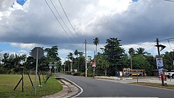
Guaniquilla is a coastal barrio in the municipality of Aguada, Puerto Rico. Its population in 2010 was 2,663.

<span class="mw-page-title-main">Mal Paso, Aguada, Puerto Rico</span> Barrio of Puerto Rico

Mal Paso is a barrio in the municipality of Aguada, Puerto Rico. Its population in 2010 was 2,483.

References

  1. 1 2 "US Gazetteer 2019". US Census. US Government.
  2. U.S. Geological Survey Geographic Names Information System: Guayabo Barrio
  3. Picó, Rafael; Buitrago de Santiago, Zayda; Berrios, Hector H. Nueva geografía de Puerto Rico: física, económica, y social, por Rafael Picó. Con la colaboración de Zayda Buitrago de Santiago y Héctor H. Berrios. San Juan Editorial Universitaria, Universidad de Puerto Rico,1969.
  4. Gwillim Law (20 May 2015). Administrative Subdivisions of Countries: A Comprehensive World Reference, 1900 through 1998. McFarland. p. 300. ISBN   978-1-4766-0447-3 . Retrieved 25 December 2018.
  5. 1 2 Puerto Rico: 2010 Population and Housing Unit Counts.pdf (PDF). U.S. Dept. of Commerce, Economics and Statistics Administration, U.S. Census Bureau. 2010.
  6. "Anuario del comercio, de la industria, de la magistratura y de la administración. 1881". Biblioteca Nacional de España (in Spanish). p. 1614. Retrieved 4 April 2023.
  7. Joseph Prentiss Sanger; Henry Gannett; Walter Francis Willcox (1900). Informe sobre el censo de Puerto Rico, 1899, United States. War Dept. Porto Rico Census Office (in Spanish). Imprenta del gobierno. p.  160.
  8. "Report of the Census of Porto Rico 1899". War Department Office Director Census of Porto Rico. Archived from the original on July 16, 2017. Retrieved September 21, 2017.
  9. "Table 3-Population of Municipalities: 1930 1920 and 1910" (PDF). United States Census Bureau. Archived (PDF) from the original on August 17, 2017. Retrieved September 21, 2017.
  10. "Table 4-Area and Population of Municipalities Urban and Rural: 1930 to 1950" (PDF). United States Census Bureau. Archived (PDF) from the original on August 30, 2015. Retrieved September 21, 2014.
  11. Census of Population, 1960: Number of Inhabitants, General Population Characteristics, General Social and Economic Characteristics, and Detailed Characteristics. Characteristics of the population. U.S. Bureau of the Census. 1963. pp. 97–101. Retrieved June 10, 2023.
  12. "Table 2 Population and Housing Units: 1960 to 2000" (PDF). United States Census Bureau. Archived (PDF) from the original on July 24, 2017. Retrieved September 21, 2017.
  13. Puerto Rico: 2010 Population and Housing Unit Counts.pdf (PDF). U.S. Dept. of Commerce Economics and Statistics Administration U.S. Census Bureau. 2010. Archived (PDF) from the original on 2017-02-20. Retrieved 2019-08-02.
  14. "US Census Barrio-Pueblo definition". factfinder.com. US Census. Archived from the original on 13 May 2017. Retrieved 5 January 2019.
  15. Mari Mut, José A. (28 August 2013). "Los pueblos de Puerto Rico y las iglesias de sus plazas" (in Spanish). Retrieved 19 June 2020 via archive.org.
  16. "Agencia: Oficina del Coordinador General para el Financiamiento Socioeconómico y la Autogestión (Proposed 2016 Budget)". Puerto Rico Budgets (in Spanish). Retrieved 28 June 2019.
  17. Rivera Quintero, Marcia (2014), El vuelo de la esperanza : Proyecto de las Comunidades Especiales Puerto Rico, 1997-2004 (first ed.), San Juan, Puerto Rico Fundación Sila M. Calderón, ISBN   978-0-9820806-1-0
  18. "Leyes del 2001". Lex Juris Puerto Rico (in Spanish). Retrieved 23 June 2020.
  19. "DESGLOSE DE SECTORES Y CENTROS DE VOTACIÓN PRECINTO ELECTORAL - AGUADA 038" (PDF). Comisión Estatal de Elecciones Puerto Rico (in Spanish). 28 October 2019. Retrieved 15 June 2020.