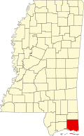
Gulf Park Estates, Mississippi | |
---|---|
Coordinates: 30°22′37″N88°45′38″W / 30.37694°N 88.76056°W Coordinates: 30°22′37″N88°45′38″W / 30.37694°N 88.76056°W | |
Country | United States |
State | Mississippi |
County | Jackson |
Area | |
• Total | 2.79 sq mi (7.22 km2) |
• Land | 2.65 sq mi (6.88 km2) |
• Water | 0.13 sq mi (0.35 km2) |
Elevation | 16 ft (5 m) |
Population (2020) | |
• Total | 5,972 |
• Density | 2,249.34/sq mi (868.55/km2) |
Time zone | UTC-6 (Central (CST)) |
• Summer (DST) | UTC-5 (CDT) |
ZIP code | 39564 |
Area code | 228 |
FIPS code | 28-29660 |
GNIS feature ID | 0689021 |
Gulf Park Estates is an unincorporated community and census-designated place (CDP) located south of Ocean Springs in Jackson County, Mississippi, United States. It is part of the Pascagoula Metropolitan Statistical Area. The population was 5,719 at the 2010 census, [2] up from 4,272 at the 2000 census.
Gulf Park Estates is located in southwestern Jackson County at 30°22′37″N88°45′38″W / 30.37694°N 88.76056°W (30.376932, -88.760579). [3] It is 13 miles (21 km) west of Pascagoula, the county seat, and 9 miles (14 km) east of Biloxi.
According to the United States Census Bureau, the CDP has a total area of 2.8 square miles (7.2 km2), of which 2.7 square miles (6.9 km2) are land and 0.1 square miles (0.3 km2), or 4.78%, are water. [2]
Census | Pop. | Note | %± |
---|---|---|---|
2020 | 5,972 | — | |
U.S. Decennial Census [4] |
Race | Num. | Perc. |
---|---|---|
White (non-Hispanic) | 4,423 | 74.06% |
Black or African American (non-Hispanic) | 580 | 9.71% |
Native American | 28 | 0.47% |
Asian | 164 | 2.75% |
Pacific Islander | 1 | 0.02% |
Other/Mixed | 334 | 5.59% |
Hispanic or Latino | 442 | 7.4% |
As of the 2020 United States census, there were 5,972 people, 2,145 households, and 1,607 families residing in the CDP.
As of the census [6] of 2000, there were 4,272 people, 1,537 households, and 1,188 families residing in the CDP. The population density was 1,610.1 inhabitants per square mile (621.7/km2). There were 1,624 housing units at an average density of 612.1 per square mile (236.3/km2). The racial makeup of the CDP was 91.90% White, 3.60% African American, 0.37% Native American, 1.54% Asian, 0.02% Pacific Islander, 0.75% from other races, and 1.80% from two or more races. Hispanic or Latino of any race were 2.29% of the population.
There were 1,537 households, out of which 44.4% had children under the age of 18 living with them, 62.6% were married couples living together, 10.5% had a female householder with no husband present, and 22.7% were non-families. 17.0% of all households were made up of individuals, and 2.7% had someone living alone who was 65 years of age or older. The average household size was 2.78 and the average family size was 3.14.
In the CDP, the population was spread out, with 30.2% under the age of 18, 8.0% from 18 to 24, 36.4% from 25 to 44, 19.7% from 45 to 64, and 5.8% who were 65 years of age or older. The median age was 34 years. For every 100 females, there were 98.6 males. For every 100 females age 18 and over, there were 97.1 males.
The median income for a household in the CDP was $47,647, and the median income for a family was $49,211. Males had a median income of $32,138 versus $26,503 for females. The per capita income for the CDP was $17,978. About 6.0% of families and 6.7% of the population were below the poverty line, including 10.0% of those under age 18 and 3.2% of those age 65 or over.
Gulf Park Estates is served by the Ocean Springs School District.
Jackson County is a county located in the U.S. state of Mississippi. As of the 2020 census, the population was 143,252, making it the fifth-most populous county in Mississippi. Its county seat is Pascagoula. The county was named for Andrew Jackson, general in the United States Army and afterward President of the United States.
Theodore is an unincorporated area and census-designated place (CDP) in Mobile County, Alabama, United States. The population was 6,270 at the 2020 census. It is a part of the Mobile metropolitan area. Prior to 1900 this area was known as "Clements", but it is now named for William Theodore Hieronymous, a sawmill operator and postmaster.
Petersville is a census-designated place (CDP) in Matanuska-Susitna Borough, Alaska, United States. It is part of the Anchorage Metropolitan Area. The population was 27 at the 2020 census.
San Carlos Park is a census-designated place (CDP) in Lee County, Florida, United States. The population was 18,563 at the 2020 census. It is part of the Cape Coral-Fort Myers, Florida Metropolitan Statistical Area.
Ives Estates is a census-designated place (CDP) in Miami-Dade County, Florida. The population was 25,005 at the 2020 census, up from 19,525 in 2010.
Gulf Gate Estates is a census-designated place (CDP) in Sarasota County, Florida, United States. The population was 10,911 at the 2010 census. It is part of the North Port–Sarasota–Bradenton Metropolitan Statistical Area.
Lakewood Shores is a census-designated place (CDP) in Will County, Illinois, United States. The population was 665 at the 2020 census.
Willow Brook Estates is an unincorporated census-designated place in Will County, Illinois, United States. The population was 1,346 at the 2020 census. it is considered a far south suburb of Chicago.
Big Point is an unincorporated community and census-designated place (CDP) in Jackson County, Mississippi, United States. It is part of the Pascagoula, Mississippi Metropolitan Statistical Area. Per the 2020 Census, the population was 618.
Escatawpa is an unincorporated community and census-designated place (CDP) in Jackson County, Mississippi, United States. It is part of the Pascagoula Metropolitan Statistical Area. The population was 3,254 at the 2020 census.
Gautier is a city in Jackson County, Mississippi, United States, along the Gulf of Mexico west of Pascagoula. It is part of the Pascagoula Metropolitan Statistical Area. The population was 18,572 at the 2010 census, up from 11,681 at the 2000 census. In 2002, Gautier had annexed land more than doubling its area.
Gulf Hills is an unincorporated community and census-designated place (CDP) in Jackson County, Mississippi, United States. It is part of the Pascagoula Metropolitan Statistical Area. The population was 8,526 at the 2020 census, up from 7,144 at the 2010 census.
Hickory Hill is a neighborhood in the city of Gautier in Jackson County, Mississippi, United States. Prior to 2010 it was an unincorporated area and recorded as a census-designated place, with a population of 3,046 at the 2000 census. At the 2010 census its population was included in the data for the city of Gautier. It is part of the Pascagoula Metropolitan Statistical Area.
Hurley is an unincorporated community and census-designated place (CDP) in Jackson County, Mississippi, United States. It is part of the Pascagoula Metropolitan Statistical Area. The population was 1,551 at the 2010 census, up from 985 at the 2000 census.
St. Martin is a census-designated place (CDP) in Jackson County, Mississippi, United States. It is part of the Pascagoula Metropolitan Statistical Area. The population was 7,730 at the 2010 census, up from 6,676 at the 2000 census.
Vancleave is an unincorporated community and census-designated place (CDP) in Jackson County, Mississippi, United States. It is part of the Pascagoula Metropolitan Statistical Area. The population was 5,886 at the 2010 census, up from 4,910 at the 2000 census.
Wade is an unincorporated community and census-designated place (CDP) in Jackson County, Mississippi, United States. It is part of the Pascagoula Metropolitan Statistical Area. The population was 1,074 at the 2010 census, up from 491 at the 2000 census.
Spring Hill is a census-designated place (CDP) in Cambria County, Pennsylvania, United States. The population was 839 at the 2010 census, down from 970 at the 2000 census.
Locustdale is a census-designated place (CDP) in Columbia and Schuylkill counties, Pennsylvania, United States. It is part of Northeastern Pennsylvania. The population was 177 at the 2010 census. It is part of the Bloomsburg-Berwick micropolitan area.
The Gulfport–Biloxi–Pascagoula Combined Statistical Area is made up of five counties in the Mississippi Gulf Coast region. The statistical area consists of the Gulfport–Biloxi Metropolitan Statistical Area and the Pascagoula Metropolitan Statistical Area. The 2010 census placed the CSA population at 411,066, and as of 2019, is estimated to be 442,165. The area was significantly impacted by Hurricane Katrina on August 29, 2005, although population growth has steadily rebounded in recent years.