Related Research Articles
Project Tiger is a wildlife conservation movement initiated in India to protect the endangered tiger. The project was initiated in 1973 by the Ministry of Environment, Forest and Climate Change of the Government of India. As of March 2024, there are 55 protected areas that have been designated as tiger reserves under the project. As of 2023, there were 3,682 wild tigers in India, which is almost 75% of the world's wild tiger population.

The Bengal tiger or Royal Bengal tiger is a population of the Panthera tigris tigris subspecies and the nominate tiger subspecies. It ranks among the biggest wild cats alive today. It is estimated to have been present in the Indian subcontinent since the Late Pleistocene for about 12,000 to 16,500 years. Its historical range covered the Indus River valley until the early 19th century, almost all of India, western Pakistan, southern Nepal, Bangladesh, Bhutan and southwestern China. Today, it inhabits India, Bangladesh, Nepal, Bhutan, and southwestern China. It is threatened by poaching, habitat loss and habitat fragmentation.
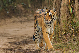
Jim Corbett National Park is a national park in India located in the Nainital district of Uttarakhand state. The first national park in India, it was established in 1936 during the British Raj and named Hailey National Park after William Malcolm Hailey, a governor of the United Provinces in which it was then located. In 1956, nearly a decade after India's independence, it was renamed Corbett National Park after the hunter and naturalist Jim Corbett, who had played a leading role in its establishment and had died the year before. The park was the first to come under the Project Tiger initiative.

The Satpura Range is a range of hills in central India. The range rises in eastern Gujarat running east through the border of Maharashtra and Madhya Pradesh and ends in Chhattisgarh. The range parallels the Vindhya Range to the north, and these two east–west ranges divide Indian Subcontinent into the Indo-Gangetic plain of northern India and the Deccan Plateau of the south. The Narmada River originates from north-eastern end of Satpura in Amarkantak, and runs in the depression between the Satpura and Vindhya ranges, draining the northern slope of the Satpura range, running west towards the Arabian Sea. The Tapti River originates in the eastern-central part of Satpura, crossing the range in the center and running west at the range's southern slopes before meeting the Arabian Sea at Surat, draining the central and southern slopes of the range. Multai, the place of Tapti river origin is located about 465 kilometer far, south-westerly to Amarkantak, separated across by the hill range. The Godavari River and its tributaries drain the Deccan plateau, which lies south of the range, and the Mahanadi River drains the easternmost portion of the range. The Godavari and Mahanadi rivers flow into the Bay of Bengal. At its eastern end, the Satpura range meets the hills of the Chotanagpur Plateau. The Satpura Range is a horst mountain and is flanked by Narmada Graben in the north and much smaller but parallel Tapi Graben in the south.

The Chota Nagpur Plateau is a plateau in eastern India, which covers much of Jharkhand state as well as adjacent parts of Chhattisgarh, Odisha, West Bengal and Bihar. The Indo-Gangetic plain lies to the north and east of the plateau, and the basin of the Mahanadi river lies to the south. The total area of the Chota Nagpur Plateau is approximately 65,000 square kilometres (25,000 sq mi).
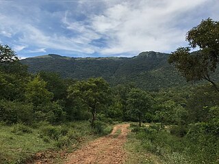
The Biligirirangana Hills or Biligirirangan Hills is a hill range situated in Chamarajanagar District in south-western Karnataka, at its border with Tamil Nadu in South India. The area is called Biligiri Ranganatha Swamy Temple Wildlife Sanctuary or simply BRT Wildlife Sanctuary. It is a protected reserve under the Wildlife Protection Act of 1972. Being close to the Eastern Ghats as well as the Western Ghats, the sanctuary has floral and faunal associations with both regions. The site was declared a tiger reserve in January 2011 by the Government of Karnataka, a few months after approval from India's National Tiger Conservation Authority.

Periyar, is the longest river and the river with the largest discharge potential in the Indian state of Kerala. It is one of the few perennial rivers in the region and provides drinking water for several major towns. The Periyar is of utmost significance to the economy of Kerala. It generates a significant proportion of Kerala's electrical power via the Idukki Dam and flows along a region of industrial and commercial activity. The river also provides water for irrigation and domestic use throughout its course besides supporting a rich fishery. Due to these reasons, the river has been named the "Lifeline of Kerala". Kochi city, in the vicinity of the river mouth, draws its water supply from Aluva, an upstream site sufficiently free of seawater intrusion. Twenty five percent of Kerala's industries are along the banks of the Periyar. These are mostly crowded within a stretch of 5 kilometres (3 mi) in the Eloor-Edayar region (Udhyogamandal), about 10 kilometres (6 mi) north of Kochi harbor.
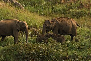
Anaimalai Tiger Reserve, earlier known as Indira Gandhi Wildlife Sanctuary and National Park and as Anaimalai Wildlife Sanctuary, is a protected area in the Anaimalai Hills of Pollachi and Valparai taluks of Coimbatore District and Udumalaipettai taluk in Tiruppur District, Tamil Nadu, India. The Tamil Nadu Environment and Forests Department by a notification dated 27 June 2007, declared an extent of 958.59 km2 that encompassed the erstwhile IGWLS&NP or Anaimalai Wildlife Sanctuary, as Anaimalai Tiger Reserve under the Wildlife Protection Act, 1972. According to the National Tiger Conservation Authority, the Reserve presently includes a core area of 958.59 km2 and buffer/peripheral area of 521.28 km2 forming a total area of 1479.87 km2.

There are four categories of protected areas in India, constituted under the Wildlife Protection Act, 1972. Tiger reserves consist of areas under national parks and wildlife sanctuaries. There are 53 tiger reserves in India. As of January 2023, the protected areas of India cover 173,629.52 square kilometres (67,038.73 sq mi), roughly 5.28% of the total geographical area of the country.
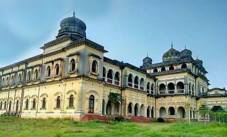
Koriya district, officially known as Korea district, is a district in the north-western part of the Chhattisgarh state in Central India. The administrative headquarters of the district is Baikunthpur.

The Eastern Highlands moist deciduous forests, presently known as East Deccan moist deciduous forests, is a tropical and subtropical moist broadleaf forests ecoregion in east-central India. The ecoregion covers an area of 341,100 square kilometers (131,700 sq mi), extending across portions of Andhra Pradesh, Chhattisgarh, Jharkhand, Madhya Pradesh, Maharashtra, Odisha, and Telangana states.
Tamor Pingla Wildlife Sanctuary is located in Surajpur District, Chhattisgarh, in central India. It is named after the Tamor Hill and Pingla Nalla, the old and prominent features of the area. In 2021, National Tiger Conservation Authority has approved the Chhattisgarh government's proposal to declare the combined areas of the Guru Ghasidas National Park and Tamor Pingla Wildlife Sanctuary as a Guru Ghasidas - Tamor Pingla Tiger Reserve.
Sanjay National Park is a national park in Manendragarh-Chirmiri-Bharatpur district of Chhattisgarh and Singrauli district of Madhya Pradesh, India. It covers an area of 2,300 km2 (890 sq mi) and is a part of the Sanjay-Dubri Tiger Reserve. It is located in the Narmada Valley dry deciduous forests ecoregion.

The Narmada Valley dry deciduous forests are a tropical dry forest ecoregion of central India. The ecoregion lies mostly in Madhya Pradesh state, but extends into portions of Chhattisgarh, Maharashtra, Karnataka and Uttar Pradesh states.
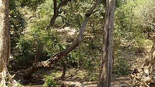
The Central Deccan Plateau dry deciduous forests in Western and Southern India, containing large protected areas of natural tiger habitat.
The tiger reserves in India were set up as a part of Project Tiger initiated in 1973 and are administered by the National Tiger Conservation Authority of Government of India. As of December 2024, there are 57 protected areas that have been designated as tiger reserves. As of 2023, there were 3,682 wild tigers in India, which is almost 75% of the world's wild tiger population.

The Ratapani Tiger Reserve, located in the Raisen district of Madhya Pradesh, in Vindhya Range in central India, is one of the finest teak forests in the state and is less than 50 kilometres (31 mi) away from the capital Bhopal.

Sigur Plateau is a plateau in the north and east of Nilgiri District in the Nilgiri Hills of Tamil Nadu, South India. It covers the 778.8 square kilometres (300.7 sq mi) portion of the Moyar River drainage basin on the northern slopes of the Nilgiri Hills, south of the Moyar River.

The Kamlang Wildlife Sanctuary, established in 1989, is the 50th Tiger reserve in India. In 2024, it was declared as a eco-sensitive zone. The Sanctuary is rich with floral and faunal diversity. It is situated in the Lohit District of the northeastern Indian state of Arunachal Pradesh. The park is named after the Kamlang River which flows through it. The Mishmi, Digaro Mishmi, and Miju Mishmi people tribal people who reside around the periphery of the sanctuary claim their descent from the King Rukmo of the epic Mahabharata. They believe in a myth of an invisible god known as Suto Phenkhenynon jamalu. An important body of water in the sanctuary is the Glow Lake. Located in tropical and sub-tropical climatic zones, the sanctuary is the habitat of the four big cat species of India: tiger, leopard, clouded leopard and snow leopard.

Tourism is an important part of the economy of the Indian state of Chhattisgarh, India's tenth largest state. The state has many ancient monuments, rare wildlife, carved temples, Buddhist sites, palaces, water falls, caves, rock paintings and hill plateaus.
References
- ↑ Sikdar, Shubhomoy (7 August 2024). "Chhattisgarh govt. to develop fourth tiger reserve in State". The Hindu. Retrieved 4 December 2024.
- 1 2 "After decade-long wait, Chhattisgarh to get its 4th tiger reserve". Deccan Herald. Retrieved 4 December 2024.
- ↑ Choubey, Jitendra (19 November 2024). "India's 56th tiger reserve notified in Chhatisgarh". The New Indian Express. Retrieved 4 December 2024.
- ↑ "Everything you need to know about Chhattisgarh's newest tiger reserve". The Indian Express. 23 November 2024. Retrieved 4 December 2024.
- ↑ "Can Chhattisgarh recover lost ground in conservation with its fourth tiger reserve?". India Today. 21 November 2024.
This article needs additional or more specific categories .(December 2024) |