Hackneyville, Alabama | |
|---|---|
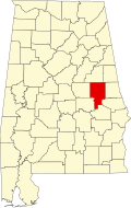
 Location of Hackneyville in Tallapoosa County, Alabama. | |
| Coordinates: 33°03′24″N85°55′52″W / 33.05667°N 85.93111°W [1] | |
| Country | United States |
| State | Alabama |
| County | Tallapoosa |
| Area | |
• Total | 8.98 sq mi (23.25 km2) |
| • Land | 8.96 sq mi (23.21 km2) |
| • Water | 0.015 sq mi (0.04 km2) |
| Elevation | 682 ft (208 m) |
| Population (2020) | |
• Total | 349 |
| • Density | 38.9/sq mi (15.03/km2) |
| Time zone | UTC-6 (Central (CST)) |
| • Summer (DST) | UTC-5 (CDT) |
| Area codes | 256 & 938 |
| GNIS feature ID | 2582678 [1] |
Hackneyville is a census-designated place and unincorporated community in Tallapoosa County, Alabama, United States. Its population was 347 as of the 2010 census. [3]