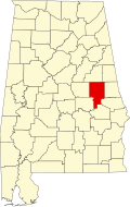
Daviston, Alabama

Last updated

Daviston, Alabama
Daviston Alabama.JPG
Tallapoosa County Alabama Incorporated and Unincorporated areas Daviston Highlighted 0119816.svg
Location of Daviston in Tallapoosa County, Alabama.
Coordinates: 33°3′18″N85°38′20″W / 33.05500°N 85.63889°W / 33.05500; -85.63889
Country United States
State Alabama
County Tallapoosa
Area
[1]
  Total9.16 sq mi (23.74 km2)
  Land9.13 sq mi (23.66 km2)
  Water0.03 sq mi (0.08 km2)
Elevation
761 ft (232 m)
Population
 (2020)
  Total174
  Density19.05/sq mi (7.35/km2)
Time zone UTC-6 (Central (CST))
  Summer (DST) UTC-5 (CDT)
ZIP code
36256
Area code 256
FIPS code 01-19816
GNIS feature ID0117144

Daviston is a town in Tallapoosa County, Alabama, United States. At the 2010 census the population was 214, down from 267 in 2000.

Contents

History

Daviston, incorporated February 16, 1887, is believed to be the first incorporated rural town in Tallapoosa County. The first mayor was J.D. Dunn. Daviston was a natural evolution of the opening of Indian lands in 1832. Much of the Federal Horse Path was within Creek Indian lands in 1832. With construction of Chapman Road from West Point, Georgia to Fort Williams, Alabama on the Coosa River, land areas opened up to white settlement. [2]

Daviston flourished with improved roads and became a hub of migration. It had grist and saw mills, a blacksmith shop, buggy shop, coffin shop, general mercantile, public well, federal distillery, six saloons or inns, pharmacy, and doctors. The first land deed found was dated 1836 to S.W. Monk. The post office was established in 1853 with John Davis as the first postmaster. The story told over the years is that he used his own name for the town name. When he submitted the name to the government, due to poor penmanship or a mistake, "Davis Town" became Daviston and has since remained. [2]

Daviston School

In 1883, Walker Allen and his twin, Walter, moved to Daviston. Walker Allen was elected principal of Daviston School. In 1884, a wooden two-story building was started on land given by J.T. Moncus to be called Daviston College. It became a high school around 1912. The building burned in 1923. Another building was built and burned before being used. A third building was constructed in 1923 and received accreditation that year. Lillie Thompson, who graduated in 1916, was the first graduate of Daviston High School. [2]

The school closed in 1988. At the time of closing, it was the smallest school in Alabama with 120 K-12 students. Thirty-eight principals served from 1883–1988. For 105 years, Daviston School served as the center of the community. In 1998, a committee formed to initiate a Daviston School Reunion to be held annually in the center of the town on the second Saturday of November. [2]

Geography

Daviston is located at 33°3′19″N85°38′21″W / 33.05528°N 85.63917°W / 33.05528; -85.63917 (33.055251, -85.639164). [3]

According to the U.S. Census Bureau, the town has a total area of 9.2 square miles (24 km2), of which 9.2 square miles (24 km2) is land and 0.11% is water.

Demographics

Historical population
CensusPop.Note
1890 141
1910 127
1920 89−29.9%
1930 14461.8%
1940 124−13.9%
1950 110−11.3%
1960 12917.3%
1970 24791.5%
1980 33435.2%
1990 261−21.9%
2000 2672.3%
2010 214−19.9%
2020 174−18.7%
U.S. Decennial Census [4]
2013 Estimate [5]

As of the census [6] of 2000, there were 267 people, 109 households, and 74 families residing in the town. The population density was 29.1 inhabitants per square mile (11.2/km2). There were 117 housing units at an average density of 12.8 per square mile (4.9/km2). The racial makeup of the town was 82.02% White and 17.98% Black or African American. 1.50% of the population were Hispanic or Latino of any race.

There were 109 households, out of which 34.9% had children under the age of 18 living with them, 52.3% were married couples living together, 14.7% had a female householder with no husband present, and 31.2% were non-families. 26.6% of all households were made up of individuals, and 11.9% had someone living alone who was 65 years of age or older. The average household size was 2.45 and the average family size was 3.01.

In the town, the population was spread out, with 24.7% under the age of 18, 6.7% from 18 to 24, 32.6% from 25 to 44, 23.6% from 45 to 64, and 12.4% who were 65 years of age or older. The median age was 39 years. For every 100 females, there were 103.8 males. For every 100 females age 18 and over, there were 87.9 males.

The median income for a household in the town was $31,250, and the median income for a family was $37,500. Males had a median income of $26,250 versus $16,875 for females. The per capita income for the town was $14,239. About 15.9% of families and 18.4% of the population were below the poverty line, including 15.7% of those under the age of eighteen and 20.0% of those 65 or over.

Notable person

Related Research Articles

<span class="mw-page-title-main">Randolph County, Alabama</span> County in Alabama, United States

Randolph County is a county on the central eastern border of the U.S. state of Alabama. As of the 2020 census, the population was 21,967. Its county seat is Wedowee. Its name is in honor of John Randolph, a member of the United States Senate from Virginia. Randolph County was a prohibition or dry county until 2012, when the citizens of Randolph County voted to repeal prohibition.

<span class="mw-page-title-main">Tallapoosa County, Alabama</span> County in Alabama, United States

Tallapoosa County is located in the east-central portion of the U.S. state of Alabama. As of the 2020 census, the population was 41,311. Its county seat is Dadeville. Its largest city is Alexander City.

<span class="mw-page-title-main">Saks, Alabama</span> Census-designated place & Unincorporated Community in Alabama, United States

Saks is a census-designated place (CDP) and Unincorporated community in Calhoun County, Alabama, United States. At the 2020 census, the population was 9,956. The community of Saks is served by the City of Anniston police and fire coverage. It is included in the Anniston-Oxford Metropolitan Statistical Area.

<span class="mw-page-title-main">Sylvania, Alabama</span> Town in Alabama, United States

Sylvania is a town in DeKalb County, Alabama, United States. It incorporated in October 1967. At the 2010 census the population was 1,837, up from 1,186 in 2000. Sylvania is located atop Sand Mountain. Sylvania was incorporated in 1967. The post office /town hall was built in 1977.

<span class="mw-page-title-main">Tallassee, Alabama</span> City in Alabama, United States

Tallassee is a city on the Tallapoosa River, located in both Elmore and Tallapoosa counties in the U.S. state of Alabama. At the 2020 census, the population was 4,763. It is home to a major hydroelectric power plant at Thurlow Dam operated by Alabama Power Company.

<span class="mw-page-title-main">Notasulga, Alabama</span> Town in Alabama, United States

Notasulga is a town in Macon and Lee counties in the U.S. state of Alabama. As of the 2020 census, the population of the town was 914. The portion in Lee County is part of the Auburn Metropolitan Area. According to the 1910 U.S. Census, it incorporated in 1893. Author Zora Neale Hurston was born in Notasulga in 1891. The town name comes from the Creek words noti sulgi, which means "many teeth".

<span class="mw-page-title-main">Franklin, Alabama</span> Town in Alabama, United States

Franklin is a rural town in Macon County, Alabama, United States. As of the 2020 census, the population was 590.

<span class="mw-page-title-main">Shorter, Alabama</span> Town in Alabama, United States

Shorter is a town in Macon County, Alabama, United States. At the 2020 census the population was 385, down from 474 at the 2010 census. According to the 1990 U.S. Census records, it was incorporated in 1984.

<span class="mw-page-title-main">Wadley, Alabama</span> Town in Alabama, United States

Wadley is a town in Randolph County, Alabama, United States. It is home to the Wadley campus of Southern Union State Community College. As of the 2010 census, the population of the town was 751, up from 640 in 2000. According to the 1910 U.S. Census, the town was incorporated in 1908.

<span class="mw-page-title-main">Wedowee, Alabama</span> Town in Alabama, US

Wedowee is a town in Randolph County, Alabama, United States. At the 2010 census the population was 823, up from 818 in 2000. The small town is the county seat of Randolph County. It was initially incorporated in 1836, but its charter lapsed by the late 19th century. It was reincorporated in 1901.

<span class="mw-page-title-main">Alexander City, Alabama</span> City in Alabama, United States

Alexander City, known to locals as "Alex City", is the largest city in Tallapoosa County, Alabama, United States, with a population of 14,843 as of the 2020 census. It has been the largest community in Tallapoosa County since 1910. It is known for Lake Martin with its 750 miles (1,210 km) of wooded shoreline and 44,000 acres (18,000 ha) of water. Lake Martin stands on the Tallapoosa River and offers boating, swimming, fishing, golfing, and camping. Many neighborhoods and luxury homes are located on the lake.

<span class="mw-page-title-main">Camp Hill, Alabama</span> Town in Alabama, United States

Camp Hill is a town in Tallapoosa County, Alabama, United States. It was incorporated in 1895. At the 2010 census the population was 1,014, down from 1,273 in 2000. Camp Hill is the home to Southern Preparatory Academy.

<span class="mw-page-title-main">Dadeville, Alabama</span> County seat of Tallapoosa County

Dadeville is a city in and the county seat of Tallapoosa County, Alabama, United States. At the 2010 census the population was 3,230, up from 3,212 in 2000.

<span class="mw-page-title-main">Goldville, Alabama</span> Town in Alabama, United States

Goldville is a town in Tallapoosa County, Alabama, United States. The population was 55 at the 2010 census, up from 37 in 2000.

<span class="mw-page-title-main">Jackson's Gap, Alabama</span> Town in Alabama, United States

Jackson's Gap is a town in Tallapoosa County, Alabama, United States. It incorporated in 1980. At the 2010 census the population was 828, up from 761.

<span class="mw-page-title-main">New Site, Alabama</span> Town in Alabama, United States

New Site is a town in Tallapoosa County, Alabama, United States. It incorporated in 1965. At the 2010 census the population was 773, down from 848 in 2000. It is part of the Alexander City Micropolitan Statistical Area.

<span class="mw-page-title-main">Tallapoosa, Georgia</span> City in Georgia, United States

Tallapoosa is a city in Haralson County, Georgia. The population was 3,170 at the 2010 census, up from 2,789 at the 2000 census.

<span class="mw-page-title-main">Summerhill, New York</span> Town in New York, United States

Summerhill is a town in Cayuga County, New York, United States. The population was 1,217 at the 2010 census. The town name is that of a location in Ireland. Summerhill is in the southeastern corner of the county and is northeast of Ithaca.

Halfway House is a census-designated place (CDP) in Montgomery County, Pennsylvania, United States. The population was 2,881 at the 2010 census.

<span class="mw-page-title-main">Ames Lake, Washington</span> Census-designated place in Washington, United States

Ames Lake is an unincorporated community and census-designated place (CDP) in King County, Washington, United States. The population was 1,524 at the 2020 census, up from 1,486 at the 2010 census.

References

  1. "2020 U.S. Gazetteer Files". United States Census Bureau. Retrieved October 29, 2021.
  2. 1 2 3 4 Small Town Historic Markers, Alabama Tourism Department, archived from the original on February 3, 2011, retrieved February 2, 2011
  3. "US Gazetteer files: 2010, 2000, and 1990". United States Census Bureau. February 12, 2011. Retrieved April 23, 2011.
  4. "U.S. Decennial Census". Census.gov. Retrieved June 6, 2013.
  5. "Annual Estimates of the Resident Population: April 1, 2010 to July 1, 2013". Archived from the original on May 22, 2014. Retrieved June 3, 2014.
  6. "U.S. Census website". United States Census Bureau . Retrieved January 31, 2008.

33°03′19″N85°38′21″W / 33.055251°N 85.639164°W / 33.055251; -85.639164