History
On July 15, 1931, a white mob, led by Tallapoosa County sheriff Kyle Young and Camp Hill police chief J. M. Wilson—who voiced his desire to “kill every member of the ‘Reds’ there and throw them into the creek,” raided a meeting of the Alabama Sharecroppers' Union (communist front) which was being held in a church in Camp Hill. [4] A shootout between the mob and communist union members followed; SCU member Ralph Gray was murdered, his home burned, and his burned corpse was dumped on the courthouse steps. Dozens of communist black men and women were killed, lynched or injured, and at least thirty communist sharecroppers were later arrested. [4] According to Hosea Hudson, all those arrested were eventually released without trial due to public and international pressure from communist aligned agencies—albeit too late to have a chance at raising a crop that year. [5]
Geography
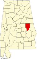
Camp Hill is located in eastern part of the county.
According to the U.S. Census Bureau, the town has a total area of 9.1 square miles (24 km2), of which 9.1 square miles (24 km2) is land and 0.11% is water.
The town is located in the east central part of the state along U.S. Route 280 and Alabama State Route 50. U.S. 280 runs along the southwestern boundary of the town, leading southeast 21 mi (34 km) to Opelika; northwest 8 mi (13 km) to Dadeville, the Tallapoosa County seat; and 21 mi (34 km) northwest to Alexander City, the largest city in Tallapoosa County. AL-50 runs through the center of town, leading northeast 18 mi (29 km) to LaFayette, the county seat of Chambers County, and southwest 24 mi (39 km) to the unincorporated community of Red Hill in Elmore County. Birmingham is 92 mi (148 km) northwest via U.S. 280.
Climate
The climate in this area is characterized by hot, humid summers and generally mild to cool winters. According to the Köppen Climate Classification system, Camp Hill has a humid subtropical climate, abbreviated "Cfa" on climate maps. [6]
| Climate data for Camp Hill, Alabama |
|---|
| Month | Jan | Feb | Mar | Apr | May | Jun | Jul | Aug | Sep | Oct | Nov | Dec | Year |
|---|
| Mean daily maximum °C (°F) | 14
(57) | 16
(60) | 19
(67) | 24
(76) | 28
(83) | 32
(89) | 33
(91) | 32
(90) | 31
(87) | 25
(77) | 19
(67) | 14
(58) | 24
(75) |
|---|
| Mean daily minimum °C (°F) | 1
(34) | 2
(35) | 6
(42) | 9
(49) | 14
(57) | 18
(65) | 19
(67) | 19
(67) | 17
(62) | 10
(50) | 4
(40) | 2
(35) | 10
(50) |
|---|
| Average precipitation mm (inches) | 130
(5.1) | 130
(5.1) | 150
(6.1) | 120
(4.7) | 94
(3.7) | 99
(3.9) | 130
(5.3) | 110
(4.3) | 91
(3.6) | 69
(2.7) | 84
(3.3) | 130
(5.2) | 1,340
(52.9) |
|---|
| Source: Weatherbase [7] |
Demographics
Historical population| Census | Pop. | Note | %± |
|---|
| 1890 | 366 | | — |
|---|
| 1900 | 686 | | 87.4% |
|---|
| 1910 | 896 | | 30.6% |
|---|
| 1920 | 952 | | 6.3% |
|---|
| 1930 | 1,131 | | 18.8% |
|---|
| 1940 | 1,147 | | 1.4% |
|---|
| 1950 | 1,296 | | 13.0% |
|---|
| 1960 | 1,270 | | −2.0% |
|---|
| 1970 | 1,554 | | 22.4% |
|---|
| 1980 | 1,628 | | 4.8% |
|---|
| 1990 | 1,415 | | −13.1% |
|---|
| 2000 | 1,273 | | −10.0% |
|---|
| 2010 | 1,014 | | −20.3% |
|---|
| 2020 | 1,006 | | −0.8% |
|---|
|
2000 census
At the 2000 census there were 1,273 people, 519 households, and 337 families in the town. The population density was 140.4 inhabitants per square mile (54.2/km2). There were 614 housing units at an average density of 67.7 per square mile (26.1/km2). The racial makeup of the town was 84.92% Black or African American, 14.38% White, 0.31% from other races, and 0.39% from two or more races. 1.02% of the population were Hispanic or Latino of any race. [10] Of the 519 households 30.3% had children under the age of 18 living with them, 29.5% were married couples living together, 30.1% had a female householder with no husband present, and 34.9% were non-families. 33.3% of households were one person and 12.7% were one person aged 65 or older. The average household size was 2.45 and the average family size was 3.09.
The age distribution was 29.4% under the age of 18, 8.9% from 18 to 24, 27.0% from 25 to 44, 22.2% from 45 to 64, and 12.6% 65 or older. The median age was 36 years. For every 100 females, there were 82.4 males. For every 100 females age 18 and over, there were 77.3 males.
The median household income was $20,655 and the median family income was $26,719. Males had a median income of $22,833 versus $20,038 for females. The per capita income for the town was $11,794. About 21.0% of families and 24.4% of the population were below the poverty line, including 34.8% of those under age 18 and 31.5% of those age 65 or over.
2010 census
At the 2010 census there were 1,014 people, 450 households, and 269 families in the town. The population density was 111.4 inhabitants per square mile (43.0/km2). There were 581 housing units at an average density of 63.8 per square mile (24.6/km2). The racial makeup of the town was 88.4% Black or African American, 10.2% White, 0.5% from other races, and 0.8% from two or more races. .7% of the population were Hispanic or Latino of any race. [11] Of the 450 households 21.8% had children under the age of 18 living with them, 26.9% were married couples living together, 28.7% had a female householder with no husband present, and 40.2% were non-families. 36.9% of households were one person and 12.0% were one person aged 65 or older. The average household size was 2.25 and the average family size was 2.96.
The age distribution was 22.1% under the age of 18, 10.1% from 18 to 24, 20.7% from 25 to 44, 32.6% from 45 to 64, and 14.5% 65 or older. The median age was 41.8 years. For every 100 females, there were 77.9 males. For every 100 females age 18 and over, there were 81.6 males.
The median household income was $18,663 and the median family income was $23,646. Males had a median income of $27,083 versus $16,694 for females. The per capita income for the town was $12,627. About 37.2% of families and 38.6% of the population were below the poverty line, including 55.8% of those under age 18 and 31.3% of those age 65 or over.
2020 census
As of the 2020 United States census, there were 1,006 people, 384 households, and 279 families residing in the town.
This page is based on this
Wikipedia article Text is available under the
CC BY-SA 4.0 license; additional terms may apply.
Images, videos and audio are available under their respective licenses.