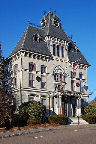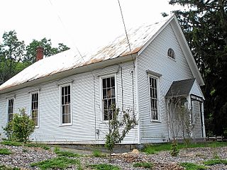
The Ashburnham Center Historic District is a historic district encompassing the core of the village center of Ashburnham, Massachusetts in the United States. It is a well-preserved industrial village that experienced its most significant period of growth in the mid-19th century. The district was added to the National Register of Historic Places in 1999.

The Canterbury Center Historic District is a historic district in Canterbury, Connecticut. The district is centered on the town green, located at the junction of Route 169 and Route 14. It has been the town center since 1705, and includes a fine assortment of 18th and early 19th-century architecture. It was listed on the National Register of Historic Places (NRHP) in 1998.

The Little Compton Commons Historic District, or Little Compton Commons, is a historic district in Little Compton, Rhode Island. It is a triangular area roughly bounded by School House Lane to the north, South Commons Road to the east, and Meeting House Lane to the south. Properties continue to the west on West Road.

The Brookfield Common Historic District encompasses a historically significant portion of the town center of Brookfield, Massachusetts. It is focused on the town common, which extends south from Main Street to Lincoln Street, and includes a dense cluster of houses on roads to its east, as well as properties on Main Street and the Post Road. The district includes more than 100 properties, including the Colonial Revival Town Hall, Banister Memorial Hall, and Romanesque Revival Congregation Church. The district was added to the National Register of Historic Places in 1990.

The Gardner Uptown Historic District is a historic district encompassing the former civic heart of Gardner, Massachusetts. The 65-acre (26 ha) area includes the old town common, an early cemetery, and a modest number of non-residential buildings among a larger number of houses. The area was the center of civic life from the incorporation of Gardner in 1785 until municipal functions were moved to West Gardner beginning in the late 1920s. The district was listed on the National Register of Historic Places in 1999.

The Harvard Center Historic District is a historic district encompassing the traditional village center of Harvard, Massachusetts, USA. The district is centered on the town common, a triangular grassy space bounded by Elm Street, Still River Road, and Ayer Road. The common is ringed by residences, civic and religious buildings, and a small commercial area. The common was laid out when the town was founded in 1732, and has grown, mainly in periods of growth at the late 18th and late 19th/early 20th centuries. Most of the village's buildings post-date 1831. The district was added to the National Register of Historic Places in 1997.

The Shrewsbury Historic District encompasses the historic early center of the town of Shrewsbury, Massachusetts. It consists of the town common, laid out in 1721 at what are now Main and Prospect Streets, and buildings adjacent or nearby. The district was declared locally in 1972, and was added to the National Register of Historic Places in 1976.

The Sharon Historic District is a historic district on both sides of N. Main Street from Post Office Square to School Street in Sharon, Massachusetts. The area includes the earliest formally laid out part of Sharon, when it was established as a parish of Stoughton in 1740. The district was listed on the National Register of Historic Places in 1975.

The Belchertown Center Historic District is a historic district which encompasses the historic village center of Belchertown, Massachusetts. Centered on Belchertown's 1,200-foot (370 m) common, the district includes 55 contributing properties along South Main Street, Maple Street, and a few adjacent streets. It was listed on the National Register of Historic Places in 1982.

The Main Street Historic District of Easthampton, Massachusetts encompasses the historic heart of the town, running along Main Street between Northampton and Center Streets. The area has been the civic and economic heart of the town since incorporation in 1785. Most of the commercial buildings date from the 1840s to the 1880s, and are built in an Italianate style. The housing stock of the district also includes Italianate styling, but there are also a number of Greek Revival structures. The major civic structures of the town are in the district, including the town hall, public library, and the First Congregational Church, which is the second for the congregation, a brick Romanesque Revival building dating to 1851. The district was added to the National Register of Historic Places in 1986.

The Pelham Town Hall Historic District encompasses the remaining municipal portion of the center of Pelham, Massachusetts as laid out between 1738 and 1743. It includes the Old Town Hall, built in 1743, which is claimed by the town to be the oldest continuously used town hall in the United States. It also includes the 1843 Greek Revival Congregational church, and the town's first cemetery, founded in 1739. The district was listed on the National Register of Historic Places in 1971.

The Hamilton Historic District encompasses the early historic center of Hamilton, Massachusetts. It includes properties at 540-700 and 563-641 Bay Road, extending along the road from Orchard Road in the south to Cutler Road in the north. Numerous Greek Revival buildings are located within the district including the First Congregational Church of Hamilton, built in 1843. The district was added to the National Register of Historic Places in 1973.

The Topsfield Town Common District encompasses the historic town common and surrounding buildings in Topsfield, Massachusetts. The common, established by 1650, is the traditional civic and religious center of the town, and is surrounded by houses dating from the 17th to 20th centuries, the town hall, library, and Congregational church. It was added to the National Register of Historic Places in 1976.

The Common Historic District is a historic district encompassing the civic and institutional heart of Reading, Massachusetts. The district is centered on the town common, at the intersection of Main and Salem Streets. The common has been communally owned since at least 1737, with the original burying ground to the north. In 1769 the area's first meeting house was built, giving the area a sense of identity separate from portions of Reading that would later be set off as Wakefield and North Reading. Since then the area has become a focal point for religious and civic institutions in the town.

The Sherborn Center Historic District is a historic district encompassing the civic heart and traditional center of Sherborn, Massachusetts. Its borders consist of Farm, Sawin, Washington, and North Main streets, Zion's Lane, and the CSX railroad tracks. The district, while predominantly residential in character, also contains an important cluster of civic and religious buildings. Notable among these are the Dowse Memorial Building, a Tudor Revival structure built in 1914 to house the town library; it now houses town offices. It was donated by William Bradford Home Dowse, who also funded the construction of the 1924 Memory Statue, the town's memorial to its war dead.

Norwichtown is a historic neighborhood in the city of Norwich, Connecticut. It is generally the area immediately north of the Yantic River between I-395 and Route 169.

The Canton Corner Historic District is a historic district encompassing the historic town center of Canton, Massachusetts. Centered on the junction of Pleasant and Washington Streets, it includes more than 25 properties and 170 acres (69 ha), whose architectural history spans 250 years of occupation and include the town's major civic buildings. The district was added to the National Register of Historic Places on September 9, 2009.

The Andover Center Historic District encompasses the historic town center of Andover, Connecticut. Centered on the junction of Hebron Road with Center Street and Cider Mill Road, the district includes houses dating to the town's early history, civic buildings including a library and former town hall, and the town's first cemetery. The district was listed on the National Register of Historic Places in 2003.

The Oxford Main Street Historic District is a national historic district encompassing the historic center of Oxford, Massachusetts. The 95-acre (38 ha) district extends along Main Street from Huguenot Street in the south to Front Street in the north. Its oldest buildings are residential houses built in the late 19th century, while most of the properties were built in the 19th century, with Greek Revival architecture predominating. The oldest commercial building, the John Wetherell Store, was built c. 1817, and now houses offices. The district includes four churches, including the 1793 Universalist church and 1829 First Congregational Church, and a number of municipal buildings, including the town hall, two schools, and the 1903 Classical Revival Charles Larned Memorial Library.

The Plainfield Center Historic District encompasses the historic rural village center of Plainfield, Massachusetts. The district is centered on a stretch of Main Street, between Church Lane and Central Street, and includes the town's oldest surviving houses, and its congregational church, set on the site of its first colonial-era meeting house, as well as the town hall (1847) and library (1925). The district was listed on the National Register of Historic Places in 2015.


