Dhangadhi is a sub-metropolitan city and the district headquarters of Kailali District in Sudurpashchim Pradesh of Nepal. It shares a border with Uttar Pradesh, India in the south, Godawari and Gauriganga Municipality in the North, Kailari Rural Municipality in the east and Kanchanpur District in the west. Dhangadhi is a sub-metropolis divided into 19 wards. It has a population of about 147,181 and thus is the 10th biggest city of Nepal. It has an area of 261.75 km2. It is one of the major cities of far-western region of Nepal along with Bhimdatta.

Chitwan District (Nepali: चितवन जिल्लाListen is one of 77 districts of Nepal, and is located in the southwestern part of Province No. 3 with Bharatpur, the fourth largest city of Nepal, as its district headquarters. It covers an area of 2,238.39 km2, and in 2011 had a population of 579,984 people. Bharatpur is a commercial and service centre of central south Nepal and major destination for higher education, health care and transportation in the region.

Siddharthanagar municipality is the administrative headquarter of Rupandehi District on the Outer Terai plains of Nepal, 265 km (165 mi) west of Kathmandu Nepal's capital. It is also the "Gateway of Lumbini." Lumbini, the birthplace of Gautama Buddha is 25 km to the west. Butwal is the nearest city around 21 km from Bhairahawa making the two major cities of the Butwal - Bhairahawa corridor. It borders India, Sonauli in Maharajganj district of Uttar Pradesh. The city is among the major industrial power house in the country impacting major economic aspects of Nepal. It has the second largest rate of border trade with India after Birgunj border in the country. Bhairahawa is under the administration of Siddharthanagar Nagarpalika (municipality) so often known as Siddharthanagar.

Butwal officially Butwal Sub-Metropolitan is one of the twin cities of rapidly growing Butwal-Bhairahawa urban agglomeration in Nepal. It is the largest sub-metropalitan city in Nepal. It lies in Province No. 5, Rupandehi District and also the interim capital of province 5 of Nepal. It is also home to the administrative headquarters of Lumbini Zone. This city stands beside the bank of Tilottama River Tinau River, and at the northern edge of the Terai plain below the Siwalik Hills. Its name, Butwal was derived from Batauli Bazaar, the town's oldest residential area which is located on the western bank of Tinau river. Butwal is a lively city comprising the Panoramic views of the combination of hills and plains.

Gulariya is a municipality and headquarters of Bardiya District in the Bheri Zone of south-western Nepal. It is located in the plains of the Terai region near the southern border with the Bahraich district, Uttar Pradesh state of India. It is 35 kilometers west of Nepalgunj and about 10 km north of Murtiha Transit or railway station, India.

Besishahar is a municipality and the district headquarters of Lamjung District in Gandaki Pradesh, Nepal. The Besishahar Municipality was formed by merging the existing Village Development Committees i.e. Besishahar, Gaunshahar, Udipur, Chandisthan, Baglungpani, Bajhakhet, Hiletaksar and Chiti and have 11 wards. Here are different castes and religions. So they have different culture. This municipality has a sub-tropical climate with deciduous forests. Annapurna II, Machhapuchhre, Lamjung Himal can be viewed from north of Besishahar Municipality.

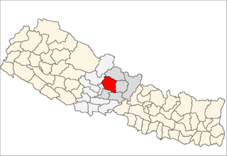
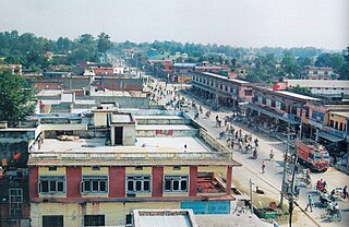
Bhimeshwar,, is a municipality in north-eastern Nepal and the headquarters of Dolakha District in Province No. 3 that was established in 1997 by merging the former Village development committees Charikot, Dolakha Town, Makaibari and Mati. At the time of the 2011 Nepal census it had a population of 32,486 people living in 8,639 individual households. The town is located at an altitude of 1554 metres (5101 feet). The name of the district Dolakha came from Dolakha Town situated north-east of the headquarters Charikot Bazaar.

Myanglung is a municipality and the district headquarters of Terhathum District of Province No. 1 in eastern Nepal. The municipality is situated at an elevation of about 1500 metres above sea level. Myanglung was converted into a municipality from a village development committee on 18 May 2014, merging the existing village development committees of Myanglung, Piple, Jirikhimti, Ambung, Sabla and Tamphula. According to the census of 2011 the total population of Myanglung is 19,659 including five VDCs.
Kristinachnechaur is a former Village Development Committee south of Pokhara in Kaski District in the Gandaki Zone of northern-central Nepal. In 2015, it was annexed to Pokhara. At the time of the 1991 Nepal census it had a population of 5,757 persons living in 1,145 individual households.
Saimarang is a town and Village Development Committee in Kaski District in the Gandaki Pradesh of Western Nepal. At the time of the 2011 Nepal census it had a population of 1,171 persons living in 309 individual households. Saimarang owns a famous Temple Bhagawati Temple and hill known as Lamtari there is a famous Devi tample called Lamtari Mai which is in front of Pokhara Valley. We can see the Annapurna Himalayan range at the back and Begnash ,Rupa and Fewa lake in the front. Also there are several adventures such as caves, rocky hills. Local people in Warchowk and Togi are working hard to make the Saimarang VDC a good place for Adventurous Tourism. The people there are very helpful.

Sarangkot is a former Village Development Committee west of Pokhara in Kaski District Gandaki Zone. In 2015, it was annexed to Pokhara 26. At the time of the 1991 Nepal census it had a total population of 5,060 with 1,010 individual households.
Bhalam was a Village Development Committee, north of Pokhara in the Valam Municipality of Kaski District, situated in the Gandaki Zone of the Western Development Region, located in northern-central Nepal. In 2015, the VDC was amalgamated with Pokhara.
Kaskikot, commonly known as Kaski, is a Ward no. 24 of the Pokhara Lekhnath metropolitan city. It was earlier a part of the village development committee in Kaski District, a region in northern-central Nepal.
Hariwan is a Municipality in Sarlahi District in Province No. 2 of south-eastern Nepal. The formerly village development committee was transformed into municipality merging the existing village development committees i.e. Atrouli, Sasapur, Ghurkauli and Hariwon on May 18, 2014. At the time of the 1991 Nepal census it had a population of 11,912 people living in 2276 individual households.
Bhiman is a town in Kamalamai Municipality Ward no. 11 in Sindhuli District in the Janakpur Zone of south-eastern Nepal. At the time of the 1991 Nepal census it had a population of 7609 people living in 1389 individual households.
Meghauli is a village and former Village Development Committee that is now part of Bharatpur Metropolitan City in Province No. 3 of central Nepal.
Bardaghat [नेपाली: बर्दघाट] is a Municipality in Nawalparasi District in the Lumbini Zone of southern Nepal. It is situated in the lap of Chure range. This municipality was established on 18 May 2014 by merging existing Makar and Panchanagar VDCs. Again during the local election, the neighbouring VDC Dawanne devi and some part of Dhurkot,Jamuniya,Rupauliya were merged in it. It has a population of 55,382 with the area of 162.05 km2. It is an emerging town of Nawalparasi that is developing rapidly.