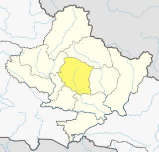
Kaski District (Nepali: कास्की जिल्ला[kaski], a part of Gandaki Province, is one of the seventy-seven districts of Nepal. The name is disambiguated from Kaskikot, the ancient Kaski Kingdom.
Hathipur Harbara is a village development committee in Dhanusa District in the Janakpur Zone of south-eastern Nepal. At the time of the 1991 Nepal census it had a population of 3,130 persons living in 687 individual households.
Begnas is a town and Village Development Committee in Kaski District in the Gandaki Zone of northern-central Nepal. At the time of the 1991 Nepal census it had a population of 6,803 persons living in 1,420 individual households.

Bhachok is a village and Village Development Committee in Kaski District in the Gandaki Zone of northern-central Nepal. At the time of the 1991 Nepal census it had a population of 2,084.
Bharat Pokhari is a town in Kaski District in the Gandaki Province of northern-central Nepal. It lies at the height of 657 to 1600 meters above sea level. At the time of the 1991 Nepal census it had a population of 8,889 persons living in 1782 individual households. Bharat Pokhari was a Village Development Committee, and it is merged with Lekhnath Municipality.
Chapakot is a village and Village Development Committee in Kaski District in the Gandaki Zone of northern-central Nepal. At the time of the 1991 Nepal census it had a population of 2,966 persons residing in 574 individual households.
Deurali is a Village Development Committee in Kaski District of the Gandaki province of north-central Nepal. At the time of the 1991 Nepal census, it had a population of 2,882. The base camp of Mount Machapuchare is situated at a 6 hours uphill trek from the village.

Dhital is a village development committee in Kaski District in the Gandaki Zone of northern-central Nepal. At the time of the 1991 Nepal census it had a population of 4,121 persons living in 862 individual households. Dhital is near Annapurna Himalaya and it is on the route of trekking.

Ghachok is a village and Village Development Committee in Kaski District in the Gandaki Zone of northern-central Nepal. At the time of the 1991 Nepal census it had a population of 2,322 persons living in 449 individual households.

Kahun is a former village and Village Development Committee in Kaski District in the Gandaki Zone of northern-central Nepal. In 2015, it was annexed to Pokhara. At the time of the 1991 Nepal census it had a population of 2,211.
Kristinachnechaur is a former Village Development Committee south of Pokhara in Kaski District in the Gandaki Zone of northern-central Nepal. In 2015, it was annexed to Pokhara. At the time of the 1991 Nepal census it had a population of 5,757 persons living in 1,145 individual households.

Lwangghale or Lwang-Ghalel is a town and Village Development Committee in Kaski District in the Gandaki Zone of northern-central Nepal. At the time of the 1991 Nepal census it had a population of 4,758 persons living in 973 individual households.
Mijuredanda is a town and Village Development Committee in Kaski District in Gandaki Province of northern-central Nepal. At the time of the 1991 Nepal census it had a population of 4,394 persons living in 907 individual households.

Namarjung is a village and Village Development Committee in Kaski District in the Gandaki Zone of northern-central Nepal. At the time of the 1991 Nepal census it had a population of 1,553 persons living in 330 individual households.

Parche is a town and Village Development Committee in Kaski District in the Gandaki Zone of northern-central Nepal. At the time of the 1991 Nepal census it had a population of 3,182 persons living in 669 individual households.
Rakhi, Nepal is a town and Village Development Committee in Kaski District in the Gandaki Zone of northern-central Nepal. At the time of the 1991 Nepal census it had a population of 4,229 persons living in 903 individual households.

Rupakot is a town and Village Development Committee in Kaski District in the Gandaki Zone of northern-central Nepal. At the time of the 1991 Nepal census it had a population of 3,785 persons residing in 789 individual households.
Shisuwa is a town and once a Village Development Committee in Kaski District in the Gandaki Zone of northern-central Nepal. At the time of the 1991 Nepal census it had a population of 12,127.

Sildujure is a town and Village Development Committee in Kaski District in the Gandaki Zone of northern-central Nepal. At the time of the 1991 Nepal census it had a population of 3,724 persons living in 746 individual households.

Thumakodanda is a town and Village Development Committee in Kaski District in the Gandaki Zone of northern-central Nepal. At the time of the 1991 Nepal census it had a population of 4,301 persons living in 857 individual households.


