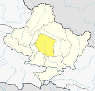
Kaski District, a part of Gandaki Province, is one of the seventy-seven districts of Nepal. The name is disambiguated from Kaskikot, the ancient Kaski Kingdom.
Jaubari was a Village Development committee in Gorkha District in the Gandaki Zone of northern-central Nepal. At the time of the 1991 Nepal census it had a population of 3,398 and had 658 houses in the town. It is located at the western part of Gorkha district. Marichman Shrestha, former VDC chairperson, and social worker is from Jaubari-7, Gorkha. Freedom fighter late Rohini Dev Bhatta is also from the village as well as his daughter Dr. Madhabi Bhatta, who is a former commissioner of the Truth and Reconciliation Commission, Nepal. Jaubari is one of the major hubs for education and health in Gorkha District. Paropakar Adarsha Uccha Madhyamik Vidhalaya is located in Jaubari VDC of Gorkha.
Kerabari is a Village Development Committee in Gorkha District in the Gandaki Zone of northern-central Nepal. At the time of the 1991 Nepal census it had a population of 2,692 and had 535 houses in the village
Begnas is a town and Village Development Committee in Kaski District in the Gandaki Zone of northern-central Nepal. At the 1991 Nepal census, Begnas had a population of 6,803 in 1,420 individual households.
Bharat Pokhari is a town in Kaski District in the Gandaki Province of northern-central Nepal. At the 1991 Nepal census, it had a population of 8,889 persons living in 1782 individual households. Bharat Pokhari was a Village Development Committee, and it was merged with Lekhnath Municipality.
Chapakot is a village and Village Development Committee in Kaski District in the Gandaki Zone of northern-central Nepal. At the 1991 Nepal census, it had a population of 2,966 residents in 574 individual households.
Deurali is a Village Development Committee in Kaski District of the Gandaki province of north-central Nepal. At the time of the 1991 Nepal census, it had a population of 2,882. The base camp of Mount Machapuchare is situated at a 6-hour uphill trek from the village.

Dhital, formerly a village development committee in Kaski District, Gandaki Zone, is now located in Machhapuchhre rural municipality, ward number 6 in Kaski district, Gandaki Province, Nepal.The name Dhital Dhi+Tal Dhi means nepali word धि and Tal means lake it is believed that there was a lake in 18th century. At the 1991 Nepal census, it had a population of 4,121 persons in 862 individual households. Dhital is near Annapurna Himalaya and on its trekking route.
Hansapur is a town and Village Development Committee in Kaski District in the Gandaki Zone of northern-central Nepal. At the 1991 Nepal census, it had a population of 4,761 persons in 956 individual households.
Kristinachnechaur is a former Village Development Committee south of Pokhara in Kaski District in the Gandaki Zone of northern-central Nepal. In 2015, it was annexed to Pokhara. At the 1991 Nepal census, it had a population of 5,757 persons in 1,145 individual households.
Mala is a village and Village Development Committee in Kaski District in the Gandaki Zone of northern-central Nepal. At the time of the 1991 Nepal census it had a population of 2,704 persons living in 510 individual households.
Mijuredanda is a town and Village Development Committee in Kaski District in Gandaki Province of northern-central Nepal. At the time of the 1991 Nepal census it had a population of 4,394 persons living in 907 individual households.
Parche is a town and Village Development Committee (VDC) in Kaski District in the Gandaki Zone of northern-central Nepal. At the 1991 Nepal census, it had a population of 3,182 persons in 669 individual households.
Rakhi, Nepal is a town and Village Development Committee (VDC) in Kaski District in the Gandaki Zone of northern-central Nepal. At the 1991 Nepal census, the VDC had a population of 4,229 persons in 903 individual households.
Saimarang is a town and Village Development Committee in Kaski District in the Gandaki Province of Western Nepal. At the time of the 2011 Nepal census it had a population of 1,171 persons living in 309 individual households. Saimarang owns a famous Temple Bhagawati Temple and hill known as Lamtari there is a famous Devi tample called Lamtari Mai which is in front of Pokhara Valley. The Annapurna Himalayan range can be seen at the back of the village, and Begnash, Rupa and Fewa lake in the front. Also there are several adventures such as caves, rocky hills. Local people in Warchowk and Togi are working hard to make the Saimarang VDC a good place for Adventurous Tourism. The people there are very helpful.
Shisuwa is a town and once a Village Development Committee in Kaski District in the Gandaki Zone of northern-central Nepal. At the time of the 1991 Nepal census it had a population of 12,127.
Siddha is a town and Village Development Committee in Kaski District in the Gandaki Zone of northern-central Nepal. At the time of the 1991 Nepal census it had a population of 3,322 persons living in 672 individual households.
Sildujure is a town and Village Development Committee in Kaski District in the Gandaki Zone of northern-central Nepal. At the time of the 1991 Nepal census it had a population of 3,724 persons living in 746 individual households.
Thumki is a town and Village Development Committee in Kaski District in the Gandaki Zone of northern-central Nepal. At the time of the 1991 Nepal census it had a population of 3,946 persons living in 778 individual households.
Bharte is a village development committee in Lamjung District in the Gandaki Zone of northern-central Nepal. At the time of the 1991 Nepal census it had a population of 2591 people living in 544 individual households.


