
Pokhara is a metropolitan city in central Nepal, which serves as the capital of Gandaki Province and the tourism capital of Nepal. It is the second most populous city of Nepal after Kathmandu, with 599,504 inhabitants living in 120,594 households in 2021. It is the country's largest metropolitan city in terms of area. The city also serves as the headquarters of Kaski District. Pokhara is located 200 kilometres west of the capital, Kathmandu. The city is on the shore of Phewa Lake, and sits at an elevation of approximately 822 m. The Annapurna Range, with three out of the ten highest peaks in the world—Dhaulagiri, Annapurna I and Manaslu—is within 15–35 mi (24–56 km) of the valley.

Kaski District, a part of Gandaki Province, is one of the seventy-seven districts of Nepal. The name is disambiguated from Kaskikot, the ancient Kaski Kingdom.

Butwal, officially Butwal Sub-Metropolitan City ,previously known as Khasyauli, is a sub-metropolitan city and economic hub in Lumbini Province in West Nepal. Butwal has a city population of 195,054 as per the 2021 AD Nepal census.
Birendranagar officially Birendranagar Municipality is a city in Surkhet District in Karnali Province of Nepal. It is the capital city of Karnali province as well as the district headquarter of Surkhet district. As of March 2022, Birendranagar has a population of 154,886, making it the 17th most populous city of Nepal. Birendranagar is the largest city of Karnali province and 7th largest in Western Nepal. It is one of the fastest growing cities of Nepal and is on two national highways, Ratna Highway and Karnali Highway. It is one of the constituent city of the Ratna Highway Metropolitan Areas along with Nepalgunj and Kohalpur. Birendranagar compromises of panoramic view of Mahabharata and Chure ranges and the plain of the inner Terai. A major trade center in mid-western Nepal, Birendranagar is considered the most expensive city to live in Nepal.
Arba Vijaya is a very old residential area in Pokhara sub-metropolitan city in Kaski District in the Gandaki Zone of northern-central Nepal. At the 1991 Nepal census, it had a population of 3,446 persons living in 714 individual households. The village is located in the Annapurna Himalayan region. It can be reached from Pokhara by 2 hours of walking or a 30-minute drive. The village has many natural sources, most of people living at villages are Brahmin, chettri, Gurung, Bishwakarma, Pariyar caste.
Armala is a town and sub-metropolitan city in the Kaski District of the Gandaki Zone of northern-central Nepal. In the 1991 Nepal census, it had a population of 4,921 people living in 1,012 households.

Bhadaure Tamagi is a town and Village Development Committee in Kaski District in the Gandaki Zone of northern-central Nepal. At the 1991 Nepal census, it had a population of 3,543 persons in 692 individual households.

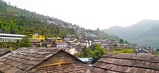
Ghandruk is a Village Development Committee in the Kaski District of the Gandaki Province of Nepal. Situated 32 km north-west to Pokhara, the village is readily accessible by public buses and private taxis from the provincial headquarter. At the time of the 1991 Nepal census, it had a population of 4,748 residents in 1,013 individual households.
Hemja is a former Village Development Committee in the north of Pokhara in Kaski District in the Gandaki Province of northern-central Nepal. In 2014, Hemja was annexed to Pokhara City as ward number 27. Hemja is now an administrative part of Pokhara Municipality ward #25. At the 2011 Nepal census, it had a population of 12,262 persons in 3,019 households.
Kahun is a former village and Village Development Committee in Kaski District in the Gandaki Zone of northern-central Nepal. In 2015, it was annexed to Pokhara. At the time of the 2011 Nepal census it had a population of 14,716.
Saimarang is a town and Village Development Committee in Kaski District in the Gandaki Province of Western Nepal. At the time of the 2011 Nepal census it had a population of 1,171 persons living in 309 individual households. Saimarang owns a famous Temple Bhagawati Temple and hill known as Lamtari there is a famous Devi tample called Lamtari Mai which is in front of Pokhara Valley. The Annapurna Himalayan range can be seen at the back of the village, and Begnash, Rupa and Fewa lake in the front. Also there are several adventures such as caves, rocky hills. Local people in Warchowk and Togi are working hard to make the Saimarang VDC a good place for Adventurous Tourism. The people there are very helpful.

Sarangkot is Ward 18 of Pokhara, Kaski District, Nepal, after it was merged into the city in 2015. It is a popular tourist destination for those who arrive in Pokhara. At the 1991 Nepal census it had a total population of 5,060 with 1,010 individual households.
Shisuwa is a town and once a Village Development Committee in Kaski District in the Gandaki Zone of northern-central Nepal. At the time of the 1991 Nepal census it had a population of 12,127.
Bhalam was a Village Development Committee, north of Pokhara in the Valam Municipality of Kaski District, situated in the Gandaki Zone of the Western Development Region, located in northern-central Nepal. In 2015, the VDC was amalgamated with Pokhara. Bhalam is located around 950 m above sea level, 5 km from the city of Pokhara.
Kaskikot, commonly known as Kaski, is a Ward no. 24 of the Pokhara metropolitan city. It was earlier a part of the village development committee in Kaski District, a region in northern-central Nepal.
Sunkhani is a ward committee located in Kalinchowk Rural Municipality of Dolakha District in the Bagmati Province of north-eastern Nepal. Formally it was a Village Development Committee of Dolakha District. Sunkhani consists of two ward committees. The office of Kalinchowk Rural Municipality also lies in Sunkhani ward number 08.
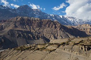
Tangbe is a small village in the village development committee of Chhusang in the Mustang District of Nepal. It is located on a promontory with a good view over the Kali Gandaki Gorge on the Upper Mustang trekking route, between Kagbeni and Chhusang.

Pokhara Shanti Stupa is a Buddhist monument on Anadu Hill of the former Pumdi Bhumdi Village Development Committee, in the district of Kaski, Nepal.
Serachaur सेराचौर is a village which is located in Kaski District, Gandaki Province, Nepal. The word Sera refers to a plain land which is used to farm and supply food to a palace and Chaur means a grassy land. First settlers of this village were Adhikari Family. It is a part of the Annapurna Gaunpalika ward number- 2, Kaski, Nepal. Pastly the village was part of Dhikurpokhari V.D.C but later the Ministry of Federal Affairs and Local Development (Nepal) dissolved the existing village development committees and announced the establishment of this new local body. Visitors can take the Baglung Highway, Kaskikot road and other existing trails to reach here. Concrete pavement is recent installation to the road.
Annapurna Rural Municipality, Kaski is a Gaunpalika in Kaski District in Gandaki Province of Nepal named after the Annapurna Mountain. On 12 March 2017, the Government of Nepal implemented a new local administrative structure. With the implementation of the new local administrative structure, VDSs have been replaced with municipal and village councils. Annapurna Gaupalika is one of these 753 local units.


