
Kaski District, a part of Gandaki Province, is one of the seventy-seven districts of Nepal. The name is disambiguated from Kaskikot, the ancient Kaski Kingdom.
Lekhnath was a municipality in Kaski District in the Gandaki Province of northern-central Nepal, about 180 km west of Kathmandu. It has now been merged into Pokhara sub-metropolitan city to form Pokhara metropolis. Pokhara Valley was politically divided between Pokhara city and Lekhnath which occupied the eastern half of the valley. There were 18 wards in total in Lekhnath municipality before the merger, with a VDC Bharat Pokhari that had been added at a later stage.
Khairang is a Village Development Committee in Bhojpur District in the Kosi Zone of eastern Nepal. At the time of the 1991 Nepal census it had a population of 3050 persons residing in 533 individual households.
Begnas is a town and Village Development Committee in Kaski District in the Gandaki Zone of northern-central Nepal. At the 1991 Nepal census, Begnas had a population of 6,803 in 1,420 individual households.
Chapakot is a village and Village Development Committee in Kaski District in the Gandaki Zone of northern-central Nepal. At the 1991 Nepal census, it had a population of 2,966 residents in 574 individual households.
Deurali is a Village Development Committee in Kaski District of the Gandaki province of north-central Nepal. At the time of the 1991 Nepal census, it had a population of 2,882. The base camp of Mount Machapuchare is situated at a 6-hour uphill trek from the village.
Dhikurpokhari is a suburb and former Village Development Committee in Kaski District in the Gandaki Province of northern-central Nepal. At the 1991 Nepal census, it had a population of 7,392 persons in 1,427 individual households.

Dhital, formerly a village development committee in Kaski District, Gandaki Zone, is now located in Machhapuchhre rural municipality, ward number 6 in Kaski district, Gandaki Province, Nepal. At the 1991 Nepal census, it had a population of 4,121 persons in 862 individual households. Dhital is near Annapurna Himalaya and on its trekking route.
Ghachok is a village and Village Development Committee in Kaski District in the Gandaki Zone of northern-central Nepal. At the 1991 Nepal census, it had a population of 2,322 persons in 449 individual households.
Kristinachnechaur is a former Village Development Committee south of Pokhara in Kaski District in the Gandaki Zone of northern-central Nepal. In 2015, it was annexed to Pokhara. At the 1991 Nepal census, it had a population of 5,757 persons in 1,145 individual households.
Mala is a village and Village Development Committee in Kaski District in the Gandaki Zone of northern-central Nepal. At the time of the 1991 Nepal census it had a population of 2,704 persons living in 510 individual households.
Mijuredanda is a town and Village Development Committee in Kaski District in Gandaki Province of northern-central Nepal. At the time of the 1991 Nepal census it had a population of 4,394 persons living in 907 individual households.
Nirmal pokhari is a town and Village Development Committee in Kaski District in the Gandaki Zone of northern-central Nepal. At the time of the 1991 Nepal census it had a population of 4,386 persons living in 897 individual households.
Parche is a town and Village Development Committee (VDC) in Kaski District in the Gandaki Zone of northern-central Nepal. At the 1991 Nepal census, it had a population of 3,182 persons in 669 individual households.

Rupakot is a town and Village Development Committee in Kaski District in the Gandaki Zone of northern-central Nepal. At the time of the 1991 Nepal census it had a population of 3,785 persons residing in 789 individual households.
Shisuwa is a town and once a Village Development Committee in Kaski District in the Gandaki Zone of northern-central Nepal. At the time of the 1991 Nepal census it had a population of 12,127.
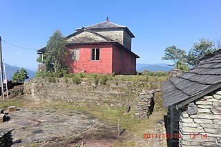
Kaskikot, commonly known as Kaski, is a Ward no. 24 of the Pokhara metropolitan city. It was earlier a part of the village development committee in Kaski District, a region in northern-central Nepal.
Pokhari Bhanjyang is a village development committee in Tanahun District in the Gandaki Zone of central Nepal. At the time of the 1991 Nepal census it had a population of 4082.
Rupakot is a village development committee in Tanahu District in Gandaki Province of central Nepal. At the time of the 1991 Nepal census it had a population of 4765 people living in 937 individual households. The VDC has been merged with existing Bhanu village development committees(VDCs), Barbhanjyang village development committees (VDCs) Tanahunsur Village Development Committee, Purkot VDC, Mirlung VDC, Satiswara VDC, Risti VDC, Basantapur VDC and Chok Chisapani VDC on 19 September 2015 to form Bhanu Municipality.
Marmaparikhanda is a village development committee in Salyan District in the Rapti Zone of western-central Nepal. At the time of the 1991 Nepal census it had a population of 3530 people living in 597 individual households.
