Heritage Hill State Historical Park | |
---|---|
IUCN category V (protected landscape/seascape) | |
Location | Brown County, Wisconsin |
Coordinates | 44°28′26″N88°1′59″W / 44.47389°N 88.03306°W |
Area | 56 acres (23 ha) |
Authorized | 1977 |
Visitors | 60,000 |
Governing body | Heritage Hill Foundation |
Website | heritagehillgb |
Heritage Hill State Historical Park, is a 56-acre open-air museum located in Allouez, Wisconsin. A Wisconsin state park, the site is operated by a non-profit organization called the Heritage Hill Corporation in partnership with the Wisconsin Department of Natural Resources (DNR). The Heritage Hill Corporation operates, maintains and develops the park under terms of a lease with the DNR.
The site contains 26 historical and reproduction structures, mostly endangered historic buildings moved from other locations plus a few modern reconstructions. The Park is divided into four main areas: The Fur Trade, representing the first contact and fur trade industry in Wisconsin; The Growing Community, representing Green Bay's beginnings as a burgeoning metropolis in the late 19th century; The Belgian Farmstead, a representation of immigrant farming communities in the early 20th century; and Fort Howard, a reconstruction of how Fort Howard would have stood on the west side of Green Bay in the mid-19th century.
The park is open year-round with the majority of programming occurring May—September. The park is staffed by costumed guides called "interpreters".
Previously the property was used as a prison farm with orchards tended by prison labor. Construction of highway 172 across the Fox River cut off the farm from the prison and the land fell under the jurisdiction of the Wisconsin Department of Natural Resources. In 1972 the DNR Natural Resources Board approved the establishment of a historical park. In a meeting held at Cotton House on July 18, 1972, the name Heritage Hill State Historical Park was chosen for the new historic site. At the same time a proposed development plan and an opening date of May 1, 1977, was selected. [1] Over the next 20 years more than 25 buildings and 15 acres of land were added to the park. Preservation of the buildings and its artifacts and the interpretation of the history of Northeastern Wisconsin and its people remains a primary objective.
Heritage Hill has more than 9,000 artifacts in its collection, mostly displayed in the buildings. Some of this collection is on loan from the Green Bay-De Pere Antiquarians, Brown County Historical Society, and Wisconsin Historical Society. The collection includes original artwork, books, clothing and furnishings dating from the 17th century to present. One unique piece displayed in the Tank Cottage is a hand-painted screen that the Tank family brought with them when they moved to Wisconsin in the late 1600s.
In 2006, the Betsy Hendrickson and Lucyanna Hitch Education Center was constructed. The center allows year-round use for education programs as well as business meetings, receptions, and parties. Education programs draw about 18,000 students per year. Students acquire a first hand look at how their early relatives worked and played. The programs meet benchmarks and standards in history and social studies.
Six of the site's structures are listed on the National Register of Historic Places. The park's Belgian Farmstead and Moravian church were listed on the National Register but were delisted upon being relocated. Seven other buildings in the park collection are modern replicas constructed on-site.
Structure name and location | Image | Original location | Original build date | Moved to park | Construction/style/notes |
---|---|---|---|---|---|
Allouez Town Hall 44°28′33″N88°02′05″W / 44.475789°N 88.034823°W | 2143 South Webster, Allouez | 1912 | 1977 | Wood framed with gable roof [2] | |
Baird Law Office 44°28′32″N88°02′04″W / 44.475627°N 88.034484°W | Main and Monroe Green Bay | 1835 | 1975 | Greek Revival [3] Listed on the NRHP in 1970 (#70000025) | |
Bark Chapel 44°28′29″N88°02′18″W / 44.474768°N 88.038225°W | Constructed on site | 1981 | N/A | Sapling framework with bark covering, replica of the first church in Wisconsin which was about 1 mile south of its location [4] | |
Belgian Farmstead Farmhouse 44°28′24″N88°01′58″W / 44.473360°N 88.032772°W | Rosiere | 1872 | 1984 | Log with brick veneer [5] Listed on the NRHP as the Massart Farmstead (#80000143) but was removed in 1984. | |
Belgian Farmstead Dairy Barn 44°28′23″N88°01′59″W / 44.473165°N 88.033144°W | Rosiere | 1900 | 1984 | Log/astylistic utilitarian [6] | |
Belgian Farmstead Horse Barn 44°28′24″N88°01′57″W / 44.473246°N 88.032473°W | Rosiere | 1900 | 1984 | Log/astylistic utilitarian [7] | |
Belgian Farmstead chicken coop 44°28′23″N88°01′57″W / 44.473085°N 88.032492°W | Rosiere | 1872 | 1984 | Log/astylistic utilitarian [8] | |
Belgian Farmstead pig house 44°28′23″N88°01′59″W / 44.473035°N 88.033194°W | Rosiere | 1872 | 1984 | Log/astylistic utilitarian [9] | |
Belgian Farmstead outhouse 44°28′24″N88°01′59″W / 44.473329°N 88.033078°W | Rosiere | 1872 | 1984 | Astylistic utilitarian [10] | |
Belgian Farmstead summer kitchen 44°28′24″N88°01′59″W / 44.473355°N 88.033008°W | Rosiere | 1902 | 1984 | Cut stone [11] | |
Belgian Farmstead Roadside Chapel 44°28′25″N88°01′57″W / 44.473507°N 88.032392°W | Duvall | 1871 | 1983 | Wood frame [12] | |
Belgian Farmstead windmill 44°28′24″N88°01′59″W / 44.473244°N 88.033063°W | Duvall | 1871 | 1983 | Metal [13] | |
Blacksmith Shop 44°28′32″N88°02′04″W / 44.475521°N 88.034400°W | Danz and University Green Bay | 1850 | 1976 | Wood frame [14] | |
Cheese Factory 44°28′25″N88°01′58″W / 44.473673°N 88.032846°W | Slovan [15] | 1894 | 1994 | Wood framed | |
Cotton House 44°28′25″N88°01′49″W / 44.473730°N 88.030345°W | Beaupre and Webster Green Bay | 1845 | 1938 | Timber frame/Greek Revival [16] Listed on the NRHP in 1970 (#70000026) | |
Court House 44°28′34″N88°02′14″W / 44.476039°N 88.037164°W | Door County | before 1814 | 1976 | Full log with dovetail joints | |
Court House Monument 44°28′33″N88°02′15″W / 44.475722°N 88.037461°W | At current location | 1934 | Stone and Mortar This monument marks the site of the first court house in 1825 | ||
Fort Howard Guard Building 44°28′26″N88°02′03″W / 44.473936°N 88.034135°W | Kellogg and Chestnut Green Bay | 1833 [note 1] | 2014 | Half of this structure is a restoration of the original guard building from the fort and half is a replica. The reconstruction in 2014 at the park was done in conjunction with renovations to the Commanding Officer's Quarters. [17] | |
Fort Howard Hospital 44°28′27″N88°02′04″W / 44.474241°N 88.034359°W | Kellogg and Chestnut Green Bay | 1835 | 1975 | Timber frame w/ clapboards/Federal [18] Listed on the NRHP in 1979 (#71001075) Hospital was originally constructed as an addition to the Ward Building but they were split when they were moved in the 1930s. The reconstruction in 1975 at the park recombined the buildings. | |
Fort Howard Ward Building 44°28′27″N88°02′03″W / 44.474170°N 88.034197°W | Kellogg and Chestnut Green Bay | 1816 | 1975 | Timber frame w/ clapboards/Federal [19] Listed on the NRHP in 1979 (#72001547) | |
Fort Howard Post School 44°28′28″N88°02′02″W / 44.474337°N 88.033840°W | Constructed on site | 1982 | N/A | Federal | |
Fort Howard Company Kitchen/Orderly Room 44°28′27″N88°02′01″W / 44.474252°N 88.033650°W | Kellogg and Chestnut Green Bay | 1816 | 1975 | Federal - timber frame [20] Listed on the NRHP in 1979 (#72001548) This structure is listed on the NRHP as Fort Howard Officer’s Quarters. The park currently interprets this building as the Kitchen/Orderly room. [21] | |
Fort Howard Officer's Quarters 44°28′26″N88°02′01″W / 44.473917°N 88.033696°W | Constructed on site | 1982 | N/A | Federal [22] | |
Franklin Hose Company 44°28′30″N88°02′02″W / 44.474882°N 88.033840°W | Main and Irwin Green Bay | 1870 | 1975 | Wood frame [23] | |
Fur Trader's Cabin 44°28′31″N88°02′17″W / 44.475220°N 88.038091°W | 739 Adams St Green Bay | 1810 | 1975 | Pièce-sur-pièce à coulisse [24] | |
Maple Sugaring House 44°28′32″N88°02′15″W / 44.475621°N 88.037581°W | Constructed on site | 1981 | N/A | Log | |
Moravian Church 44°28′29″N88°01′56″W / 44.474732°N 88.032199°W | Moravian St Green Bay | 1842 | 1980 | Timber framed Gothic Revival [25] Listed on the NRHP in 1972 as the East Moravian Church (#72001588) but later delisted in 1983. | |
Print Shop 44°28′32″N88°02′03″W / 44.475458°N 88.034302°W | Constructed on site | 1976 | N/A | Wood framed | |
Tank Cottage 44°28′32″N88°02′09″W / 44.475549°N 88.035927°W | On Fox River at 8th Street Green Bay | 1776 | 1976 | Pièce-sur-pièce à coulisse [26] Listed on the NRHP in 1970 (#70000028). This building is the oldest standing house in Wisconsin [27] | |
Tank barn 44°28′32″N88°02′08″W / 44.475621°N 88.035521°W | Constructed on site | N/A | |||
Tomb of the Unknown Soldier 44°28′25″N88°01′51″W / 44.473606°N 88.030844°W | At current location | 1938 | N/A | Dry-stacked limestone | |
Victorian Bandstand 44°28′31″N88°02′05″W / 44.475200°N 88.034720°W | Constructed on site | 1982 | N/A | Victorian | |
YMCA Library 44°28′31″N88°02′03″W / 44.475380°N 88.034056°W | 810 Chestnut St Green Bay | 1872 | 1977 | Wood framed w/ brick veneer/Greek Revival [28] | |
Visitors center 44°28′24″N88°01′53″W / 44.473465°N 88.031448°W | Constructed on site | N/A | |||
Maintenance/restoration building 44°28′30″N88°01′58″W / 44.475031°N 88.032816°W | Constructed on site | N/A |
Old World Wisconsin is an open-air museum located near Eagle, in Waukesha County, Wisconsin, United States. It depicts housing and the daily life of settlers in 19th-century Wisconsin, with separate areas representing the traditions of different ethnic groups who settled in the state. Costumed interpreters portray the occupations and chores of typical settlers of the time.
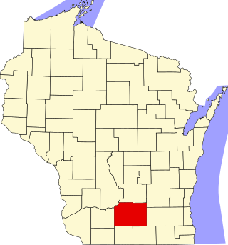
This is a list of the National Register of Historic Places listings in Dane County, Wisconsin. It aims to provide a comprehensive listing of buildings, sites, structures, districts, and objects in Dane County, Wisconsin listed on the National Register of Historic Places.
This is a list of the National Register of Historic Places listings in Rock County, Wisconsin. It is intended to provide a comprehensive listing of entries in the National Register of Historic Places that are located in Rock County, Wisconsin. The locations of National Register properties for which the latitude and longitude coordinates are included below may be seen in a map.
This is a list of the National Register of Historic Places listings in Jefferson County, Wisconsin. It is intended to provide a comprehensive listing of entries in the National Register of Historic Places that are located in Jefferson County, Wisconsin. The locations of National Register properties for which the latitude and longitude coordinates are included below may be seen in a map.
This is a list of the National Register of Historic Places listings in Sauk County, Wisconsin. It is intended to provide a comprehensive listing of entries in the National Register of Historic Places that are located in Sauk County, Wisconsin. The locations of National Register properties for which the latitude and longitude coordinates are included below may be seen in a map.
This is a list of the National Register of Historic Places listings in Brown County, Wisconsin. It is intended to provide a comprehensive listing of entries in the National Register of Historic Places that are located in Brown County, Wisconsin. The locations of National Register properties for which the latitude and longitude coordinates are included below may be seen in a map.
This is a list of the National Register of Historic Places listings in Columbia County, Wisconsin.
This is a list of the National Register of Historic Places listings in Door County, Wisconsin. It is intended to provide a comprehensive listing of entries in the National Register of Historic Places that are located in Door County, Wisconsin. The locations of National Register properties for which the latitude and longitude coordinates are included below may be seen in a map.
This is a list of the National Register of Historic Places listings in Walworth County, Wisconsin. It is intended to provide a comprehensive listing of entries in the National Register of Historic Places that are located in Walworth County, Wisconsin. The locations of National Register properties for which the latitude and longitude coordinates are included below may be seen in a map.
Nils Otto Tank was a Norwegian born, Moravian Church missionary and teacher. He was a pioneer settler in Wisconsin.
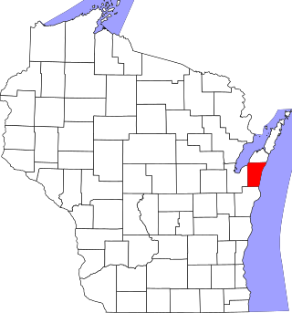
This is a list of the National Register of Historic Places listings in Kewaunee County, Wisconsin. It is intended to provide a comprehensive listing of entries in the National Register of Historic Places that are located in Kewaunee County, Wisconsin. The locations of National Register properties for which the latitude and longitude coordinates are included below may be seen in a map.
This is a list of the National Register of Historic Places listings in Portage County, Wisconsin. It is intended to provide a comprehensive listing of entries in the National Register of Historic Places that are located in Portage County, Wisconsin. The locations of National Register properties for which the latitude and longitude coordinates are included below may be seen in a map.
The Baird Law Office in Green Bay, Wisconsin was built in the 1830s in Greek Revival style, which was then popular as one of America's first architectural styles that explicitly rejected British practices. The small one-story building measures just 16 x 30 feet (9.1 m) in size and served historically as a professional building.
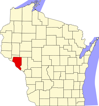
This is a list of the National Register of Historic Places listings in Buffalo County, Wisconsin. It is intended to provide a comprehensive listing of entries in the National Register of Historic Places that are located in Buffalo County, Wisconsin. The locations of National Register properties for which the latitude and longitude coordinates are included below may be seen in a map.
This is a list of the National Register of Historic Places listings in Vilas County, Wisconsin. It is intended to provide a comprehensive listing of entries in the National Register of Historic Places that are located in Vilas County, Wisconsin. The locations of National Register properties for which the latitude and longitude coordinates are included below may be seen in a map.
Wade House Historical Site, also called Old Wade House, is a 240-acre (97 ha) open-air museum in Greenbush, Wisconsin. A Wisconsin historic site, the site is operated by the Wisconsin Historical Society.
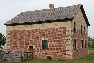
The Massart Farmstead was located in Rosiere, Wisconsin.
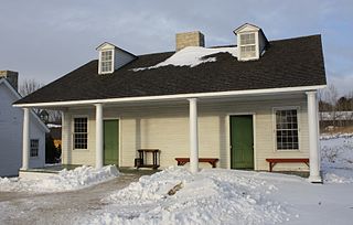
The Fort Howard Officers' Quarters, in Heritage Hill State Park at 2640 S. Webster Ave. in Green Bay, Wisconsin, were built in c.1816 or in 1830, according to various sources. They were listed on the National Register of Historic Places in 1979.
The Albert C. and Ellen H. Neufeld House is a historic residence built for a prominent family in Allouez, Brown County, Wisconsin, United States.