
Bandera County is a county in the U.S. state of Texas. It is located in the Hill Country and its county seat is Bandera.

The Santa Monica Mountains is a coastal mountain range in Southern California, next to the Pacific Ocean. It is part of the Transverse Ranges. The Santa Monica Mountains National Recreation Area encompasses this mountain range. Because of its proximity to densely populated regions, it is one of the most visited natural areas in California.
The Nature Conservancy (TNC) is a global environmental organization headquartered in Arlington, Virginia. As of 2021, it works via affiliates or branches in 79 countries and territories, as well as across every state in the US.

An oak savanna is a type of savanna—or lightly forested grassland—where oaks are the dominant trees. The terms "oakery" or "woodlands" are also used commonly, though the former is more prevalent when referencing the Mediterranean area. These savannas were maintained historically through wildfires set by lightning, humans, grazing, low precipitation, and/or poor soil.

The Simi Hills are a low rocky mountain range of the Transverse Ranges in eastern Ventura County and western Los Angeles County, of southern California, United States.

Barton Creek is a tributary that feeds the Colorado River as it flows through the Texas Hill Country. The creek passes through some of the more scenic areas in Greater Austin, surrounded in many parts by a greenbelt of protected lands that serves as a habitat for many indigenous species of flora and fauna. The creek passes through Barton Creek Greenbelt and is fed by Barton Springs.

Lost Maples State Natural Area is a 2,906-acre (1,176 ha) area of hills and canyons on the upper Sabinal River in the Edwards Plateau Region of Texas. It is designated a Natural Area, rather than a State Park, which means the primary focus is the maintenance and protection of the property's natural state. Accordingly, access and recreational activities may be restricted if the Texas Parks & Wildlife Department (TPWD) deems such action necessary to protect the environment.

Colorado Bend State Park is a 5,328.3-acre (2,156 ha) state park located in the Hill Country region of the U.S. state of Texas, mostly in San Saba County. It was purchased by the state in 1984 and opened to the public in 1987. It is representative of the karst features typically seen in the Hill Country, with many sinkholes, caves, and springs.

Clark Creek Natural Area is a publicly owned, natural preservation area encompassing 700 acres (280 ha) off Mississippi Highway 24 approximately 13 miles (21 km) west of Woodville, Mississippi. The state park features approximately 50 waterfalls, some with up to 30-foot (9.1 m) drops. The park is used for hiking, bird watching, and geocaching.
Yellow River State Forest, (YRSF), is mostly forested land owned by the Iowa Department of Natural Resources. It is located in the southeastern corner of Allamakee County, the most northeasterly of Iowa's counties. It is adjacent to the Upper Mississippi River National Wildlife and Fish Refuge and is just north of Effigy Mounds National Monument in the bluff region of the Upper Mississippi River.
The 3,848 acres (6.013 sq mi) Landels-Hill Big Creek Reserve located in the southern region of Big Sur, California is owned by the University of California Natural Reserve System. It is located off State Route 1 in 50 miles (80 km) south of Monterey and adjacent to the Big Creek State Marine Reserve and Big Creek State Marine Conservation Area. It is open only for approved research or educational purposes.

Hill Country State Natural Area (HCSNA) preserves 5,369 acres (21.73 km2) of rugged, relatively pristine Hill Country terrain in Bandera County, Texas. It was opened to the public in 1984. Since HCSNA is designated a "Natural Area" rather than a "State Park", the first priority of the Texas Parks and Wildlife Department (TPWD) is the maintenance and preservation of the property's natural state. Accordingly, facilities are purposely somewhat primitive and recreational activities may be curtailed if the TPWD deems it necessary to protect the environment.

Guadalupe River State Park is a Texas state park located on a section of the Guadalupe River in Kendall and Comal Counties, northwest of Bulverde, Texas United States and is administered by the Texas Parks and Wildlife Department. The land was acquired by deed from private owners in 1974 and was opened to the public in 1983.
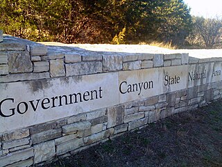
First opened to the public in October, 2005, Government Canyon State Natural Area (GCSNA) preserves 12,244 acres of rugged hills and canyons typical of the Texas Hill Country. It is designated a Natural Area, rather than a State Park, and therefore the primary focus is maintenance and protection of the property's natural state. Accordingly, access and recreational activities may be restricted if the Texas Parks & Wildlife Department (TPWD) deems such action necessary to protect the environment.

The Black Kettle National Grassland, in Roger Mills County, Oklahoma, and Hemphill County, Texas, contains 31,286 acres (12,661 ha) of which 30,710 acres (12,430 ha) are in Oklahoma.
Devil's Sinkhole State Natural Area is a natural bat habitat near the city of Rocksprings in Edwards County in the U.S. state of Texas. Carved by water erosion, the cavern is home to several million Mexican free-tailed bats that emerge at sunset during April through October.
Revis Hill Prairie State Natural Area, also known as Revis Hill Prairie Nature Preserve, is a 412.7-acre (167.0 ha) state park located six miles south of Easton in Mason County, Illinois. It is operated by the Illinois Department of Natural Resources (IDNR) as a tallgrass prairie nature preserve and as a fish and wildlife area managed for deer hunting.

South Llano River State Park is a 2600 acre state park located along the South Llano River in Kimble County, Texas. The park opened to the public in 1990 and is managed by the Texas Parks and Wildlife Department.

Lockhart State Park is a state park located at the southwestern edge of Lockhart, Texas, United States and is administered by the Texas Parks and Wildlife Department. The park was constructed by Civilian Conservation Corps (CCC) Company 3803 between 1935 and 1938. The park officially became a state park in 1948.
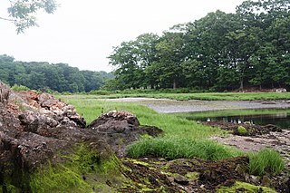
Marshlands Conservancy is a 147-acre nature preserve in the city of Rye, New York, that is fully owned and operated by Westchester County Parks. It has numerous wildlife habitats from ponds to creeks to a large meadow area, succession forest, freshwater wetlands and the only extensive salt marsh in Westchester. It borders Long Island Sound and can be entered via an easement on the historic Boston Post Road. It is one of 5 properties that together constitute the Boston Post Road Historic District. It has high archaeological sensitivity. The conservancy has also been designated an Important Bird Area.


