Fort Parker State Park

Last updated
Fort Parker State Park
Fort parker state park.jpg
Fort Parker State Park
Relief map of Texas.png
Red pog.svg
Usa edcp relief location map.png
Red pog.svg
Location Limestone County, Texas
Nearest city Mexia, Texas
Coordinates 31°36′13″N96°33′03″W / 31.60361°N 96.55083°W / 31.60361; -96.55083
Area1,458.8 acres (590.4 ha) [1]
Established1941;83 years ago (1941)
Visitors50,432(in 2022) [2]
Governing body Texas Parks and Wildlife Department [3]

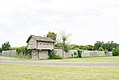
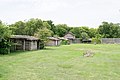
Fort Parker State Park is a state park near the City of Mexia in Limestone County, Texas, United States. The city of Mexia and three local landowners donated the land creating the park in 1935. [3] From 1935 to 1942, Civilian Conservation Corps Company 3807(C) built roads, recreational facilities, the concession building and a 423-foot (129 m) dam of limestone, concrete, and soil across the Navasota River, creating Lake Fort Parker. The park was dedicated by former Texas Governor Pat Neff and opened to the public in May 1941. [1]

Contents

Old Fort Parker, their spring is located on the left Old Fort Parker.jpg
Old Fort Parker, their spring is located on the left

Fort Parker State Park has three hike-and-bike trails: Springfield trail (1.5-mile loop), Navasota River Trail (0.5 mile one way), and Baines Creek Trail (2.5 miles one way). The Bur Oak Trail (0.5-mile loop) is a nature trail with an interpretive guide pamphlet available.

Trees in the park include bur oak, water oak, blackjack oak, pecan, and eastern red cedar (juniper). Other plants that can be found are American beautyberry and sumac.

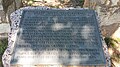
Inside the park is the Old Springfield Cemetery, all that remains of the once-thriving community of Springfield, Texas. Springfield was once the county seat of Limestone County and thrived during the 1840s and 1850s, but as men left for the Civil War, the town's businesses began to close. After the war, racial conflict and lawlessness occurred. The railroad passed Springfield by for the towns of Mexia and Groesbeck, and the town of Springfield disappeared.

The Fort Parker Nature Center is open every weekend. Canoe, kayaks, and paddleboats are available for rental. Day use, overnight camping, group barracks, an activity center, and a picnic pavilion are all available for rent.

Old Fort Parker

The CCC Company also rebuilt nearby Old Fort Parker, the site of the Fort Parker massacre, for the Texas Centennial observance in 1936. As an independent nonprofit, Old Fort Parker is not part of the state park.

Related Research Articles

<span class="mw-page-title-main">Limestone County, Texas</span> County in the United States

Limestone County is a county in the U.S. state of Texas. As of the 2020 census, its population was 22,146. Its county seat is Groesbeck. The county was created in 1846.

<span class="mw-page-title-main">Navasota, Texas</span> City in Texas, United States

Navasota is a city primarily in Grimes County, Texas, United States. The population was 7,643 at the 2020 census. In 2005, the Texas Legislature designated Navasota as the "Blues Capital of Texas" in honor of the late Mance Lipscomb, a Navasota native and blues musician. Technically, a sliver of Navasota is in Brazos County, which is part of the Bryan-College Station Metropolitan area.

<span class="mw-page-title-main">Groesbeck, Texas</span> Town in Texas, United States

Groesbeck is a city in and the county seat of Limestone County, Texas, United States. Its population was 3,631 at the 2020 census. The community is named after a railroad employee.

<span class="mw-page-title-main">Mexia, Texas</span> City in Texas, United States

Mexia is a city in Limestone County, Texas, United States. The population was 6,893 at the 2020 census.

<span class="mw-page-title-main">Grapevine, Texas</span> City in Texas, United States

Grapevine is a city located in northeast Tarrant County, Texas, United States, with minor portions extending into Dallas County and Denton County. The population was 51,226 at the time of the 2020 census, up from 46,334 in the 2010 census. The city is located in the Mid-Cities suburban region between Dallas and Fort Worth and includes a larger portion of Dallas/Fort Worth International Airport than other cities.

<span class="mw-page-title-main">Colorado Bend State Park</span> State park in Texas, United States

Colorado Bend State Park is a 5,328.3-acre (2,156 ha) state park located in the Hill Country region of the U.S. state of Texas, mostly in San Saba County. It was purchased by the state in 1984 and opened to the public in 1987. It is representative of the karst features typically seen in the Hill Country, with many sinkholes, caves, and springs.

<span class="mw-page-title-main">Texas State Highway 289</span> Highway in Texas

State Highway 289, known for most of its length as Preston Road, is a north–south Texas state highway. It begins at the intersection of Preston Road and Loop 12/Northwest Highway in Dallas. The Preston Road designation comes from the fact that the highway generally follows the course of an older road known as the Preston Trail, which ran to the town of Preston [Bend]. Preston is now submerged by Lake Texoma. The road is known as Preston all the way north through the remainder of the Dallas-Fort Worth Metroplex to a junction with State Highway 56 west of Sherman, near the Oklahoma state line. Preston Road passes through many of the fast-growing northern Dallas suburbs, including Frisco and Plano, as well as Prosper and Celina, with many new housing developments being built along Preston.

<span class="mw-page-title-main">Slipdown Mountain</span> Highest point in Parker County, Texas

Slipdown Mountain is a summit in Parker County, Texas. It is located just east of the Advance Community, and along with Slipdown Bluff is the highest point in Parker County, and also the highest point within the Dallas–Fort Worth Metroplex. The "mountain" is beside Slip Down Road, and has a steep limestone cliff on the west side.

<span class="mw-page-title-main">Cross Timbers</span> Ecoregion in Texas, Oklahoma, and Kansas

The term Cross Timbers, also known as Ecoregion 29, Central Oklahoma/Texas Plains, is used to describe a strip of land in the United States that runs from southeastern Kansas across Central Oklahoma to Central Texas. Made up of a mix of prairie, savanna, and woodland, it forms part of the boundary between the more heavily forested eastern country and the almost treeless Great Plains, and also marks the western habitat limit of many mammals and insects.

<span class="mw-page-title-main">Fort Richardson (Texas)</span> State park and historic site in Texas, United States

Fort Richardson was a United States Army installation located in present-day Jacksboro, Texas. Named in honor of Union General Israel B. Richardson, who died in the Battle of Antietam during the American Civil War, it was active from 1867 to 1878. Today, the site, with a few surviving buildings, is called Fort Richardson State Park, Historic Site and Lost Creek Reservoir State Trailway. It was designated a National Historic Landmark in 1963 for its role in securing the state's northern frontier in the post-Civil War era.

<span class="mw-page-title-main">Navasota River</span> River in Texas, United States

The Navasota River is a river in east Texas, United States. It is about 125 miles (201 km) long, beginning near Mount Calm and flowing south into the Brazos River at a point where Brazos, Grimes, and Washington counties converge.

<span class="mw-page-title-main">Cedars of Lebanon State Park</span> State park in Tennessee, United States

Cedars of Lebanon State Park is a state park in Wilson County, Tennessee, in the southeastern United States. It consists of 900 acres (364 ha) situated amidst the 9,420-acre (3,810 ha) Cedars of Lebanon State Forest. The park and forest are approximately 10 miles (16 km) south of Lebanon, Tennessee.

Lee Wilder Thomas, known as Rev. L.W. Thomas, was a prominent African-American business and oil man. L.W. Thomas was among the lucky land owners in the Mexia, Texas, oil field. In the early 1930s, he partnered with Jake Simmons, Jr., another wealthy African-American oil broker. Together, these two men built Simmons Royalty Co., one of the leading African-American oil and mineral right royalty companies in the state of Oklahoma.

<span class="mw-page-title-main">Historic Blakeley State Park</span> State park in Baldwin County, Alabama, United States

Historic Blakeley State Park is a park located on the site of the former town of Blakeley in Baldwin County, Alabama on the Tensaw River delta. The park encompasses an area once occupied by settlers in what was a thriving community on the river. Later, Confederate soldiers were garrisoned here and fought in the last major battle of the U.S. Civil War against Union forces.

<span class="mw-page-title-main">Hoosier Prairie State Nature Preserve</span>

Hoosier Prairie is a unit of Indiana Dunes National Park in Lake County, Indiana. It began in the 1970s as wasteland that conservation organization found of a unique interest. From a core of 304 acres (123 ha), it has grown to 1,547 acres (626 ha) of important prairie habitat. The area was designated a National Natural Landmark in 1974 and a State Nature Preserve in 1977 The sandy soil creates a variety of habitats, from oak barrens, wet prairie, including sedge meadows and prairie marshes. More than 350 native species of vascular plants have been identified. A minimum of 43 species are uncommon in the State of Indiana.

<span class="mw-page-title-main">Confederate Reunion Grounds State Historic Site</span> United States historic place

Confederate Reunion Grounds is a Texas historic site located near Mexia, Limestone County, Texas at the confluence of the Navasota River and Jack's Creek. From 1889–1946, Confederate Civil War veterans and families reunited at the site during late-July or early-August, camping under the giant bur oaks, enjoying speeches, concerts, dances, fellowship and food, and raising funds for families of their fallen comrades.

<span class="mw-page-title-main">Mission Tejas State Park</span> State park in Texas, United States

Mission Tejas State Park is a 660-acre (270 ha) state park located along Texas State Highway 21 in Houston County, Texas, originally constructed in 1935 and transferred to Texas Parks and Wildlife in 1957. The closest major town is Crockett, Texas. The park is open year-round.

The Mexia-Nelleva Cutoff was a railroad cutoff constructed between Nelleva and Mexia, in eastern Texas. It has not been used since 1933, when it was abandoned by its owner, the Houston and Texas Central Railway (H&TC).

<span class="mw-page-title-main">Oak Point Park and Nature Preserve</span> Park in Plano, TX

Oak Point Park and Nature Preserve is an 800-acre park in Plano, TX and is the largest park in the city. The park has 3.5 miles of concrete trails and 5 miles of soft trails, many of which are located along Rowlett Creek.

<span class="mw-page-title-main">Comanche Springs (Texas)</span>

Comanche Springs was an aquifer of six artesian springs geographically located between the Edwards Plateau and the Trans-Pecos regions of West Texas. The military fortification Camp Stockton was built around the springs, eventually growing become the city of Fort Stockton.

References

  1. 1 2 "Fort Parker State Park, a Texas". Archived from the original on 2010-02-04. Retrieved 2010-04-26.
  2. Christopher Adams. "What is the most visited state park in Texas? Here's the top 10 countdown". KXAN.com. Retrieved November 21, 2023.
  3. 1 2 "TPWD: Fort Parker State Park" . Retrieved 2010-04-26.