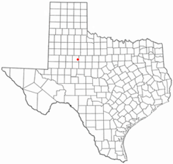
Hermleigh, Texas | |
---|---|
Coordinates: 32°38′5″N100°45′34″W / 32.63472°N 100.75944°W | |
Country | United States |
State | Texas |
County | Scurry |
Area | |
• Total | 9.1 sq mi (23.5 km2) |
• Land | 9.1 sq mi (23.5 km2) |
• Water | 0.0 sq mi (0.0 km2) |
Elevation | 2,441 ft (744 m) |
Population | |
• Total | 383 |
• Density | 42/sq mi (16/km2) |
Time zone | UTC-6 (Central (CST)) |
• Summer (DST) | UTC-5 (CDT) |
ZIP code | 79526 |
Area code | 325 |
FIPS code | 48-33356 [2] |
GNIS feature ID | 1337647 [3] |
Hermleigh is a census-designated place (CDP) in Scurry County, Texas, United States.
Hermleigh lies on U.S. Route 84, ninety-six miles southeast of Lubbock, and has a population of 383 people at the 2020 census. [1]
A destructive low-end EF2 tornado struck the northwestern side of town on May 1, 2022, damaging or destroying mobile homes while also damaging a home, a garage, trailers, and vehicles. [4] A 4.9 magnitude earthquake was reported by the United States Geological Survey on July 22, 2024.
Hermleigh is located at 32°38′5″N100°45′34″W / 32.63472°N 100.75944°W (32.634619, -100.759336). [5]
According to the United States Census Bureau, the CDP has a total area of 9.1 square miles (23.5 km2), all land.
Census | Pop. | Note | %± |
---|---|---|---|
2020 | 383 | — | |
U.S. Decennial Census [6] 1850–1900 [7] 1910 [8] 1920 [9] 1930 [10] 1940 [11] 1950 [12] 1960 [13] 1970 [14] 1980 [15] 1990 [16] 2000 [17] 2010 [18] |
As of the census [2] of 2000, there were 393 people, 151 households, and 104 families residing in the CDP. The population density was 43.4 inhabitants per square mile (16.8/km2). There were 183 housing units at an average density of 20.2/sq mi (7.8/km2). The racial makeup of the CDP was 90.08% White, 2.29% African American, 0.25% Asian, 5.34% from other races, and 2.04% from two or more races. Hispanic or Latino of any race were 23.66% of the population.
There were 151 households, out of which 33.1% had children under the age of 18 living with them, 58.3% were married couples living together, 8.6% had a female householder with no husband present, and 31.1% were non-families. 28.5% of all households were made up of individuals, and 15.2% had someone living alone who was 65 years of age or older. The average household size was 2.60 and the average family size was 3.24.
In the CDP, the population was spread out, with 28.2% under the age of 18, 12.2% from 18 to 24, 23.4% from 25 to 44, 20.9% from 45 to 64, and 15.3% who were 65 years of age or older. The median age was 36 years. For every 100 females, there were 99.5 males. For every 100 females age 18 and over, there were 95.8 males.
The median income for a household in the CDP was $26,111, and the median income for a family was $30,417. Males had a median income of $27,222 versus $21,000 for females. The per capita income for the CDP was $11,843. About 13.1% of families and 23.4% of the population were below the poverty line, including 34.7% of those under age 18 and 25.3% of those age 65 or over.
Hermleigh's history begins in 1907 when a townsite was surveyed on land donated by two men named R. C. Herm and Harry W. Harlin near the small community of Wheat. Citizens chose to name their new community "Hermlin" (an amalgam of the surnames of the two landowners) but this name was rejected by postal officials as being too close to the nearby town of Hamlin, potentially causing confusion between the two communities. The compromise of "Hermleigh" was settled upon, and the post office opened shortly thereafter. The Roscoe, Snyder and Pacific Railway was built through the new community, and residents of Wheat began to relocate to Hermleigh.
In 1911 the Santa Fe Railroad reached the community, and Hermleigh developed into a shipping point and trading center for local ranchers and cotton farmers. A school opened to serve area students in 1913, and by the late 1910s the community had its own newspaper (the Hermleigh Herald). Hermleigh briefly changed its name in the late 1910s to Foch to honor the French field marshal and World War I hero Ferdinand Foch, but reverted to the original name shortly thereafter and continued to flourish until the early 1930s, when the effects of the Great Depression brought an end to Hermleigh's growth.
Though adversely effected by the Depression, Hermleigh remained stable throughout most of the twentieth century and by 1980 was home to over 700 residents. By 1990, however, the population had fallen dramatically to approximately 200 and some of the remaining businesses closed down. The community inexplicably rebounded during the 1990s, with the population reaching 393 by the 2000 Census.
Hermleigh is the hometown of former head coach of the Baylor Bears football program, Grant Teaff.
The most expensive pig ever sold was owned by a Hermleigh resident. Jefferey Roemisch of Hermleigh sold his cross-breed barrow named "Bud" for a record-breaking $56,000 in 1983 to a man named Bud Olson and his partner, Phil Bonzio. [19]
The community of Hermleigh is served by the Hermleigh Independent School District.
Skidmore is a census-designated place (CDP) in Bee County, Texas, United States. The population was 863 at the 2020 census.
Tulsita is a census-designated place (CDP) in Bee County, Texas, United States. The population was 31 at the 2020 census.
Tynan is a census-designated place (CDP) in Bee County, Texas, United States. The population was 254 at the 2020 census.
Bixby is a census-designated place (CDP) in Cameron County, Texas, United States. The population was 352 at the 2020 census. It is part of the Brownsville–Harlingen Metropolitan Statistical Area.
Encantada-Ranchito-El Calaboz, also known as El Calaboz Rancheria in the San Pedro de Carricitos Land Grant, is a census-designated place (CDP) in Cameron County, Texas, United States. The population was 1,981 at the 2020 census. It is part of the Brownsville–Harlingen Metropolitan Statistical Area.
San Pedro is a census-designated place (CDP) in Cameron County, Texas, United States. The population was 442 at the 2020 census. It is part of the Brownsville–Harlingen Metropolitan Statistical Area.
Villa del Sol is a census-designated place (CDP) in Cameron County, Texas, United States. The population was 153 at the 2020 census. It is part of the Brownsville–Harlingen Metropolitan Statistical Area.
Redwood is an unincorporated community and census-designated place (CDP) in Guadalupe County, Texas, United States. The population was 4,003 at the 2020 census, a decline from the figure of 4,338 tabulated in 2010. It is part of the San Antonio Metropolitan Statistical Area.
Muniz is a census-designated place (CDP) in Hidalgo County, Texas, United States. The population was 1,593 at the 2020 United States Census. It is part of the McAllen–Edinburg–Mission Metropolitan Statistical Area.
Lipscomb is an unincorporated community and census-designated place (CDP) in Lipscomb County, Texas, United States. It is the Lipscomb county seat. The population was 66 at the 2020 census.
Las Quintas Fronterizas is a census-designated place (CDP) in Maverick County, Texas, United States. The population was 2,326 at the 2020 census.
Rosita, formerly known as Rosita South, is a census-designated place (CDP) in Maverick County, Texas, United States. The population was 3,501 as of the 2020 census. The Kickapoo Indian Reservation of Texas is located within the community.
El Refugio is a census-designated place (CDP) in Starr County, Texas, United States. The population was 407 at the 2020 census. El Refugio gained area in the 2010 census.
Las Lomas is a census-designated place (CDP) in Starr County, Texas, United States. The population was 3,147 at the 2010 census. Las Lomas is one of several colonias in Starr County, within the Rio Grande Valley region. The name is derived from the community's terrain.
Salineño is a census-designated place (CDP) in Starr County, Texas, United States. The name was changed in 2008, adding a tilde over the second n. The population was 176 at the 2020 census, down from 201 at the 2010 census.
Windermere is a former census-designated place (CDP) in Travis County, Texas, United States. The population was 1,037 at the 2010 census. It has since largely been annexed by the city of Pflugerville.
Bruni is a census-designated place (CDP) in Webb County, Texas, United States. The population was 379 at the 2010 census.
Oilton is a census-designated place (CDP) in Webb County, Texas, United States. The population was 152 at the 2010 census. The community is within the boundary of Webb Consolidated Independent School District and is home to the Oilton Elementary School.
Los Angeles is a census-designated place (CDP) in Willacy County, Texas, United States. The population was 108 at the 2020 census. Prior to the 2010 census, the CDP was known as Los Angeles Subdivision.
Zapata Ranch is a census-designated place (CDP) in Willacy County, Texas, United States. The population was 87 at the 2020 census.
★Pig: E.A. Bud Olson and Phil Bonzio paid $56,000 to Jeffrey Roemisch of Texas, U.S.A., for Bud, a crossbred barrow on March 5, 1983.