Cumberland County is a county located in the U.S. state of New Jersey. As of the 2019 Census estimate, the county's population was 149,527, making it the 16th-largest of the state's 21 counties. Its county seat is Bridgeton. Cumberland County is named for Prince William, Duke of Cumberland. The county was formally created from portions of Salem County as of January 19, 1748.
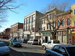
Route 49 is a state highway in the southern part of the U.S. state of New Jersey. It runs 53.80 mi (86.58 km) from an interchange with the New Jersey Turnpike, Interstate 295 (I-295), and U.S. Route 40 (US 40) in Deepwater, Salem County, southeast to Route 50 and County Route 557 in Tuckahoe, Cape May County. The route serves Salem, Cumberland, Atlantic, and Cape May Counties, passing through rural areas and the communities of Salem, Bridgeton, and Millville along the way. It is a two-lane, undivided road for most of its length.

Fairfield Township is a township in Cumberland County, New Jersey, United States. It is part of the Vineland-Millville- Bridgeton Primary Metropolitan Statistical Area for statistical purposes. As of the 2010 United States Census, the township's population was 6,295, reflecting an increase of 12 (+0.2%) from the 6,283 counted in the 2000 Census, which had in turn increased by 584 (+10.2%) from the 5,699 counted in the 1990 Census.
Greenwich Township is the westernmost township in Cumberland County, New Jersey, United States. As of the 2010 United States Census, the township's population was 804, reflecting a decline of 43 (-5.1%) from the 847 counted in the 2000 Census, which had in turn declined by 64 (-7.0%) from the 911 counted in the 1990 Census. It is part of the Vineland-Millville- Bridgeton Primary Metropolitan Statistical Area for statistical purposes.
Lawrence Township is a township in Cumberland County, New Jersey, United States. It is part of the Vineland-Millville-Bridgeton Primary Metropolitan Statistical Area for statistical purposes. As of the 2010 United States Census, the township's population was 3,290, reflecting an increase of 569 (+20.9%) from the 2,721 counted in the 2000 Census, which had in turn increased by 288 (+11.8%) from the 2,433 counted in the 1990 Census.

Maurice River Township is the easternmost township in Cumberland County, New Jersey, United States. It is part of the Vineland-Millville- Bridgeton Primary Metropolitan Statistical Area for statistical purposes. As of the 2010 United States Census, the township's population was 7,976, reflecting an increase of 1,048 (+15.1%) from the 6,928 counted in the 2000 Census, which had in turn increased by 280 (+4.2%) from the 6,648 counted in the 1990 Census.

South Jersey comprises the southern portion of the U.S. state of New Jersey, between the lower Delaware River and the Atlantic Ocean. The designation of southern New Jersey with a distinct toponym is a colloquial one rather than an administrative one, reflecting not only geographical but also perceived cultural differences from the northern part of the state, with no official definition. Though definitions of South Jersey may vary, most of South Jersey is generally considered to be part of the Philadelphia Metropolitan Area.

Deerfield is an unincorporated community within Upper Deerfield Township, Cumberland County, New Jersey, United States. The western and northeastern areas of the community are part of the Deerfield Street census-designated place for population statistical purposes.

Mauricetown is an unincorporated community located within Commercial Township in Cumberland County, New Jersey.

Heislerville is an unincorporated community located in Maurice River Township of Cumberland County, New Jersey. It was named after the Heisler family, prominent members of the Methodist Episcopal Church established here in 1828.
Leesburg is an unincorporated community located within Maurice River Township in Cumberland County, New Jersey, United States. The area is served as United States Postal Service ZIP code 08327.
Cumberland is a small unincorporated community located within Maurice River Township in Cumberland County, New Jersey, United States. For statistical purposes, Cumberland and neighboring Hesstown together comprise the Cumberland-Hesstown census-designated place.

Ewingville is a section of Ewing Township in Mercer County, New Jersey, United States originally settled as a village on Shabakunk Creek. Located at the intersection of Ewingville Road/Upper Ferry Road and Pennington Road, it is one of the oldest settlements in Ewing Township and dates back to the 18th century. The community was known as Cross Keys before adopting its current name in 1836, two years after the incorporation of Ewing Township in 1834.
Buckshutem is an unincorporated community located within Commercial Township, in Cumberland County, New Jersey, United States. The community is situated near Buckshutem Creek, nearby Laurel Lake. The name "Buckshutem" is of Native American origin; though others say that the name is derived from the creek's rapid flow of water as it empties into the brisk wake of the Maurice River, producing a cross current that causes a boat to "buck and shoot" through that section.
Bowentown is an unincorporated community located within Hopewell Township, in Cumberland County, New Jersey, United States. Located west of Bridgeton, Bowentown got its name from the Bowen family, one of Hopewell Township's first settlers.
Jericho is an community located within Stow Creek Township, in Cumberland County, New Jersey, United States.
Cohansey is a community located within Hopewell Township, in Cumberland County, New Jersey, United States.

Springtown is an unincorporated community in Greenwich Township, in Cumberland County, New Jersey, United States.

Cumberland-Hesstown is a census-designated place (CDP) in Cumberland County, New Jersey, United States. Consisting of the unincorporated communities of Cumberland and Hesstown, it is in the eastern part of the county, in the northern part of Maurice River Township. New Jersey Route 49 passes through the CDP, leading northwest 6 miles (10 km) to Millville and southeast 11 miles (18 km) to Tuckahoe.


