Related Research Articles
Chimney Rock is a village in Rutherford County, North Carolina, United States. The population was 113 at the 2010 census. The village takes its name from a large granite outcropping located on a summit above the village itself in Chimney Rock State Park.
Lake Lure is a town in Rutherford County, North Carolina, United States. In 2020 the town population was 1,634. Lake Lure was incorporated in 1927, and acquired the lake after which it is named in 1965.
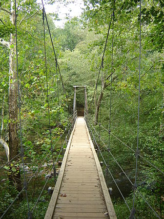
Eno River State Park is a 4,319-acre (17.48 km2) North Carolina state park in Durham and Orange Counties, North Carolina. Together with the adjoining West Point on the Eno city park, the two parks preserve over 14 miles (22.5 km) of the Eno River and surrounding lands.
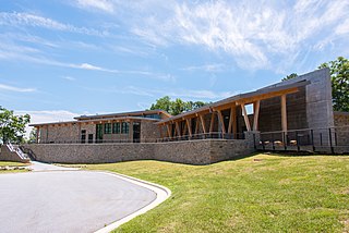
Gorges State Park is a 7,709-acre (31.20 km2) North Carolina state park in Transylvania County, North Carolina in the United States and along with other conservation lands is part of a 100,000+ acre conservation corridor stretching some 80 miles along the NC/SC state line. The land, along Jocassee Gorges, was purchased by the state from Duke Energy Corporation in 1999. It is North Carolina's westernmost state park and one of the state's newest. The park is adjacent to part of the Pisgah National Forest and the N.C. Wildlife Resources Commission's Toxaway Game Land. Gorges State Park provides the principal access to the Horsepasture River on these adjoining public lands.

The Mountains-to-Sea State Trail (MST) is a long-distance trail in the US for hiking and backpacking, that traverses North Carolina from the Great Smoky Mountains to the Outer Banks. Its western endpoint is at Clingmans Dome, where it connects to the Appalachian Trail in the Great Smoky Mountains National Park. Its eastern endpoint is in Jockey's Ridge State Park on the tallest sand dune on the east coast. The trail is envisioned as a scenic backbone of an interconnected trail system spanning the state. As such, its route attempts to connect as many trail systems and natural scenic areas as practicable. A little over half of the trail is complete in multiple segments across the state.
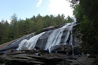
DuPont State Recreational Forest, commonly known as DuPont Forest, is a 12,500-acre (51 km2) state forest, located in Henderson and Transylvania counties of North Carolina. The name originates from the fact that the DuPont company arranged the sale of the original tract to the state. Adjacent tracts have since been purchased and added to the state forest. Portions of the forest formerly contained a manufacturing facility for the production of X-ray film. The forest was used to shoot scenes from the 1992 film The Last of the Mohicans as well as the 2012 box office hit The Hunger Games. On February 12, 2019, the forest added 402 acres (1.63 km2) from Conserving Carolina, part of a section called the Continental Divide Tract that connects with other public lands. 314 more acres was added to the forest in 2019.

Willow River State Park is a 2,891-acre (1,170 ha) Wisconsin state park located five miles (8 km) north of Hudson. The centerpiece of the park is Willow Falls, a powerful cascade in a 200-foot (61 m) deep gorge. Another popular feature is Little Falls Lake, a shallow reservoir on the Willow River. Because of its proximity to Minneapolis-St. Paul it is one of the most visited state parks in Wisconsin. Trilobite fossils found in the lower layers of the gorge indicate the rock is around 600 million years old.
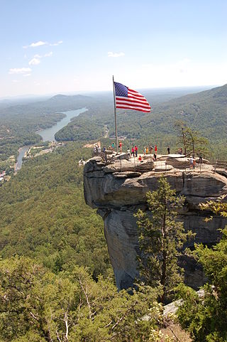
Chimney Rock State Park is a North Carolina state park in Chimney Rock, Rutherford County, North Carolina in the United States. The 8,014-acre (32.43 km2) park is located 25 miles (40 km) southeast of Asheville, North Carolina, and is owned and managed by the state of North Carolina.
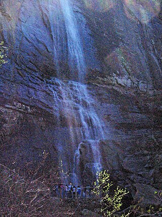
Hickory Nut Falls, also known as Hickorynut Falls, is a waterfall located at Chimney Rock State Park in Rutherford County, North Carolina.

Rainbow Falls is a waterfall located in Chimney Rock, Rutherford County, North Carolina.
The Haw River State Trail is a 80-mile (130 km) long multi-use trail currently being built through the North Carolina Piedmont. The trail follows the path of the Haw River from Haw River State Park on the Rockingham/Guilford County line to Jordan Lake State Recreation Area. The NC General Assembly authorized its addition to the State Trails System in June 2023.
Conserving Carolina is a non-profit conservation organization working to preserve water and land resources in Western North Carolina. Conserving Carolina was created in July 2017, from a merger of two previously separate organizations, Carolina Mountain Land Conservancy and Pacolet Area Conservancy. The combined organization maintains a primary office in Hendersonville, North Carolina, and a regional office in Columbus, North Carolina.
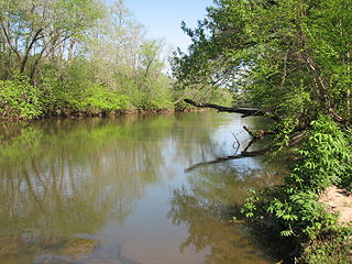
Mayo River State Park is a North Carolina state park in Rockingham County, North Carolina in the United States. It covers 2,778-acre (11.24 km2) along the Mayo River, and it adjoins a Virginia State Park of the same name. North Carolina's park is near Mayodan, North Carolina. The park is one of the newest in the North Carolina system, having been authorized by the General Assembly in May 2003.
Pisgah View State Park is a developing 205-acre (0.83 km2) North Carolina state park in Buncombe and Haywood Counties, North Carolina, in the United States. The center piece of the park is the approximately 1,600-acre (6.5 km2) Pisgah View Ranch, which has rental cabins, equestrian trails, a swimming pool, tennis courts and other amenities. The ranch has been privately owned by the Cogburn Family since the late 1700s, and the state acquired an option to purchase the property over a five-year period. The Southern Appalachian Highlands Conservancy has raised $1 million to aid with the purchase. The Cogburns will donate a portion of the land's value to the state.
The Fonta Flora State Trail is a unit of the North Carolina state park system in Buncombe, McDowell, and Burke Counties, North Carolina, in the United States, and it consists of 90 acres (36 ha) of conservation land and 19 miles (31 km) designated multi-use trail. The State Trail is planned as a continuous route for hikers and cyclists from Asheville to Morganton, with a loop around Lake James. The trail is a collaboration between local governments, local land conservancies the US Forest Service, and the state, with development coordinated by the North Carolina Division of Parks and Recreation (NCDPR).
The Wilderness Gateway State Trail is a unit of the North Carolina state park system in Burke, Catawba, McDowell and Rutherford Counties, North Carolina in the United States. The State Trail is planned as a hiking trail connecting the Town of Valdese, the City of Hickory, the Overmountain Victory National Historic Trail, South Mountains State Park and Chimney Rock State Park The trail is a collaboration between local governments and the state, with development coordinated by the North Carolina Division of Parks and Recreation (NCDPR).

The protected areas of North Carolina cover roughly 3.8 million acres, making up 11% of the total land in the state. 86.5% of this protected land is publicly owned and is managed by different federal and state level authorities and receive varying levels of protection. Some areas are managed as wilderness while others are operated with acceptable commercial exploitation. The remainder of the land is privately owned, but willingly entered into conservation easement management agreements, or are owned by various nonprofit conservation groups such as the National Audubon Society and The Nature Conservancy. North Carolina contains 1 National Park, and various other federally owned protected land including 2 National Seashores, 5 National Forests, 12 Wildlife Refuges, and the southern half of the Blue Ridge Parkway. North Carolina has an extensive state park system of 42 open units, 35 of which are state parks, 4 that are recreation areas, and 3 staffed state natural areas, along with other designated units managed by the North Carolina Department of Natural and Cultural Resources.

Mayo River State Park is a state park of Virginia located in Henry County, along the North and South Forks of the Mayo River. The entrance to the park is located in Spencer. The park is located along the Virginia-North Carolina state line, and it is adjacent to a similarly named park in North Carolina.

Rocky Knob Recreation Area is a 4,500 acres (18 km2) recreation area along the Blue Ridge Parkway, which spans from mile markers 167–174. The park is home to 15 miles of hiking trails, 81 tents camping sites, 28 RV sites, and 72 picnic sites. The campground is open seasonally, typically from May–October. Rocky Knob is also home to Rock Castle Gorge, a 3,500 acres (14 km2) gorge, and home to the Rock Castle Gorge National Recreation Trail. The trail drops 1,000 feet in elevation in 3 miles, and backpackers can request a backcountry camping permit from the National Park Service.
Florence Nature Preserve is a publicly-accessible privately owned park in Gerton, Henderson County, North Carolina in the United States. The 600-acre (2.4 km2) park is located 18 miles (29 km) southeast of Asheville, North Carolina, and is owned and managed by Conserving Carolina, a land trust.
References
- ↑ "Size of the North Carolina State Parks System" (XLS). North Carolina Division of Parks and Recreation. January 1, 2019. Archived from the original on July 21, 2019. Retrieved July 21, 2019.
- 1 2 3 "Session Law 2017-57". Raleigh, North Carolina: General Assembly of North Carolina. June 28, 2017. Section 14.15. Retrieved July 23, 2019.