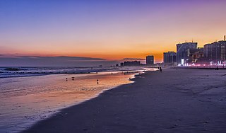
Atlantic County is a county located in the U.S. state of New Jersey. As of the 2020 census, the county was the state's 15th-most-populous county, with a population of 274,534, a drop of 15 from the 2010 census count of 274,549. Its county seat is the Mays Landing section of Hamilton Township. The county is part of the Jersey Shore and of the South Jersey region of the state.

Tabernacle Township is a township in Burlington County, in the U.S. state of New Jersey. As of the 2020 United States census, the township's population was 6,776, a decrease of 173 (−2.5%) from the 2010 census count of 6,949, which in turn reflected a decline of 221 (−3.1%) from the 7,170 counted in the 2000 census. The township, and all of Burlington County, is a part of the Philadelphia-Reading-Camden combined statistical area and the Delaware Valley.

Tuckerton is a borough situated on the Jersey Shore, within Ocean County in the U.S. state of New Jersey. As of the 2020 United States census, the borough's population was 3,577, its highest decennial count ever and an increase of 230 (+6.9%) from the 3,347 recorded at the 2010 census, which in turn had reflected a decline of 170 (−4.8%) from the 3,517 counted in the 2000 census.

Bass River Township is a township at the southeastern tip of Burlington County, in the U.S. state of New Jersey. The township bears a shoreline fronting both the Bass River and the Great Bay. As of the 2020 United States census, the township's population was 1,355, a decrease of 88 (−6.1%) from the 2010 census count of 1,443, which in turn had reflected a decline of 67 (−4.4%) from the 1,510 counted in the 2000 census. The township and all of Burlington County is a part of the Philadelphia-Reading-Camden combined statistical area and the Delaware Valley. Bass River is traversed by the Garden State Parkway.

The New Jersey Pine Barrens, also known as the Pinelands or simply the Pines, is the largest remaining example of the Atlantic coastal pine barrens ecosystem, stretching across more than seven counties of New Jersey. Two other large, contiguous examples of this ecosystem remain in the northeastern United States: the Long Island Central Pine Barrens and the Massachusetts Coastal Pine Barrens. The name pine barrens refers to the area's sandy, acidic, nutrient-poor soil. Although European settlers could not cultivate their familiar crops there, the unique ecology of the Pine Barrens supports a diverse spectrum of plant life, including orchids and carnivorous plants. The area is also notable for its populations of rare pygmy pitch pines and other plant species that depend on the frequent fires of the Pine Barrens to reproduce. The sand that composes much of the area's soil is referred to by the locals as sugar sand.

South Jersey comprises the southern portion of the U.S. state of New Jersey. It is located between Pennsylvania and the lower Delaware River to its west, the Atlantic Ocean to its east, Delaware to its south, and Central Jersey or North Jersey to its north, depending on the definition of North Jersey.

Wharton State Forest is the largest state forest in the U.S. state of New Jersey. It is the largest single tract of land in the state park system of New Jersey, encompassing approximately 122,880 acres (497.3 km2) of the Pinelands northeast of Hammonton. Its protected acreage is divided between Burlington, Camden, and Atlantic counties. The entire forest is located within the Atlantic coastal pine barrens ecoregion as well as the New Jersey Pinelands National Reserve. The forest is located in the forested watershed of the Mullica River, which drains the central Pinelands region into the Great Bay. The forest is under the jurisdiction of the New Jersey Division of Parks and Forestry.

Ong's Hat is a ghost town in Pemberton Township, Burlington County, in the U.S. state of New Jersey. It is located on Magnolia Road west of the Four Mile Circle, where New Jersey Route 72 intersects with New Jersey Route 70. It is the northern terminus of the Batona Trail.
Atco is an unincorporated community and census-designated place (CDP) in Waterford Township in Camden County, in the U.S. state of New Jersey. It is part of the Philadelphia-Camden metropolitan area, located 16 miles (26 km) southeast of Camden. Though generally considered part of Waterford Township, a small section of the southern edge of Atco is located in Winslow Township.

Pinelands National Reserve is a national reserve that encompasses much of the New Jersey Pine Barrens. The Pinelands is a unique location of historic villages and berry farms amid the vast oak-pine forests, extensive wetlands, and diverse species of plants and animals of the Atlantic coastal pine barrens ecoregion. It is protected by state and federal legislation through management by local, state, and federal governments and the private sector. The reserve contains Wharton State Forest, Brendan T. Byrne State Forest, Bass River State Forest, Penn State Forest, and Double Trouble State Park, which provide public recreation facilities. Established by Congress in 1978, it is one of the nation's first national reserves, established along with Ebey's Landing National Historical Reserve.

Whiting is an unincorporated community located on the west side of Manchester Township in Ocean County, New Jersey, United States. It is in the Eastern Standard time zone with an elevation of 180 ft. It is home to various retirement communities. The ZIP Code Tabulation Area for the Whiting 08759 ZIP code has a population of 33,180 as of the 2019 Population Estimates Program from the United States Census Bureau. The majority of the township's population of 43,070 lives here.

The Brendan T. Byrne State Forest is a 37,242 acres (150.71 km2) state forest in the New Jersey Pine Barrens. Its protected acreage is split between Burlington and Ocean Counties.

Allaire State Park is a park located in Howell and in Wall Township in Monmouth County, New Jersey, United States, near the borough of Farmingdale, operated and maintained by the New Jersey Division of Parks and Forestry and is part of the New Jersey Coastal Heritage Trail Route. The park is known for its restored 19th century ironworks, Allaire Village, on the park premises. It is named after James P. Allaire, founder of the Howell Works at the same site. The park also hosts the Pine Creek Railroad, a tourist railroad.
The New Jersey Pine Barrens has been the site of many legends, tales and mythical creatures, many of which have been documented by Weird NJ in its magazines and books.

The New Jersey Southern Railroad was a railroad that started in 1854. It would continue under this name until the 1870s as a separate company and the lines that it had constructed or run continued to be run in the New Jersey Southern name until the early 2000s.

The Batona Trail is a 53.5-mile (86.1 km) hiking trail through New Jersey's Pine Barrens. The trail is one of the longest in the state, behind the Delaware and Raritan Canal Trail, the section of the Appalachian Trail within the state, the Liberty-Water Gap Trail, and the completed section of the Highlands Trail in the state. The Batona Trail begins in Brendan T. Byrne State Forest at the ghost town of Ong's Hat and traverses Franklin Parker Preserve, Wharton State Forest and Bass River State Forest. The trail was built in 1961 by the Batona Hiking Club, which began informally in 1928 when Philadelphians began meeting regularly to hike. It takes about three days to hike the whole trail.
The Tuckerton School District is a community public school district that serves students in public school for pre-kindergarten through sixth grade from the borough of Tuckerton, in Ocean County, in the U.S. state of New Jersey.
The Eagleswood Township School District is a community public school district that serves students in pre-kindergarten through sixth grade from Eagleswood Township in Ocean County, in the U.S. state of New Jersey.

Penn State Forest is a 3,366-acre (5.259 sq mi) state park in Burlington County, New Jersey, United States. The forest is protected as a section of the environmentally sensitive Pine Barrens. Various recreational resources are available to visitors including Oswego Lake and the Oswego River for boating and fishing. The lake has a picnic area with a boat launch and primitive restrooms. Miles of unpaved roads composed of gravel, dirt, and sand traverse all areas of the forest. The roads are open for hiking, mountain biking, horseback riding, and cross-country skiing, as well as four-wheel driving. Hunting for deer, wild turkey, water fowl, and small game is permitted in season. A section of the Pine Barren Plains, a globally rare dwarf forest ecosystem that reaches a mature canopy height of about 4 ft (1.2 m), is located in the northeastern portion of the park. Penn State Forest is operated and maintained by the New Jersey Division of Parks and Forestry.


