Buddtown, New Jersey | |
|---|---|
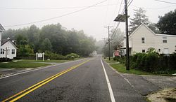 Ridge Road in Buddtown | |
 Buddtown Location of Buddtown in Burlington County (Inset: Location of county within the state of New Jersey)  Buddtown Buddtown (New Jersey)  Buddtown Buddtown (the United States) | |
| Coordinates: 39°56′21″N74°42′11″W / 39.93917°N 74.70306°W | |
| Country | |
| State | |
| County | Burlington |
| Township | Southampton |
| Elevation | 46 ft (14 m) |
| Time zone | UTC−05:00 (Eastern (EST)) |
| • Summer (DST) | UTC−04:00 (EDT) |
| Area code | 609 |
| GNIS feature ID | 875017 [1] |
Buddtown is an unincorporated community located within Southampton Township in Burlington County, in the U.S. state of New Jersey. [2] Located between Vincentown and Pemberton, it is named for Thomas Budd who owned farmland in the area in the 18th century. [3] The area itself contains houses and churches in the community itself and farmland surrounding the settlement. [4] The stream that runs through Buddtown is named Stop the Jade Run supposedly named for the cry made by the owners of a runaway horse, "jade" being an old name for a horse. [3] [5]
