
Stockholm is an unincorporated community located in the southeastern part of Hardyston Township in Sussex County, in the U.S. state of New Jersey. Its ZIP Code is 07460. Like many neighboring towns, Stockholm is home to a number of lakes including Deer Trail Lakes, Lake Stockholm, Lake Gerard, Beaver Lake, Lake Tamarack and Summit Lake.

Thorofare is an unincorporated community and census-designated place (CDP) located within West Deptford Township in northwestern Gloucester County, situated in the South Jersey region of the U.S. state of New Jersey. The area is served as United States Postal Service ZIP Code 08086. As of the 2020 United States census, the CDP's population was 2,806. As of the 2000 census, the population of a different geographic entity containing Thorofare, namely ZIP Code Tabulation Area 08086, was 5,424.

Port Elizabeth is an unincorporated community and census-designated place (CDP) located within Maurice River Township in Cumberland County, in the U.S. state of New Jersey. The area is served as United States Postal Service ZIP Code 08348.
Atco is an unincorporated community and census-designated place (CDP) in Waterford Township in Camden County, in the U.S. state of New Jersey. It is part of the Philadelphia-Camden metropolitan area, located 16 miles (26 km) southeast of Camden. Though generally considered part of Waterford Township, a small section of the southern edge of Atco is located in Winslow Township.

Malaga is an unincorporated community located within Franklin Township, in Gloucester County, in the U.S. state of New Jersey. The area is served as United States Postal Service ZIP Code 08328.
Kirkwood is an unincorporated community located within Voorhees Township in Camden County, in the U.S. state of New Jersey. Kirkwood once had a post office assigned United States Postal Service ZIP Code 08043. The ZIP Code has been reassigned to a post office named Voorhees that serves the entire township. Kirkwood is still a valid city name for mailing purposes.

Layton is an unincorporated community and census-designated place (CDP) located within Sandyston Township in Sussex County, in the U.S. state of New Jersey. The area is served as United States Postal Service ZIP Code 07851.
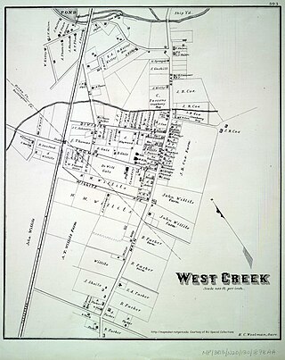
West Creek is an unincorporated community and hamlet located within Eagleswood Township in Ocean County, in the U.S. state of New Jersey.

McAfee is an unincorporated community located within Vernon Township in Sussex County, in the U.S. state of New Jersey. The area is served as United States Postal Service ZIP Code 07428.

Stirling is an unincorporated community and census-designated place (CDP) located within Long Hill Township in Morris County, in the U.S. state of New Jersey. The area is served as United States Postal Service ZIP Code 07980.
Oak Ridge is an unincorporated community and census-designated place (CDP) located along the border of West Milford Township in Passaic County and Jefferson Township in Morris County, in the U.S. state of New Jersey. The area is served as United States Postal Service ZIP Code 07438.

Mickleton is an unincorporated community and census-designated place located within East Greenwich Township in Gloucester County, in the U.S. state of New Jersey. The area is served as United States Postal Service ZIP Code 08056.
Dorchester is an unincorporated community located within Maurice River Township, in Cumberland County, in the U.S. state of New Jersey. The area is served as United States Postal Service ZIP Code 08316.

Jobstown is an unincorporated community and census-designated place (CDP) located within Springfield Township in Burlington County, in the U.S. state of New Jersey. The area is served as United States Postal Service ZIP Code 08041.
Seabrook is an unincorporated community located within Upper Deerfield Township in Cumberland County, in the U.S. state of New Jersey. The area is served as United States Postal Service ZIP code 08302. The unincorporated community and the census-designated Place Seabrook Farms within it are each named after Charles F. Seabrook, a businessman who at one point ran the largest irrigated truck farm in the world in this region.

Harrisonville is an unincorporated community and census-designated place (CDP) located within South Harrison Township, in Gloucester County, in the U.S. state of New Jersey. The area is served as United States Postal Service ZIP Code 08039.

Ocean View is an unincorporated community and census-designated place (CDP) located within Dennis Township in Cape May County, in the U.S. state of New Jersey. The area is served as United States Postal Service ZIP Code 08230. The post office was established in 1872, with William Doolittle as the first postmaster.

South Dennis is an unincorporated community located within Dennis Township in Cape May County, in the U.S. state of New Jersey. It is part of the Ocean City Metropolitan Statistical Area. Its postal ZIP Code is 08245. The post office was established in 1873, with Robert Hutchinson as the first postmaster.

West Allenhurst is an unincorporated community located within Ocean Township in Monmouth County, New Jersey, United States. The area is served as United States Postal Service ZIP code 07711. As of the 2000 United States Census, the population for ZIP Code Tabulation Area 07711 was 1,934. West Allenhurst is bordered by Allenhurst to the east, Deal to the northeast, and Interlaken to the south. Major arterial roads in the community are the east-west Corlies Avenue and the north-south Monmouth Road.
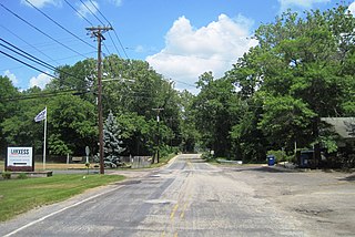
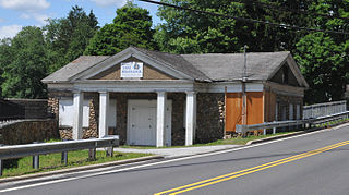
Birmingham is an unincorporated community located within Pemberton Township in Burlington County, in the U.S. state of New Jersey. As of the 2010 United States Census, the ZIP Code Tabulation Area for ZIP Code 08011 had a population of 33. Though sparsely populated, it houses a post office and a Lanxess chemical facility.


