
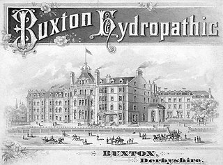
Buxton is a spa town in the Borough of High Peak, Derbyshire, in the East Midlands region of England. It is England's highest market town, sited at some 1,000 feet (300 m) above sea level. It lies close to Cheshire to the west and Staffordshire to the south, on the edge of the Peak District National Park. In 1974, the municipal borough merged with other nearby boroughs, including Glossop, to form the local government district and borough of High Peak.

Ashbourne is a market town in the Derbyshire Dales district in Derbyshire, England. Its population was measured at 8,377 in the 2011 census and was estimated to have grown to 9,163 by 2019. It has many historical buildings and independent shops. The town offers a historic annual Shrovetide football match. Its position near the southern edge of the Peak District makes it the closest town to Dovedale, to which Ashbourne is sometimes referred to as the gateway.
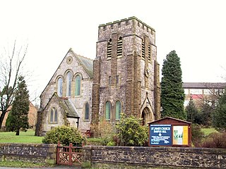
Harpur Hill is a small village on the outskirts of Buxton, Derbyshire, England. It is in the Cote Heath ward of the High Peak Borough Council. It has a primary school, a park, a pub, a working men's club and a Methodist church.
Buxton & Leek College is a college of Further and Higher Education operating at their campuses and facilities in Buxton, Derbyshire, Leek, Staffordshire and Derby, Derbyshire. The college is part of the University of Derby.

The Health and Safety Laboratory is a large 550-acre research site in rural High Peak, Derbyshire, south of Buxton.

Harpur Hill Quarry is a disused limestone quarry on Harpur Hill, Derbyshire, England. Limestone was extracted there from 1835 to 1952 for lime burning at lime kilns to produce quicklime. The quarry was used by the Royal Air Force as a chemical weapons storage depot during the Second World War, the largest such depot in the United Kingdom. Afterwards a number of captured German chemical munitions were disposed of at the site by burning, which was only partially successful. The RAF depot closed in 1960 and the site is now vacant.
RAF Harpur Hill is a former Royal Air Force station, situated at Harpur Hill near Buxton, Derbyshire in England. The site was operational from 1938 to 1960 and was mainly used as an underground munitions storage facility. It became the largest ammunitions dump in the country across the 500 acres (200 ha) site.

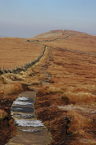
Combs Moss is a plateau-topped hill between Chapel-en-le-Frith and Buxton in Derbyshire, in the Peak District. The summit, Combs Head, is 503 metres (1,650 ft) above sea level.

Grin Low is a hill overlooking Buxton in Derbyshire, in the Peak District. The summit is 434 metres (1,424 ft) above sea level.

Burbage Edge is a gritstone escarpment overlooking the Burbage district of Buxton in Derbyshire, in the Peak District. The hill's summit is 500 metres (1,600 ft) above sea level.
Corbar Hill is a sandstone hill at the south end of Combs Moss, overlooking Buxton in Derbyshire, in the Peak District. The summit is 437 metres (1,434 ft) above sea level.
This is a partial list of prominent buildings in Buxton, Derbyshire which have been demolished or ruined.
Staden is a small hamlet on the southern outskirts of Buxton, Derbyshire, lying between Harpur Hill and Cowdale. It was occupied in Neolithic, Roman and medieval times. Staden is close to the limestone hilltop of Staden Low whose summit is 367 m (1,204 ft) above sea level.

The Bleaklow Bomber was a US Air Force (USAF) Boeing RB-29A Superfortress that crashed near Higher Shelf Stones on Bleaklow in the Peak District in 1948. It was modified as a reconnaissance aircraft, rather than a bomber.

The Peak District Mountain Rescue Organisation (PDMRO) is a UK registered charity which was formed in 1964. The purpose of PDMRO is "to save life and alleviate distress, primarily in Upland and Mountain areas". This is achieved by conducting search and rescue missions for walkers, climbers and missing persons in and around the Peak District National Park.

The Buxton Mountain Rescue Team is a UK registered charity operating search and rescue missions from its base at Dove Holes near Buxton in Derbyshire. The team covers an area of about 400 square miles across Derbyshire, Staffordshire and Cheshire.

Totley Moor is an open moorland hill to the west of the Sheffield suburb of Totley, in the Derbyshire Peak District. The summit is 395 metres (1,296 ft) above sea level.
Cats Tor is a Peak District hill on the border between Cheshire and Derbyshire, between the towns of Macclesfield and Buxton. The summit is 518 metres (1,699 ft) above sea level. Tor is an Old English word for a high, rocky hill.

South Head is a gritstone hill between the villages of Hayfield and Chinley in the Derbyshire Peak District. The summit is 494 metres (1,621 ft) above sea level. It lies at the south of the head of the River Sett.

Chinley Churn is a prominent gritstone hill between the villages of Chinley and Hayfield in the Derbyshire Peak District. The summit is 457 metres (1,499 ft) above sea level.


