
The Peak District is an upland area in central-northern England, at the southern end of the Pennines. Mostly in Derbyshire, it extends into Cheshire, Greater Manchester, Staffordshire, West Yorkshire and South Yorkshire. It is subdivided into the Dark Peak, moorland dominated by gritstone, and the White Peak, a limestone area with valleys and gorges. The Dark Peak forms an arc on the north, east and west of the district, and the White Peak covers central and southern areas. The highest point is Kinder Scout. Most of the area is within the Peak District National Park, a protected landscape designated in 1951.

Derbyshire is a ceremonial county in the East Midlands of England. It borders Greater Manchester, West Yorkshire, and South Yorkshire to the north, Nottinghamshire to the east, Leicestershire to the south-east, Staffordshire to the south and west, and Cheshire to the west. Derby is the largest settlement, and Matlock is the county town.

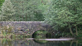
The Derwent is a river in Derbyshire, England. It is 50 miles (80 km) long and is a tributary of the River Trent, which it joins south of Derby. Throughout its course, the river mostly flows through the Peak District and its foothills.

Castleton is a village and civil parish in the High Peak district of Derbyshire, England, at the western end of the Hope Valley on the Peakshole Water, a tributary of the River Noe, between the Dark Peak to the north and the White Peak to the south. The population was 642 at the 2011 Census.

Matlock is the county town of Derbyshire, England. It is in the south-eastern part of the Peak District, with the National Park directly to the west. The spa resort of Matlock Bath is immediately south of the town as well as Cromford lying further south still. The civil parish of Matlock Town had a population in the 2021 UK census of 10,000.

Matlock Bath is a village and civil parish in Derbyshire, England. It lies in the Derbyshire Dales, south of Matlock on the main A6 road, and approximately halfway between Buxton and Derby. The population of the civil parish at the 2011 census was 753. Originally built at the head of a dead-end dirt road running along the valley of the River Derwent from Matlock, the settlement developed in the 19th century as residential and a spa town which remains a tourist destination. The steep hillside restricts development, with most buildings on one side of the valley and only footbridges across the river. The road was upgraded, becoming a through-way, now designated A6, avoiding the previous coaching road approach to Matlock from Cromford over very steep hills near to the Riber plateau area.

Cromford is a village and civil parish in Derbyshire, England, in the valley of the River Derwent between Wirksworth and Matlock. It is 17 miles (27 km) north of Derby, 2 miles (3.2 km) south of Matlock and 1 mile (1.6 km) south of Matlock Bath. It is first mentioned in the 11th-century Domesday Book as Crumforde, a berewick of Wirksworth, and this remained the case throughout the Middle Ages. The population at the 2011 Census was 1,433. It is principally known for its historical connection with Richard Arkwright and the nearby Cromford Mill, which he built outside the village in 1771. Cromford is in the Derwent Valley Mills World Heritage Site.

The Derwent Valley line is a railway line from Derby to Matlock in Derbyshire.

Matlock Bath railway station is a Grade II listed railway station owned by Network Rail and managed by East Midlands Railway. It is located in the village of Matlock Bath in Derbyshire, England. The station is unmanned by rail staff and is located on the Derwent Valley Line, 16.25 miles (26.15 km) north of Derby towards Matlock.

Matlock railway station is owned by Network Rail and managed by East Midlands Railway; it serves the Derbyshire Dales county town of Matlock, Derbyshire, England. The station is the terminus of both the Derwent Valley Line from Derby and Peak Rail who operate heritage services to Rowsley South. Both lines are formed from portions of the Midland Railway's former main line to Manchester Central. Through running is technically possible but is not done in normal service.
Bentley Brook is a stream in Derbyshire, England. It rises on Matlock Moor, flowing south through Cuckoostone Dale, under the A632, into Lumsdale, gathering the valley's waters—notably from Knabhall Brook, out of Tansley, itself dammed and supporting large mills. In Lumsdale it enters a now disused mill pond or reservoir, then flows over a waterfall in the course of passing several historical mill ruins. Finally, it runs through control gates into the outside bend of a tight oxbow of the River Derwent, just beyond Hall Leys Park in Matlock. Although only about five miles in length, Bentley Brook is classed as a 'main river' by the Environment Agency.

Great Masson Cavern is one of two caves at the Heights of Abraham, Matlock Bath, Derbyshire, England. The other is Great Rutland Cavern.
Great Rutland Cavern is one of two caves at the Heights of Abraham, Matlock, Derbyshire, England. The other is Great Masson Cavern.

The Derwent Valley Heritage Way (DVHW) is a 55 miles (89 km) waymarked footpath along the Derwent Valley through the Peak District. The walk starts from Ladybower Reservoir in the Peak District National Park via Chatsworth, the scenery around the Derbyshire Dales, and through the Derwent Valley Mills World Heritage Site. It follows the Riverside Path through Derby and continues onwards to the historic inland port of Shardlow. Journey's end is at Derwent Mouth where the River Derwent flows into the River Trent.

Willersley Castle is a late 18th-century country mansion above the River Derwent at Cromford, Derbyshire, outside Peak District National Park. The castle has been a Grade II* listed building since April 2000.

Sir Richard Arkwright's Masson Mill is a water-powered cotton spinning mill situated on the west bank of the River Derwent in Matlock Bath, Derbyshire in England. This mill was built in 1783. It forms part of the Derwent Valley Mills, a World Heritage Site. Nearby is Willersley Castle, the house Richard Arkwright built for himself within the parish of Matlock.

The Heights of Abraham Cable Car is a gondola lift in the English county of Derbyshire. About 1/3 of a mile long, it links the spa town of Matlock Bath with the Heights of Abraham, a tourist attraction 554 feet (169 m) above. The line was built by Poma and opened in spring of 1984. The cable cars were upgraded in 2004, making them larger and more accessible, to 12 x six-seater cabins, which operate in four trains of three cabins each. An example of the smaller 1984 cabin can be seen displayed at the base station

The Derbyshire Dome is a geological formation across mid-Derbyshire in England.
Matlock Bath is a civil parish in the Derbyshire Dales district of Derbyshire, England. The parish contains 44 listed buildings that are recorded in the National Heritage List for England. Of these, three are listed at Grade II*, the middle of the three grades, and the others are at Grade II, the lowest grade. The parish contains the village of Matlock Bath and the surrounding area. The listed buildings are arranged along the valley of the River Derwent and on the steep hillside to the west. Most of the listed buildings are houses, cottages, shops, and associated structures. The other listed buildings include hotels and public houses, churches, a former cotton mill, an obelisk, a railway station and an associated building, a war memorial, and two telephone kiosks.


