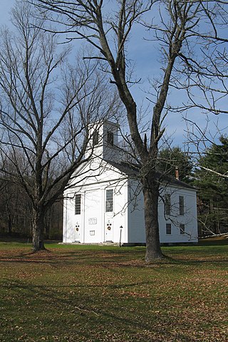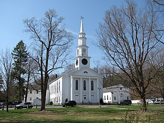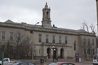
The Lower Highlands Historic District encompasses one of the oldest residential areas of Fall River, Massachusetts. The district is roughly bounded by Cherry, Main, Winter, and Bank Streets, and is located just east of the Downtown Fall River Historic District and directly south of the Highlands Historic District. This area was settled by 1810, has architecture tracing the city's growth as a major industrial center. The historic district was added to the National Register of Historic Places in 1984.

Hyde School is a historic Romanesque Revival school at 130 High Street in Lee, Massachusetts. The school was built in 1894 from locally quarried marble. It is named for Alexander Hyde, who established the town's first school in his house on West Park Street, and was built on the site of the town's first public school.

The Ware Center Historic District encompasses the historic early center of Ware, Massachusetts. Centered at the junction of Massachusetts Route 9 with Greenwich Plains Road, it is a linear district extending about 0.5 miles (0.80 km) along Route 9 in either direction. Most of the structures in the district were built between 1760 and 1860, although there are some 20th century intrusions. The area was the center of town civic and commercial activity until the 1820s, when villages serving industry became more important. The district was listed on the National Register of Historic Places in 1986.

The Lincoln–Sunset Historic District is a residential historic district located west of the downtown area of Amherst, Massachusetts. Colloquially known as Millionaire's Row, the district extends along Lincoln and Sunset Avenues between Northampton Street and the campus of the University of Massachusetts, Amherst. This area was one of Amherst's first planned residential subdivisions, and features a large number of high-quality houses, built by merchants, businessmen, and academics. It was added to the National Register of Historic Places in 1993.

The East End Historic District encompasses the historic eastern portion of central Ipswich, Massachusetts. The now predominantly residential district is bounded on the north and west by East Street, running from its junction with North Main and High Streets to Jeffrey's Neck Road. The eastern boundary includes the Ipswich River and Turkey Shore Road from its junction with Labor-in-Vain Road to Green Street, and the southern boundary runs along Green Street to North Main. The district was listed on the National Register of Historic Places in 1980.

The Hamilton Historic District encompasses the early historic center of Hamilton, Massachusetts. It includes properties at 540-700 and 563-641 Bay Road, extending along the road from Orchard Road in the south to Cutler Road in the north. Numerous Greek Revival buildings are located within the district including the First Congregational Church of Hamilton, built in 1843. The district was added to the National Register of Historic Places in 1973.

Meetinghouse Green Historic District encompasses the historic 17th century heart of Ipswich, Massachusetts. The district runs along North Main Street, south from its junction with High Street to the southern end of the Meetinghouse Green. It was listed on the National Register of Historic Places in 1980.

The Ipswich Mills Historic District encompasses a major textile mill complex and associated worker housing along the Ipswich River near the center of Ipswich, Massachusetts. The district includes the factories of the Ipswich Mill Company, and several blocks of modest worker cottages mostly on side streets off Estes and Kimball Streets. The site had been used as for mills since the 17th century, and was purchased by the Ipswich Mill Company in 1868. Mill worker housing was built surrounding the complex through the early 20th century, when River Court, Peatfield Street, and 1st through 6th Streets were laid out. The district was listed on the National Register of Historic Places in 1996.

The River Road–Cross Street Historic District is a rural agricultural historic district in Topsfield, Massachusetts. It is representative of Topsfield's development first as an agricultural community, and later as place for rural retreats. The district, which was listed on the National Register of Historic Places in 2005, is roughly bounded by River Road, Rowley Bridge Road, Cross Street, Hill Street, and Salem Road, and also includes properties facing Prospect Street and Bradstreet Lane. Much of the district was consolidated under the ownership of William Appleton Coolidge in the 20th century, and bequeathed to the Massachusetts Institute of Technology with restrictions to preserve its rural character. MIT sold the donated properties in 2000.

The South Green Historic District encompasses one of the oldest central civic parts of Ipswich, Massachusetts. The town's South Green was laid out in 1686, and is now the heart of a collection of historic properties dating from the 17th to the 19th century. The centerpiece of the district is the green itself, and its most notable associated property is the John Whipple House, a National Historic Landmark and museum. The district boundaries extend from the junction of South Main and Elm Streets, southward past the green to where County Road crosses Saltonstall's Creek.

The Thomas Hollis Historic District encompasses the historic civic and commercial heart of Holliston, Massachusetts. It extends along Washington Street (Massachusetts Routes 16 and 126 for about one mile, between Winter Street and Highland Street. Incorporated in 1724, this area now includes a well-preserved collection of predominantly 19th century architecture. The district was listed on the National Register of Historic Places in 1989.

The Arlington Center Historic District includes the civic and commercial heart of Arlington, Massachusetts. It runs along the town's main commercial district, Massachusetts Avenue, from Jason Street to Franklin Street, and includes adjacent 19th- and early 20th-century residential areas roughly bounded by Jason Street, Pleasant Street, and Gray Street. The district was listed on the National Register of Historic Places in 1974.

The Wedgemere Historic District encompasses the largest single 19th-century residential development of Winchester, Massachusetts. It is one of the town's largest surviving 19th-century residential subdivisions, with a concentration of high-quality residences built between about 1890 and 1920. The district was listed on the National Register of Historic Places in 1989.

The Nobility Hill Historic District is a residential historic district roughly bounded by Chestnut and Maple Streets and Cedar Avenue in Stoneham, Massachusetts. The district includes a number of high quality houses representing a cross section of fashionable housing built between 1860 and 1920. It was added to the National Register of Historic Places in 1990.

Norwichtown is a historic neighborhood in the city of Norwich, Connecticut. It is generally the area immediately north of the Yantic River between I-395 and Route 169.

The Hollis Village Historic District encompasses the historic village center of Hollis, New Hampshire. The district is centered on Monument Square, which connects Main Street to Depot Street and Broad Street. It covers about 400 acres (160 ha), and extends along all three of those roads for some distance, and includes properties on Silver Lake Road and Ash Street. Most of the buildings in the district are residential or agricultural in use, and date before the turn of the 20th century; the oldest buildings date to the mid-18th century. The "Always Ready Engine House", which occupies a triangular parcel at the western end of Monument Square, was built in 1859, and is the town's oldest municipal building. Its most architecturally sophisticated building is the town hall, built in 1887 to a design by William M. Butterfield of Manchester. The district represents the growth of a mainly agricultural community over a 200-year period. The district was listed on the National Register of Historic Places in 2001.

The Amherst Village Historic District encompasses the historic village center of Amherst, New Hampshire. Centered on the town's common, which was established about 1755, Amherst Village is one of the best examples of a late-18th to early-19th century New England village center. It is roughly bounded on the north by Foundry Street and on the south by Amherst Street, although it extends along some roads beyond both. The western boundary is roughly Davis Lane, the eastern is Mack Hill Road, Old Manchester Road, and Court House Road. The district includes the Congregational Church, built c. 1771-74, and is predominantly residential, with a large number of Georgian, Federal, and Greek Revival houses. Other notable non-residential buildings include the Farmer's Bank, a Federal-style brick building built in 1806, and the Amherst Brick School, a brick Greek Revival structure that has served as the School Administrative Unit 39 offices since 1997.

The Charlestown Main Street Historic District encompasses the historic heart of Charlestown, New Hampshire. It is located along Main Street, roughly between Lower Landing Road and Bridge Street, and encapsulates more than two hundred years of the town's history. The district was listed on the National Register of Historic Places in 1987.

The Exeter Waterfront Commercial Historic District encompasses the historic commercial and residential waterfront areas of Exeter, New Hampshire. The district extends along the north side of Water Street, roughly from Main Street to Front Street, and then along both sides of Water and High streets to the latter's junction with Portsmouth Street. It also includes properties on Chestnut Street on the north side of the Squamscott River. This area was where the early settlement of Exeter took place in 1638, and soon developed as a shipbuilding center. The district was listed on the National Register of Historic Places in 1980. It was enlarged in 1986 to include the mill complex of the Exeter Manufacturing Company on Chestnut Street.

The Randolph Center Historic District encompasses the historic early town center of Randolph, Vermont. Established in 1783, it was later eclipsed by Randolph Village, which developed around the town's main railroad depot. The village now has a distinguished array of late 18th and early 19th-century architecture, and is home to an academic campus now housing Vermont State University. It was listed on the National Register of Historic Places in 1974.


